Muir Glacier facts for kids
Quick facts for kids Muir Glacier |
|
|---|---|
 |
|
| Type | Valley Glacier |
| Coordinates | 59°06′17″N 136°22′56″W / 59.10472°N 136.38222°W |
| Length | 11 miles (18 km) |
| Terminus | Ice-contact delta |
| Status | Retreating |
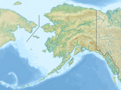
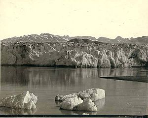
The Muir Glacier is a large glacier located in Glacier Bay National Park and Preserve in Alaska, U.S.. It is a valley glacier, meaning it flows through a valley like a slow-moving river of ice. Today, the glacier is about 0.7 km (0.43 mi) wide at its end. Not long ago, in the mid-1980s, it was a "tidewater glacier." This means its end reached the ocean, and large pieces of ice, called icebergs, would break off from its tall ice wall, which was about 90 meters (200 feet) high.
Who Was John Muir?
The Muir Glacier is named after John Muir, a famous Scottish-born naturalist. A naturalist is someone who studies nature. John Muir traveled a lot in the area and wrote about its amazing environment. His writings helped people become interested in protecting these natural places.
John Muir first visited the glacier in 1879 when he was 41 years old. He came back again in 1880. During his visits, he sent stories about his adventures to a newspaper called the San Francisco Bulletin. Later, he put these stories together into a book called Travels in Alaska. This book was published in 1915, the year after he passed away.
Why Is Muir Glacier Shrinking?
The Muir Glacier has been shrinking very quickly. Scientists have carefully recorded this retreat. Its biggest size was during the Little Ice Age, around 1780, when it reached the mouth of Glacier Bay.
In 1794, an explorer named Captain George Vancouver explored the area. He found that most of Glacier Bay was covered by a huge sheet of ice. In some places, this ice was about 1,200 meters (3,900 ft) thick!
By 1904, reports said the glacier had "broken through the mountains." This meant it had moved past Pyramid Peak to the west and Mt. Wright and Mount Case to the east.
From 1892 to about 1980, the glacier pulled back nearly 32 kilometers (20 mi). Between 1941 and 2004, it retreated more than 12 kilometers (7.5 mi). It also became much thinner, losing over 800 meters (2,600 ft) of ice. As the ice melted and retreated, ocean water filled the valley where the glacier used to be. This created a new body of water called Muir Inlet.
See also
 In Spanish: Glaciar Muir para niños
 | Kyle Baker |
 | Joseph Yoakum |
 | Laura Wheeler Waring |
 | Henry Ossawa Tanner |


