Muldentalkreis Rural District facts for kids
Quick facts for kids
Muldentalkreis
|
|
|---|---|
 |
|
| Country | |
| State | Saxony |
| Adm. region | Leipzig |
| Capital | Grimma |
| Area | |
| • Total | 892.62 km2 (344.64 sq mi) |
| Population
(2001)
|
|
| • Total | 135,459 |
| • Density | 151.7544/km2 (393.042/sq mi) |
| Time zone | UTC+1 (CET) |
| • Summer (DST) | UTC+2 (CEST) |
| Vehicle registration | MTL |
| Website | http://www.lra-mtl.de |
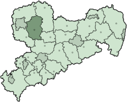
The Muldentalkreis was a district located in the Free State of Saxony, Germany. It was a part of the state of Saxony, which is in the eastern part of Germany.
Contents
History of Muldentalkreis
This district was created in 1994. It was formed by joining two older districts: Grimma and Wurzen. Some towns from other areas around Bad Lausick also became part of the new Muldentalkreis.
Geography of the Mulde Valley
The name Muldentalkreis comes from its main river, the Mulde. The German word German: Muldental means "Valley of the Mulde".
The Mulde River begins in the southern part of the district. It forms when two smaller rivers, the Freiberger Mulde and the Zwickauer Mulde, meet and flow together.
Symbols: The Coat of Arms
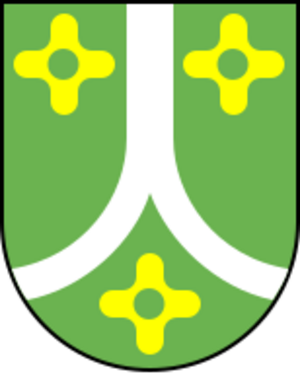
The coat of arms for Muldentalkreis tells a story about the district. The silver lines you see represent the Mulde River. They also show its two smaller "source arms" that join to form it.
The green color in the coat of arms stands for the many forests in the district. The three flower symbols represent the two old districts (Grimma and Wurzen) and the other towns that joined to create Muldentalkreis.
Towns and Communities
The Muldentalkreis district included several towns and smaller communities. Here are some of them:
Towns
Municipalities
- Belgershain
- Bennewitz
- Borsdorf
- Falkenhain
- Großbothen
- Hohburg
- Machern
- Otterwisch
- Parthenstein
- Zschadraß
- Thallwitz
- Thümmlitzwalde
 | Victor J. Glover |
 | Yvonne Cagle |
 | Jeanette Epps |
 | Bernard A. Harris Jr. |


