Mullengandra, New South Wales facts for kids
Quick facts for kids MullengandraNew South Wales |
|
|---|---|
 |
|
| Postcode(s) | 2644 |
| Elevation | 305 m (1,001 ft) |
| Location |
|
| LGA(s) | Greater Hume Shire Council |
| County | Goulburn |
| State electorate(s) | Albury |
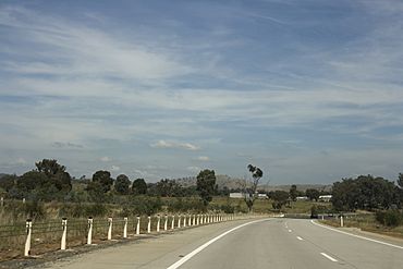
Mullengandra is a small village located in the southeastern part of a region called the Riverina in Australia. It's about 7 kilometers (4.3 miles) northeast of Bowna and 8 kilometers (5 miles) southwest of Woomargama. This village is found along the Hume Highway, which is a major road north of the city of Albury.
In 2016, a count showed that 320 people lived in Mullengandra.
Contents
Exploring Mullengandra's Past
Mullengandra has an interesting history, especially from the 1800s.
Early Days and Bushrangers
In the 1850s, the village faced some challenges from Bushrangers. These were people who lived outside the law, often in the Australian bush, and sometimes caused trouble.
How the Town Began
Mullengandra was officially declared a town in 1852. At that time, it was described as an area of about 1.5 square miles. It was located within the County of Goulburn and bordered on its western side by the Mullengandra Creek.
Important Buildings and Services
Over the years, Mullengandra had several important buildings that served the community:
- An Anglican Church was built and officially opened in 1876.
- The Mullengandra Post Office started its service on May 16, 1888. This was important for sending and receiving mail.
- A public school opened in 1871, providing education for the children of the village for many years.
Recent Changes in the Village
In more recent times, some of the village's services have closed. The public school, which had been open since 1871, closed its doors in 2017. The village's churches and the local pub (a type of hotel or inn) have also closed in recent years.
 | Lonnie Johnson |
 | Granville Woods |
 | Lewis Howard Latimer |
 | James West |


