Nanih Waiyah Lake facts for kids
Quick facts for kids Nanih Waiyah Lake |
|
|---|---|
| Location | Pushmataha County, Oklahoma |
| Coordinates | 34°38′04″N 95°18′02″W / 34.63444°N 95.30056°W |
| Type | artificial lake |
| Surface area | 131 acres (0.53 km2) |
| Water volume | 1,064 acre-feet (1,312,000 m3) |
| Shore length1 | 3 miles (4.8 km) |
| Surface elevation | 594 foot (181 m) |
| 1 Shore length is not a well-defined measure. | |
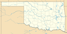
Nanih Waiya Lake is a fun, man-made lake in Pushmataha County, Oklahoma. It's a great spot for outdoor activities! You can find it nestled in the beautiful Ouachita Mountains. The lake is about 1.5 miles (2.4 km) northeast of Tuskahoma, Oklahoma. It's also about 16.3 miles (26.2 km) from Talihina, Oklahoma.
Contents
About Nanih Waiya Lake
Nanih Waiya Lake was built in 1958. It was created by collecting water from several small creeks. These creeks flow into the Kiamichi River. The lake gets its special name from Nanih Waiya. This place was the first capital of the Choctaw Nation. They settled here after moving to Oklahoma during the Trail of Tears. The Oklahoma Department of Wildlife Conservation helps manage the lake.
Lake Size and Features
Nanih Waiya Lake covers an area of about 131 acres (0.53 square kilometers). It has a shoreline that stretches for about 3 miles (4.8 km). The lake's normal water level is 594 feet (181 meters) above sea level. It can hold about 1,064 acre-feet (1,312,300 cubic meters) of water.
Fun Things to Do
This lake is a popular place for many outdoor adventures. You can enjoy boating and fishing here. There are two boat ramps, one on the southeast side and one on the southwest side.
Camping and Hiking
If you love camping, you're in luck! The area around the lake has places where you can set up tents. There are also several hiking trails nearby. These trails include:
- Clayton Trail
- Cripple Mountain Trail
- Five N Trail
- Hurd Trail
- Walters Mule Trail
Working Together for the Lake
The Choctaw Nation and the State of Oklahoma have a special agreement. This agreement helps make sure the lake stays well-maintained. It also helps Choctaw citizens enjoy hunting and fishing.
The Agreement
Since January 1, 2017, the Choctaw Nation has been able to buy many hunting and fishing licenses. These licenses are for their citizens who live in Oklahoma. The Choctaw Nation also pays a yearly fee to the Oklahoma Department of Wildlife Conservation. This department owns the lake. As part of this agreement, the Choctaw Nation also helps take care of Nanih Waiya Lake. This partnership helps keep the lake beautiful for everyone. The agreement was in effect until December 31, 2019.
 | DeHart Hubbard |
 | Wilma Rudolph |
 | Jesse Owens |
 | Jackie Joyner-Kersee |
 | Major Taylor |


