Pushmataha County, Oklahoma facts for kids
Quick facts for kids
Pushmataha County
|
|
|---|---|
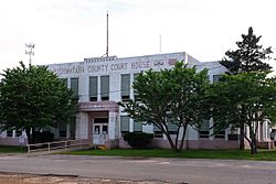
The Pushmataha County Courthouse in Antlers.
|
|
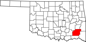
Location within the U.S. state of Oklahoma
|
|
 Oklahoma's location within the U.S. |
|
| Country | |
| State | |
| Founded | 1907 |
| Named for | Pushmataha |
| Seat | Antlers |
| Largest city | Antlers |
| Area | |
| • Total | 1,423 sq mi (3,690 km2) |
| • Land | 1,396 sq mi (3,620 km2) |
| • Water | 27 sq mi (70 km2) 1.9%% |
| Population
(2020)
|
|
| • Total | 10,812 |
| • Density | 7.5980/sq mi (2.9336/km2) |
| Congressional district | 2nd |
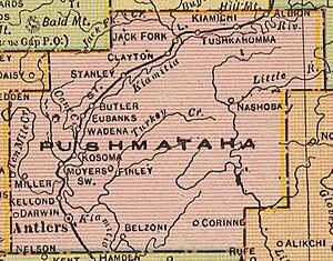
Pushmataha County is a special area in the southeastern part of Oklahoma, a state in the United States. It's like a big neighborhood with its own government. As of 2020, about 10,812 people live here. The main town and center of the county's government is Antlers.
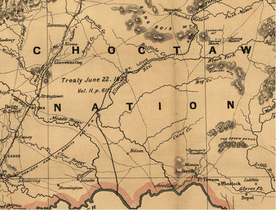
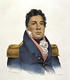
This county was created in 1907 when Oklahoma became a state. It used to be part of the land belonging to the Choctaw Nation, a Native American tribe. The county is named after Pushmataha, an important Choctaw chief. He tried to protect his people's land but sadly passed away in 1824. The Choctaw people were later forced to move to this area during a time called the Indian Removal.
Contents
History of Pushmataha County
Pushmataha County has a long and interesting past. It has been home to different cultures and under the rule of several countries over hundreds of years.
Who Ruled Pushmataha County?
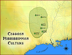
- Around 1000–1500: The Caddoan Mississippian culture lived here. They built amazing earth mounds at a place called Spiro Mounds.
- 1492–1718: Spain claimed this land.
- 1718–1763: France took control.
- 1763–1800: Spain ruled again.
- 1800–1803: France was back in charge.
- 1803–Today: The United States bought the land as part of the Louisiana Purchase.
- 1824–1825: The eastern part of the county was briefly part of Miller County, Arkansas Territory.
- 1825–1907: It became part of the Choctaw Nation in what was called Indian Territory.
- 1907–Today: It became Pushmataha County in the new Oklahoma state.
Early People and Explorers
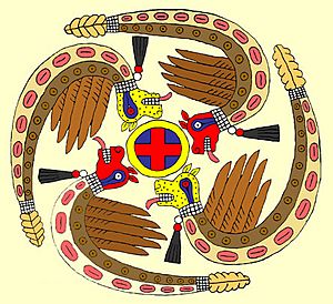
Long ago, the area of Pushmataha County was home to the Fourche Maline culture. Over time, they became the Caddoan Mississippian culture. Their main center was at Spiro Mounds, which is now Oklahoma's only Archeological State Park. Here, they built large earth mounds for burials and ceremonies. This place was a hub for trade, reaching from the Great Lakes to the Gulf Coast.
After Christopher Columbus arrived in 1492, European explorers began to explore North America. They were looking for fame, riches, and new lands for their empires.
In 1719, a French explorer named Bernard de la Harpe explored this area. France wanted to trade with Native American tribes and find a route to New Mexico. This region became known as La Louisiane, claimed by France.
In 1803, the United States bought this huge area from France in the Louisiana Purchase. The first American explorers to visit the county were Major Stephen H. Long in 1817 and scientist Thomas Nuttall in 1819. They both explored the Kiamichi River valley.
The Red River became a border in 1819. The U.S. built forts along its southern border to protect against Spain and Native American uprisings. Fort Towson was one of these forts. A military road was built to connect Fort Towson with Fort Smith, Arkansas to bring supplies. This was Pushmataha County's first modern road.
The Indian Territory and the Civil War
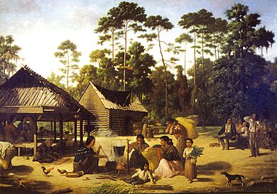
Before Oklahoma became a state, Pushmataha County was part of the Choctaw Nation. This was a self-governing area for the Choctaw people.
During the American Civil War (1861-1865), U.S. troops left Indian Territory. The Choctaw Nation joined the Confederate States of America. They even sent a representative to the Confederate Congress and had their own soldiers.
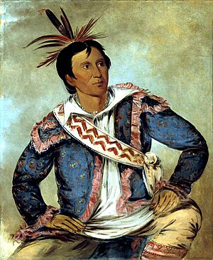
No big battles happened in Pushmataha County itself. However, many Choctaw people from the area fought in battles nearby, like the Battle of Pea Ridge in Arkansas. Many refugees also traveled through the Kiamichi River valley during the war. The war ended in 1865 when the last Confederate army surrendered at Fort Towson.
Around this time, before 1862, a slave named Wallace Willis composed the famous song "Swing Low, Sweet Chariot". He worked at Spencer Academy, a Choctaw Nation school near the county's southern border.
Railroads Arrive and Change the Land
The Choctaw people were farmers and lived quietly on their land. There wasn't much industry in the Choctaw Nation. So, the area that became Pushmataha County was mostly wild nature for many years.
In the 1880s, the St. Louis and San Francisco Railroad (called the Frisco) built a train line through the area. The U.S. government gave the railroad land to help new towns grow and attract settlers. Train stops were set up every few miles.
The Frisco train line followed the Kiamichi River valley. It helped businesses grow and connected the area to the rest of the United States. The telegraph also came with the railroad, bringing fast news.
Logging companies quickly started cutting down trees. Small towns grew around the train stops, like Kosoma, which had hotels and stores. For decades, loggers harvested trees from the entire region. These train stops became today's towns like Albion, Moyers, and Antlers. Other smaller communities along the railroad disappeared over time.
The Frisco Railroad was a huge engineering project for Pushmataha County. It brought trade and industry, attracting many people who wanted to start new lives.
Becoming Part of Oklahoma
The Native American tribes in Indian Territory didn't want to become part of a U.S. state. But by the early 1900s, it seemed unavoidable. Leaders from the five main tribes (Choctaw, Cherokee, Chickasaw, Creek, and Seminole) met to try and create their own state called State of Sequoyah.
They realized that the old Choctaw Nation county lines didn't make sense for business. So, they drew new county lines, including one for a new Pushmataha County, Sequoyah, with Antlers as its main town. They named it after Chief Pushmataha.
However, the U.S. Congress didn't approve the State of Sequoyah. Instead, in 1907, the Oklahoma Constitutional Convention met to create the new State of Oklahoma. They mostly used the same county boundaries that the Sequoyah Convention had planned, including for Pushmataha County, Oklahoma. Antlers was still chosen as the county seat.
Pushmataha County Since Statehood
When Oklahoma became a state, Pushmataha County was seen as a great place for farming. People thought the soil was rich and the weather was good for growing almost any fruit or vegetable. Most residents were farmers.
For the first few decades, cotton was the most important crop. It was grown all over the Kiamichi River valley and shipped out by train. Many of the farmers were African Americans, who were descendants of slaves of the Choctaw. After the Civil War, they were called Choctaw Freedmen and became members of the Choctaw Nation.
The Choctaw government used to own land together, not individually. They didn't need many roads or bridges. When the state was formed, local business leaders wanted to build roads and bridges. But voters often said no to funding these projects. This slowed down business growth compared to other counties.
Communities in Pushmataha County grew as more people settled there. Each community built its own school and churches. Some towns even started cultural groups like poetry clubs. Choctaw members continued to be important leaders in the county's government and society.
During World War I, a Choctaw soldier from the county, Tobias W. Frazier, was one of the famous Choctaw Code Talkers. These fourteen soldiers used the Choctaw language as a secret code to send messages during the war. Their work helped the Allies win the war faster.
In the 1930s, during the Great Depression, the U.S. government started programs like the Works Progress Administration (WPA). The WPA built strong, beautiful schools and gyms in many communities using local "red rock." Some of these buildings are still used today.
The Rural Electrification Administration brought electricity to the county's rural areas. This meant homes got electricity, leading to things like air conditioning and television. People started spending more time indoors.
Highways were paved in the 1950s, making travel easier. People started using cars more, and the Frisco Railroad stopped carrying passengers in the late 1950s. By the early 1980s, the railroad stopped carrying freight too, and its tracks were removed.
In 1970, the Indian Nation Turnpike opened. This major highway made it easier for people in Pushmataha County to travel to bigger cities like Oklahoma City and Tulsa.
Geography of Pushmataha County
Pushmataha County is in southeastern Oklahoma. It's part of an area called Choctaw Country, known for tourism. The county covers about 1,423 square miles. Most of this is land, with about 27 square miles of water.
Most of Pushmataha County is mountainous. The Kiamichi Mountains, part of the larger Ouachita Mountains, cover most of the land. These mountains can be hard to build roads through, so large parts of the county have very few people. The mountains can reach about 1,650 feet high.
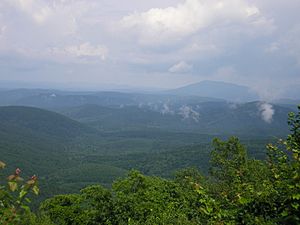
The Kiamichi River valley runs like a crescent shape through the county. Most people have always lived along this river valley.
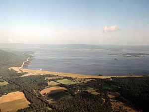
Two main rivers, the Kiamichi and Little River, flow through the county. There are also several lakes: Sardis Lake (which controls floods), Clayton Lake, Nanih Waiyah Lake, Ozzie Cobb Lake, and Pine Creek Lake.
Interesting natural spots include Rock Town (unique boulders), Umbrella Rock near Clayton, McKinley Rocks near Tuskahoma, and the Potato Hills (unusual jagged hills).
Neighboring Counties
Pushmataha County shares borders with these other counties:
- Latimer County (north)
- Le Flore County (northeast)
- McCurtain County (east)
- Choctaw County (south)
- Atoka County (west)
- Pittsburg County (northwest)
Main Roads and Highways
 Indian Nation Turnpike
 Oklahoma State Highway 2
 Oklahoma State Highway 3
 Oklahoma State Highway 43
 Oklahoma State Highway 93
 Oklahoma State Highway 144
 U.S. Highway 271
Wildlife Areas
Pushmataha County has three areas set aside for wildlife management:
- The Pine Creek Wildlife Management Area (10,280 acres) near Pine Creek Lake.
- The Pushmataha Wildlife Management Area (19,237 acres) near Clayton.
- Part of the Honobia Creek Wildlife Management Area (97,758 acres).
These areas help protect animals and their habitats.
Climate and Weather
Pushmataha County is in "Tornado Alley", so its weather can be wild and unpredictable.
Summers can be very hot, often reaching 100°F for several days. Winters usually have mild temperatures, with very cold days being rare and short.
Rainfall varies across the county. The eastern part gets about 52 inches of rain each year, while the western part gets about 46 inches.
Snow is rare and usually melts quickly. Ice storms happen more often and can break tree branches and power lines.
Tornado season is from April to September. Strong storms happen every year. A powerful tornado hit Antlers in April 1945, causing a lot of damage and killing 69 people. Today, "storm spotters" watch the skies during bad weather, and sirens warn residents in Antlers to find shelter if a tornado is spotted.
In recent years, the county has had unusual weather, including a long period of less rain than usual.
Population and People
As of 2010, there were 11,572 people living in Pushmataha County. Most people (75%) were White, and a significant number (17.6%) were Native American. About 3% of the population was Hispanic or Latino. Most people (96.2%) spoke English, but some also spoke Spanish (1.7%) or Choctaw (1.6%).
The average age in the county was 44.3 years old. About 22.4% of the population was under 18.
The average income for a family in the county was about $36,887. About 27.2% of the people lived below the poverty line.
Economy and Jobs
Pushmataha County's economy is somewhat separated from the rest of Oklahoma because of the Ouachita Mountains. These mountains make it harder to trade with areas to the north.
The county's economy has always relied on its natural resources. Unlike many parts of Oklahoma, there isn't much oil drilling here. However, companies have been successfully drilling for natural gas recently.
In the past, asphalt was mined in two places: Jumbo and Sardis. These mines were successful for a while.
Timber (wood from trees) is a very important part of the economy. Large companies own huge areas of land and grow many pine trees. In some places, almost all the trees are pine trees.
Better roads and highways have helped Pushmataha County's economy grow. The Indian Nation Turnpike makes it easier to travel to other parts of the state.
Communities in Pushmataha County
City
- Antlers (This is the main town and county seat.)
Towns
Census-Designated Places
These are areas that are like towns but don't have their own local government.
Other Communities
- Adel
- Belzoni
- Cloudy
- Corinne
- Darwin
- Dela
- Ethel
- Fewell
- Honobia
- Jumbo
- Kellond
- Kosoma
- Miller
- Ringold
- Oleta
- Sardis
- Snow
- Sobol
- Stanley
Ghost Towns
These are towns that no longer exist or have very few people left.
Historic Places in Pushmataha County
Several places in Pushmataha County are listed on the National Register of Historic Places. This means they are important historical sites that should be protected.
- Albion State Bank, Albion
- Antlers Frisco Depot and Antlers Spring, Antlers
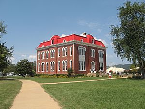
- Choctaw Capitol Building, Tuskahoma
- Clayton High School Auditorium, Clayton
- Fewell School, Nashoba
- James Martin Baggs Log Barn, Pickens
- Mato Kosyk House, Albion
- Snow School, Snow
In 1984, people in Antlers started the Pushmataha County Historical Society to protect the county's rich history. Their first project was saving the Antlers Frisco Depot.
Another important historical site is on Big Mountain. During World War II, two British planes crashed there in bad weather, killing four pilots. In 2000, the AT6 Monument was built to remember them.
Famous People from Pushmataha County
- Nicole DeHuff – an actress
- Tobias W. Frazier – a Choctaw Code Talker from World War I
- Mato Kosyk – a poet
- Anna Lewis (historian) – a historian, writer, and professor
- Charles C. Stephenson Jr. – a CEO of an energy company
- Kings of Leon – a rock band
See also
 In Spanish: Condado de Pushmataha para niños
 | John T. Biggers |
 | Thomas Blackshear |
 | Mark Bradford |
 | Beverly Buchanan |


