Nant Ceiswyn facts for kids
Quick facts for kids Nant Ceiswyn |
|
|---|---|

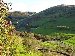
The Nant Ceiswyn flowing along Cwm Ratgoed
|
|
| Country | Wales |
| Physical characteristics | |
| Main source | Mynydd Dolgoed 1,900 ft (580 m) |
| River mouth | Pont Cymerau, Aberllefenni 52°40′40″N 3°48′30″W / 52.67777°N 3.80843°W |
The Nant Ceiswyn (sometimes called the Afon Ceiswyn) is a small river in Mid Wales. It starts on the north side of Mynydd Dolgoed mountain. The river then flows down to a place called Pont Cymerau. This spot is north-east of Aberllefenni.
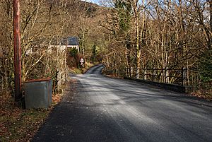
At Pont Cymerau, the Nant Ceiswyn joins another river, the Nant Llwydiarth. Together, they form the Afon Dulas. The Afon Dulas then flows south until it reaches the Afon Dyfi. There used to be a very old bridge at Pont Cymerau.
The Valley of Nant Ceiswyn
The area around the Nant Ceiswyn river is often known as Cwm Ratgoed. Sometimes it's also called Ralltgoed. This name comes from the Ratgoed slate quarry. The quarry is about two miles north of Pont Cymerau.
Ratgoed Quarry and Tramway
The Ratgoed slate quarry was an important place for mining slate. To move the slate, a special track was built. This track was called the Ratgoed Tramway. Horses pulled wagons along this tramway.
The tramway connected the quarry to the Corris Railway at Aberllefenni. It crossed the Nant Ceiswyn river near another quarry, Cymerau Quarry. This system helped transport slate from the mountains to other places.
Surrounding Mountains
To the east of the Nant Ceiswyn valley, you can find Mynydd Ceiswyn. This mountain is part of a long line of ridges. These ridges stretch southwards from a larger mountain area called Maesglase.
 | Aaron Henry |
 | T. R. M. Howard |
 | Jesse Jackson |


