
Naranjo, Fajardo, Puerto Rico facts for kids
Quick facts for kids
Naranjo
|
|
|---|---|
|
Barrio
|
|

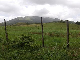
View of El Yunque from PR-984 in Naranjo
|
|

Location of Naranjo within the municipality of Fajardo shown in red
|
|

Naranjo, Fajardo, Puerto Rico
Location in Caribbean
|
|
| Commonwealth | |
| Municipality | |
| Area | |
| • Total | 1.5 sq mi (4 km2) |
| • Land | 1.5 sq mi (4 km2) |
| • Water | 0 sq mi (0 km2) |
| Elevation | 289 ft (88 m) |
| Population
(2010)
|
|
| • Total | 349 |
| • Density | 232.7/sq mi (89.8/km2) |
| Source: 2010 Census | |
| Time zone | UTC−4 (AST) |
| ZIP Code |
00738
|
Naranjo is a small area, called a barrio, located in the town of Fajardo, Puerto Rico. In 2010, about 349 people lived there. It covers an area of 1.5 square miles.
History
Early Days in Puerto Rico
Puerto Rico became a territory of the United States after the Spanish–American War. This happened in 1898, following the Treaty of Paris of 1898.
Population Counts Over Time
In 1899, the United States government counted the people living in Puerto Rico. They found that Naranjo and a nearby barrio called Sardinera had a combined population of 999 people.
The population of Naranjo has changed quite a bit over the years. Here's a look at how many people lived there during different census counts:
| Historical population | |||
|---|---|---|---|
| Census | Pop. | %± | |
| 1910 | 506 | — | |
| 1920 | 503 | −0.6% | |
| 1930 | 510 | 1.4% | |
| 1940 | 458 | −10.2% | |
| 1950 | 334 | −27.1% | |
| 1980 | 136 | — | |
| 1990 | 67 | −50.7% | |
| 2000 | 218 | 225.4% | |
| 2010 | 349 | 60.1% | |
| U.S. Decennial Census 1899 (shown as 1900) 1910-1930 1930-1950 1980-2000 2010 |
|||
Gallery
-
View of El Yunque from PR-984 in Naranjo

See also
 In Spanish: Naranjo (Fajardo) para niños
- List of communities in Puerto Rico

All content from Kiddle encyclopedia articles (including the article images and facts) can be freely used under Attribution-ShareAlike license, unless stated otherwise. Cite this article:
Naranjo, Fajardo, Puerto Rico Facts for Kids. Kiddle Encyclopedia.