National Register of Historic Places listings in Alleghany County, Virginia facts for kids
Have you ever wondered about old buildings or places that tell a story? In Alleghany County, Virginia, there are many such special spots! This article is about the places here that are listed on the National Register of Historic Places.
The National Register of Historic Places is like a special list. It helps protect important buildings, sites, and objects across the United States. These places are special because they have a big role in American history, architecture, archaeology, engineering, or culture. When a place is on this list, it means it's worth saving for future generations.
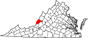
In Alleghany County, there are 14 places on this list. One of them is even more special! It's called a National Historic Landmark. That means it's super important to the history of the whole country.
Exploring Alleghany County's Historic Gems
Alleghany County is full of history. Let's explore some of the amazing places that are part of the National Register of Historic Places. These sites help us understand what life was like long ago.
Historic Districts: Stepping Back in Time
Some areas are special because they have many historic buildings together. These are called "historic districts."
Clifton Forge's Charming Streets
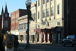
The Clifton Forge Commercial Historic District is the heart of downtown Clifton Forge. It includes streets like E. Ridgeway Street and Main Street. Imagine what these streets looked like when they were first built! Many of these buildings were shops and businesses. They show how people lived and worked in the past.
Close by is the Clifton Forge Residential Historic District. This area has many old homes. They show how people lived in Clifton Forge over the years. Walking through these streets is like taking a trip back in time. You can see different styles of houses.
Covington's Rosedale Neighborhood
In Covington, the Rosedale Historic District is another special neighborhood. It's near U.S. Route 60 and the Jackson River. This area also has many historic homes. They tell stories about the families who lived there.
Luke Mountain's Unique History
The Luke Mountain Historic District is also in Covington. This area on Luke Mountain Road has its own unique history. It shows how communities developed in the mountain regions of Virginia.
Old Furnaces: Industrial History
Alleghany County was once important for making iron. You can still find remains of old furnaces.
Clifton Furnace: An Iron-Making Past
The Clifton Furnace is southeast of Clifton Forge. This old furnace was used to melt iron ore. Iron was very important for making tools and other items long ago. The furnace reminds us of the county's industrial past.
Longdale Furnace: A Busy Center
The Longdale Furnace Historic District is another important iron-making site. It includes areas along Longdale Furnace Road. This was once a busy place where workers made iron. It shows how important industries were to the growth of the county.
Parks and Bridges: Nature and Engineering
Alleghany County also has historic places that show off its natural beauty and clever engineering.
Douthat State Park: A Beautiful Getaway
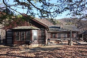
Douthat State Park Historic District is a beautiful park near Millboro. It was built during the Great Depression by the Civilian Conservation Corps. This group helped build many parks and public works. The park is a great example of their work. It offers hiking, fishing, and camping.
Humpback Covered Bridge: A National Treasure
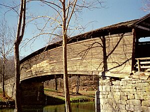
The Humpback Bridge is a very special place. It's a covered bridge over Dunlap Creek near Callaghan. This bridge is unique because it has a hump in the middle! It was built in 1857. It is the oldest covered bridge in Virginia. Because it's so old and special, it's a National Historic Landmark. This means it's important to the history of the entire United States.
Other Notable Historic Sites
There are other individual buildings and sites that are also on the National Register.
Jefferson School: A Place of Learning
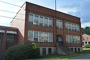
The Jefferson School in Clifton Forge is an old school building. It was listed on the Register in 2010. Schools are important parts of a community's history. They show how education has changed over time.
Oakland Grove Presbyterian Church: A Community Hub
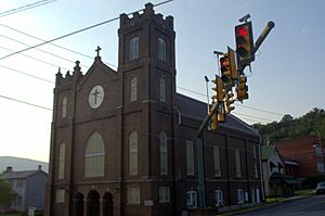
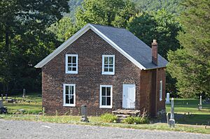
The Oakland Grove Presbyterian Church is near Selma. Churches often serve as important gathering places for communities. This church has been a part of the Selma community for many years.
Sweet Chalybeate Springs: A Healing Retreat
The Sweet Chalybeate Springs are located south of Earlhurst. In the past, people believed that the waters from these springs had healing powers. Many people would visit these "springs" for their health. It was a popular resort area long ago.
Historic Homes: Massie, Persinger, and Wood Hall
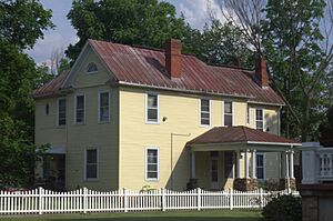
Several historic homes are also listed. These include the Massie House near Falling Spring, the Persinger House near Covington, and Wood Hall near Callaghan. Each of these homes tells a story about the families who lived there and the architectural styles of their time.
These historic places in Alleghany County are like open books. They help us learn about the past and appreciate the history around us.
Images for kids


