National Register of Historic Places listings in Blount County, Alabama facts for kids
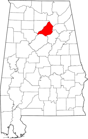
Have you ever wondered about old buildings and bridges that are really important to history? In Blount County, Alabama, there are some special places that are listed on the National Register of Historic Places. This is like a special list kept by the United States government to protect and celebrate buildings, structures, and sites that have a lot of history or are very unique.
When a place is on this list, it means it's recognized for its historical importance. It could be an old house, a bridge, or even a whole neighborhood. Blount County has five of these amazing places! Let's explore them and learn why they are so special.
Contents
Blount County's Historic Treasures
Blount County, located in Alabama, is home to several historic sites that tell stories from the past. These places are preserved so that people today and in the future can learn about the history and culture of the area.
Easley Covered Bridge
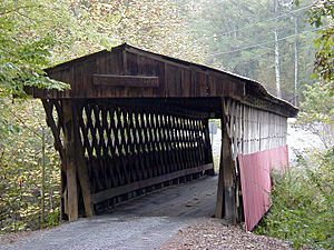
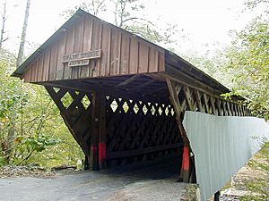
The Easley Covered Bridge is a beautiful old wooden bridge that spans a small stream called Dub Branch. It's located near the town of Oneonta, Alabama. This bridge was added to the National Register of Historic Places on August 20, 1981.
Covered bridges like Easley were once very common. The roof and sides helped protect the wooden structure of the bridge from rain and snow, making it last longer. It's a great example of how people built things a long time ago.
Robert G. Griffith Sr. House
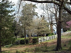
The Robert G. Griffith Sr. House is a historic home located at 1204 County Road 25 in Summit, Alabama. This house was recognized for its historical importance and was added to the National Register of Historic Places on March 14, 2000.
Old houses like the Griffith House often show us how people lived in the past. They can have unique architectural styles or be connected to important families or events in the community's history.
Horton Mill Covered Bridge
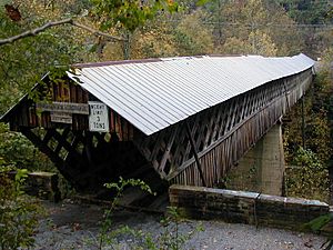
Another amazing covered bridge in Blount County is the Horton Mill Covered Bridge. You can find it about 5 miles (8 kilometers) north of Oneonta, Alabama, on Route 3. This bridge was added to the National Register of Historic Places quite a while ago, on December 29, 1970.
The Horton Mill Covered Bridge is one of the longest covered bridges in Alabama. It's a fantastic example of the craftsmanship used to build these structures, and it's a popular spot for visitors who want to see a piece of history.
Nectar Covered Bridge
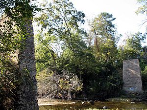
The Nectar Covered Bridge was once a historic bridge located about 8 miles southwest of Nectar, Alabama. It was added to the National Register of Historic Places on August 20, 1981, the same day as the Easley Covered Bridge.
Sadly, this historic bridge is no longer standing. It burned down on June 13, 1993. Even though it's gone, its memory and its place in history are still important, which is why it remains on the National Register.
Swann Covered Bridge
The Swann Covered Bridge is another beautiful example of a historic covered bridge in Blount County. It is located west of the town of Cleveland, Alabama. This bridge was also added to the National Register of Historic Places on August 20, 1981, along with the Easley and Nectar bridges.
The Swann Covered Bridge is one of the longest covered bridges in Alabama, similar to the Horton Mill Bridge. It's a wonderful place to visit and imagine what travel was like many years ago when these bridges were a common sight.


