National Register of Historic Places listings in Brown County, Kansas facts for kids
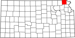
This is a list of the National Register of Historic Places listings in Brown County, Kansas.
This is intended to be a complete list of the properties and districts on the National Register of Historic Places in Brown County, Kansas, United States. The locations of National Register properties and districts for which the latitude and longitude coordinates are included below, may be seen in a map.
There are 14 properties and districts listed on the National Register in the county.
Current listings
| Name on the Register | Image | Date listed | Location | City or town | Description | |
|---|---|---|---|---|---|---|
| 1 | Bethany Brethren Church |
(#12000843) |
121 1st St. 39°54′55″N 95°37′49″W / 39.915394°N 95.630185°W |
Hamlin | ||
| 2 | Samuel Bierer House |
(#10000450) |
410 North 7th St. 39°51′22″N 95°32′15″W / 39.856111°N 95.5375°W |
Hiawatha | ||
| 3 | Davis Memorial |
(#77000571) |
0.1 mile east of Hiawatha, Mt. Hope Cemetery 39°50′57″N 95°30′58″W / 39.849214°N 95.515991°W |
Hiawatha | ||
| 4 | Delaware River Warren Truss Bridge |
(#04000580) |
Coyote Rd., 190th St., 4.1 miles south and 0.5 miles east of Fairview 39°46′59″N 95°42′51″W / 39.782924°N 95.714233°W |
Fairview | ||
| 5 | A. J. Eicholtz House |
(#03001493) |
406 North 7th St. 39°51′22″N 95°32′15″W / 39.856111°N 95.5375°W |
Hiawatha | ||
| 6 | Seward Graham House |
(#08001172) |
115 Miami St. 39°51′22″N 95°31′38″W / 39.856111°N 95.527222°W |
Hiawatha | ||
| 7 | Hiawatha Courthouse Square Historic District |
(#05001052) |
520-819 Oregon, 101-123 S6, 108-124 S7, 601-613 Utah 39°51′09″N 95°32′13″W / 39.8525°N 95.536944°W |
Hiawatha | ||
| 8 | Hiawatha Memorial Auditorium |
(#85001978) |
611 Utah St. 39°51′09″N 95°32′10″W / 39.8525°N 95.536111°W |
Hiawatha | ||
| 9 | Hiawatha National Guard Armory |
(#04000667) |
108 N. 1st. St. 39°51′13″N 95°31′39″W / 39.853612°N 95.527612°W |
Hiawatha | ||
| 10 | Iowa Tribe Community Building |
(#16000404) |
330th Rd. 39°59′15″N 95°22′13″W / 39.987500°N 95.370278°W |
White Cloud | ||
| 11 | Site No. RH00-062 |
(#87001001) |
6½ miles southeast of Rulo, Nebraska and 200 feet west of the road between White Cloud, Kansas and Rulo 40°00′00″N 95°19′55″W / 40.0°N 95.331944°W |
Iowa Township | Extends into Doniphan County, Kansas and Richardson County, Nebraska | |
| 12 | U.S. Post Office – Horton |
(#89001643) |
825 1st Ave. E. 39°39′39″N 95°31′34″W / 39.66071°N 95.526156°W |
Horton |

All content from Kiddle encyclopedia articles (including the article images and facts) can be freely used under Attribution-ShareAlike license, unless stated otherwise. Cite this article:
National Register of Historic Places listings in Brown County, Kansas Facts for Kids. Kiddle Encyclopedia.


