National Register of Historic Places listings in Richardson County, Nebraska facts for kids
Have you ever wondered about the old buildings and special places that tell stories about the past? In Richardson County, Nebraska, there's a list of these amazing spots called the National Register of Historic Places. This list helps protect important buildings, areas, and objects so future generations can learn from them.
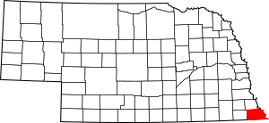
Think of it like a special hall of fame for history! When a place is added to this list, it means it's really important to the history of the United States, Nebraska, or even just Richardson County. There are 13 places in Richardson County on this list, and one of them is so special it's called a National Historic Landmark! Let's explore some of these cool historic sites.
Contents
- Historic Places You Can Discover
- R.A. Clark House
- Falls City Commercial Historic District
- Gehling's Theatre
- John Holman House
- Humboldt Commercial Historic District
- Leary Site: A National Historic Landmark
- Miles Ranch
- Mount Zion Brick Church
- Richardson County Courthouse
- Alfred and Magdalena Schmid Farmstead
- Way Side Stock Farm
- Gov. Arthur J. Weaver House
- A Former Listing: The Rulo Bridge
Historic Places You Can Discover
Many different kinds of places are on the National Register. They include old homes, busy downtown areas, and even ancient sites. Each one has a unique story to share.
R.A. Clark House
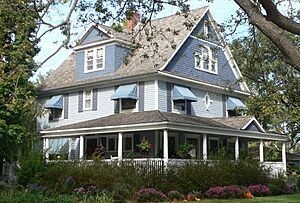
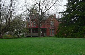
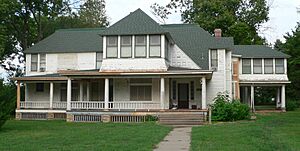
Located in Stella, the R.A. Clark House is a beautiful old home. It was added to the National Register in 2015. This house stands as a reminder of how people lived and built homes many years ago. It's a great example of the architecture from its time.
Falls City Commercial Historic District
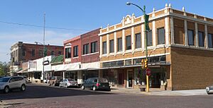
In Falls City, there's a whole area known as the Falls City Commercial Historic District. This district includes streets like Stone Street, from 15th to 19th Streets. It's a collection of historic buildings that once housed shops and businesses. Walking through this area is like stepping back in time to see how the town's main street used to look and feel. It was added to the list in 2013.
Gehling's Theatre
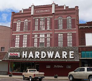
Also in Falls City, you'll find Gehling's Theatre at 1519 Stone Street. This historic theater was listed in 1988. Imagine all the movies and shows that have been enjoyed inside its walls! Old theaters like this are important because they show us how entertainment has changed over the years.
John Holman House
The John Holman House is in Humboldt at 947 Nemaha Street. This house has been on the National Register since 1972. It's another example of a historic home that has been preserved. It helps us understand the history of Humboldt and the people who lived there.
Humboldt Commercial Historic District
Just like Falls City, Humboldt also has its own Commercial Historic District. This area includes the Western Square of 4th Street to the Eastern Square, to 3rd Street. It was added to the list in 2005. These districts are important because they preserve the look and feel of old downtown areas. They show us how towns grew and developed.
Leary Site: A National Historic Landmark
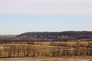
The Leary Site, near Rulo, is incredibly special. It's not just on the National Register; it's a National Historic Landmark! This means it's one of the most important historic places in the entire country. Listed in 1966, the Leary Site is an archaeological site. It holds clues about ancient people who lived in this area long, long ago. Archaeologists study sites like this to learn about past cultures and how they lived.
Miles Ranch
Near Dawson, you can find Miles Ranch at 63795 638 Ave. This historic ranch was added to the list in 2012. Ranches and farms are important because they show us the history of agriculture and how people made a living from the land. They also tell stories about family life in rural areas.
Mount Zion Brick Church
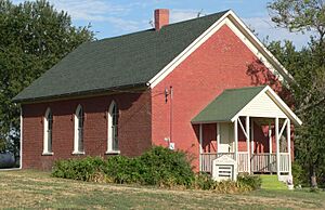
Northwest of Barada, at 718 Rd. and 651 Ave., stands the Mount Zion Brick Church. This church was listed in 1988. Historic churches are often beautiful buildings that tell us about the community's faith and social life. They were often central gathering places for people.
Richardson County Courthouse
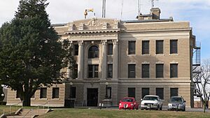
The Richardson County Courthouse is located in Falls City on Courthouse Square. It was added to the National Register in 1990. Courthouses are important because they are where local government happens. They often have grand architecture that shows the importance of civic life. This building has seen many important decisions made for the county.
Alfred and Magdalena Schmid Farmstead
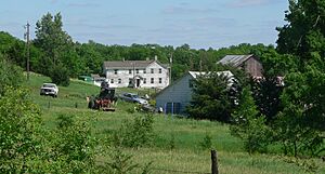
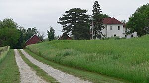
South-southwest of Dawson is the Alfred and Magdalena Schmid Farmstead. This farmstead was listed in 2005. Like Miles Ranch, it represents the agricultural history of the region. Preserving farmsteads helps us understand the hard work and daily lives of farming families.
Way Side Stock Farm
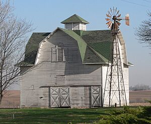
Another historic farm, the Way Side Stock Farm, is near Stella at 64480 718 Rd. It was added to the list in 2015. This farm shows us the history of raising livestock and farming practices in the area. The old barns and windmills are like living museums of agriculture.
Gov. Arthur J. Weaver House
In Falls City, at 1906 Fulton Street, is the home of former Governor Arthur J. Weaver. This house was listed in 2005. Homes of important people, like governors, are often preserved because they tell us about the lives of leaders and the history of politics in the state.
A Former Listing: The Rulo Bridge
Sometimes, a place that was once on the National Register might be removed. This happened with the Rulo Bridge.
The Story of the Rulo Bridge
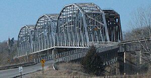
The Rulo Bridge used to carry U.S. Route 159 over the Missouri River from Rulo into Holt County, Missouri. It was listed on the National Register in 1993. However, it was removed from the list in 2015. Why? Because a new bridge was built nearby, and the old Rulo Bridge was taken down in 2015. Even though it's gone, its history as an important crossing over the Missouri River is still remembered.


