National Register of Historic Places listings in Bureau County, Illinois facts for kids
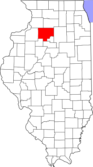
Have you ever wondered how we protect important buildings and places from the past? In Bureau County, Illinois, there's a special list of places that are super important to history. This list is called the National Register of Historic Places. It's like a hall of fame for buildings, structures, and areas that tell us about America's past.
When a place is added to this list, it means it's recognized for its historical, architectural, or archaeological importance. This helps make sure these special spots are preserved for future generations to learn from and enjoy. In Bureau County, Illinois, there are 19 different properties and areas that have earned a spot on this important list!
Historic Places in Bureau County
These are some of the amazing places in Bureau County that are listed on the National Register of Historic Places. Each one has a unique story and helps us understand the history of the area.
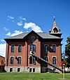
|- class="vcard" ! style="background:#A8EDEF" | 1 | Allen School
|
|
(#96000081)
| class="adr" | 301 Main St.
41°31′47″N 89°16′48″W / 41.529722°N 89.28°W
| class="note" |
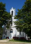
|- class="vcard" ! style="background:#A8EDEF" | 2 | First Congregational Church of LaMoille
|
|
(#96000059)
| class="adr" | 94 Franklin St.
41°31′51″N 89°16′47″W / 41.530833°N 89.279722°W
| class="note" |
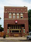
|- class="vcard" ! style="background:#A8EDEF" | 3 | First State Bank of Manlius
|
|
(#75000639)
| class="adr" | Northern side of Maple St.
41°27′24″N 89°40′11″W / 41.456667°N 89.669722°W
| class="note" |
|- class="vcard" ! style="background:#A8EDEF" | 4 | Greenwood Cottage
|
|
(#83000301)
| class="adr" | 543 E. Peru St.
41°22′20″N 89°27′22″W / 41.372123°N 89.455985°W
| class="note" |
|- class="vcard" ! style="background: #E6E6FA" | 5 | Hennepin Canal Historic District
|
|
(#78003433)
| class="adr" | West to Moline then north to the vicinity of Rock Falls
41°23′04″N 89°41′35″W / 41.3844°N 89.6930°W
| class="note" |
|- class="vcard" ! style="background:#A8EDEF" | 6 | Lone Tree School
|
|
(#04000418)
| class="adr" | 19292 250 North Avenue
41°11′11″N 89°29′11″W / 41.186389°N 89.486389°W
| class="note" |
|- class="vcard" ! style="background-color: #87CEEB;" | 7 | Owen Lovejoy Homestead
|
|
(#73000690)
| class="adr" | Peru St. (U.S. Route 6)
41°22′18″N 89°26′55″W / 41.371757°N 89.448705°W
| class="note" |
|- class="vcard" ! style="background:#A8EDEF" | 8 | Old Danish Church
|
|
(#73000691)
| class="adr" | Southeastern corner of the junction of Cook and Washington Sts.
41°21′27″N 89°44′06″W / 41.3575°N 89.735°W
| class="note" |
|- class="vcard" ! style="background:#A8EDEF" | 9 | Princeton Chapter House
|
|
(#80001338)
| class="adr" | 1007 N. Main St.
41°23′05″N 89°27′53″W / 41.384722°N 89.464722°W
| class="note" |
|- class="vcard" ! style="background:#A8EDEF" | 10 | Red Covered Bridge
|
|
(#75000640)
| class="adr" | 2 miles north of Princeton off Illinois Route 26 on Old Dad Joe Trail
41°24′59″N 89°28′43″W / 41.416389°N 89.478611°W
| class="note" |
|- class="vcard" ! style="background:#A8EDEF" | 11 | Richard M. Skinner House
|
|
(#83000302)
| class="adr" | 627 E. Peru St.
41°22′18″N 89°27′13″W / 41.371667°N 89.453611°W
| class="note" |
|- class="vcard" ! style="background:#A8EDEF" | 12 | Stevens House
|
|
(#92001537)
| class="adr" | 140 E. Main St.
41°17′31″N 89°30′22″W / 41.291944°N 89.506111°W
| class="note" |
|- class="vcard" ! style="background:#A8EDEF" | 13 | Village Hall
|
|
(#12001112)
| class="adr" | 239 S. Main St.
41°21′24″N 89°44′15″W / 41.356667°N 89.737500°W
| class="note" |
|- class="vcard" ! style="background:#A8EDEF" | 14 | Wood-Tellkamp House
|
|
(#94001599)
| class="adr" | 82 Main St.
41°32′00″N 89°16′49″W / 41.533333°N 89.280278°W
| class="note" | |}
| La Moille | La Moille | Manlius | Princeton | Hennepin | Tiskilwa | Princeton | Sheffield | Princeton | Princeton | Princeton | Tiskilwa | Sheffield | La Moille |


