
Bureau County, Illinois facts for kids
Quick facts for kids
Bureau County
|
|
|---|---|

Red Covered Bridge (1863)
|
|

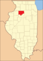
Location within the U.S. state of Illinois
|
|
 Illinois's location within the U.S. |
|
| Country | |
| State | |
| Founded | 1837 |
| Seat | Princeton |
| Largest city | Princeton |
| Area | |
| • Total | 874 sq mi (2,260 km2) |
| • Land | 869 sq mi (2,250 km2) |
| • Water | 4.5 sq mi (12 km2) 0.5% |
| Population
(2020)
|
|
| • Total | 33,244 |
| • Estimate
(2023)
|
32,729 |
| • Density | 38.037/sq mi (14.686/km2) |
| Time zone | UTC−6 (Central) |
| • Summer (DST) | UTC−5 (CDT) |
| Congressional districts | 14th, 16th |
Bureau County is a county in the state of Illinois, USA. It's like a smaller region within the state. In 2020, about 33,244 people lived here. The main town, or county seat, is Princeton. Bureau County is also part of a larger area called the Ottawa, IL Micropolitan Statistical Area. You can find part of the Hennepin Canal Parkway State Park in this county too!
Contents
History of Bureau County
Bureau County was created in 1837 from a part of Putnam County. It's named after two French-Canadian brothers, Michel and Pierre Bureau. They ran a trading post here from the late 1700s. They traded goods near where Big Bureau Creek meets the Illinois River. People think their real last name was Belleau, but local Native Americans found it hard to say.
An early settler was a man named Bulbona. He was part French and part Native American. Unlike most Native Americans, he stayed in the area after European settlers arrived. He also ran a trading post, selling things like whiskey.
The first settlers in Princeton, the oldest town in the area, came from New England. They were descendants of the English Puritans who settled New England in the 1600s. Many of them moved to the Northwest Territory in the early 1800s. This happened after the Erie Canal was finished, making travel easier.
When they arrived, they found wild forests and prairies. These New Englanders set up farms, built roads, and created government buildings. They also started mail routes. They brought their values with them, like a strong belief in education. They built many schools. They were also very strong supporters of ending slavery. Most of them belonged to the Congregationalist Church or the Episcopal Church. So, early Bureau County felt a lot like early New England.
Like many places in the Midwest, Bureau County was part of the "Underground Railroad". This was a secret network that helped enslaved people escape to freedom. There was a "station" at the home of Owen Lovejoy in Princeton. There were also other safe places in the county.
-
Bureau County's borders haven't changed since it was created in 1837.

Geography of Bureau County
The US Census Bureau says Bureau County covers about 874 square miles. Most of this area, about 869 square miles, is land. The rest, about 4.5 square miles, is water. The main waterway in the county is Big Bureau Creek.
Neighboring Counties
Bureau County shares borders with these other counties:
- Whiteside County - to the northwest
- Lee County - to the north
- LaSalle County - to the east
- Putnam County - to the southeast
- Marshall County - to the south
- Stark County - to the southwest
- Henry County - to the west
Main Roads
Several important highways pass through Bureau County:
 Interstate 80
 Interstate 180
 U.S. Route 6
 U.S. Route 34
 Illinois Route 26
 Illinois Route 29
 Illinois Route 40
 Illinois Route 89
 Illinois Route 92
Climate and Weather in Bureau County
| Weather chart for Princeton, Illinois | |||||||||||||||||||||||||||||||||||||||||||||||
|---|---|---|---|---|---|---|---|---|---|---|---|---|---|---|---|---|---|---|---|---|---|---|---|---|---|---|---|---|---|---|---|---|---|---|---|---|---|---|---|---|---|---|---|---|---|---|---|
| J | F | M | A | M | J | J | A | S | O | N | D | ||||||||||||||||||||||||||||||||||||
|
1.7
29
14
|
1.5
35
20
|
2.5
47
30
|
3.8
61
40
|
4.1
73
51
|
4.4
82
61
|
3.3
85
65
|
4.8
82
63
|
3.7
75
55
|
2.9
63
43
|
2.9
47
31
|
2.5
33
19
|
||||||||||||||||||||||||||||||||||||
| temperatures in °F precipitation totals in inches source: The Weather Channel |
|||||||||||||||||||||||||||||||||||||||||||||||
|
Metric conversion
|
|||||||||||||||||||||||||||||||||||||||||||||||
In Princeton, the county seat, temperatures usually range from 14°F (about -10°C) in January to 85°F (about 29°C) in July. The coldest temperature ever recorded was -22°F (about -30°C) in February 1996. The hottest was 102°F (about 39°C) in June 1988. The county gets the most rain in August and the least in February.
People of Bureau County

| Historical population | |||
|---|---|---|---|
| Census | Pop. | %± | |
| 1840 | 3,067 | — | |
| 1850 | 8,841 | 188.3% | |
| 1860 | 26,426 | 198.9% | |
| 1870 | 32,415 | 22.7% | |
| 1880 | 33,172 | 2.3% | |
| 1890 | 35,014 | 5.6% | |
| 1900 | 41,112 | 17.4% | |
| 1910 | 43,975 | 7.0% | |
| 1920 | 42,648 | −3.0% | |
| 1930 | 38,845 | −8.9% | |
| 1940 | 37,600 | −3.2% | |
| 1950 | 37,711 | 0.3% | |
| 1960 | 37,594 | −0.3% | |
| 1970 | 38,541 | 2.5% | |
| 1980 | 39,114 | 1.5% | |
| 1990 | 35,688 | −8.8% | |
| 2000 | 35,503 | −0.5% | |
| 2010 | 34,978 | −1.5% | |
| 2020 | 33,244 | −5.0% | |
| 2023 (est.) | 32,729 | −6.4% | |
| US Decennial Census 1790-1960 1900-1990 1990-2000 2010-2013 |
|||
In 2010, there were about 34,978 people living in Bureau County. There were over 14,200 households, which are groups of people living together. The population density was about 40 people per square mile. This means for every square mile, there were about 40 people.
Most people in the county (94.2%) were white. Other groups included Asian (0.7%), Black or African American (0.6%), and American Indian (0.3%). About 7.7% of the population was of Hispanic or Latino background. Many people have ancestors from Germany (32.8%), Ireland (13.8%), England (12.1%), Italy (8.8%), Sweden (7.6%), and Poland (5.8%).
About 29.8% of households had children under 18 living with them. The average household had 2.42 people. The average age of people in the county was 42.5 years old.
The average income for a household was about $45,692 per year. For families, it was about $55,217. About 11.1% of all people in the county lived below the poverty line. This included 15.3% of those under age 18.
Towns and Villages
Here are some of the communities in Bureau County:
| Community |
Community type |
Population | Total Area |
Water Area |
Land Area |
Pop. Density |
|
|---|---|---|---|---|---|---|---|
| Arlington | village | 169 | 0.40 | 0.00 | 0.40 | 427.85 | |
| Buda | village | 482 | 1.01 | 0.00 | 1.01 | 475.35 | |
| Bureau Junction | village | 281 | 1.51 | 0.07 | 1.45 | 190 | |
| Cherry | village | 435 | 0.51 | 0.00 | 0.51 | 850 | |
| Dalzell (part) | village | 663 | 0.83 | 0.01 | 0.82 | 808.54 | |
| DePue | village | 1,633 | 2.55 | 0.11 | 2.45 | 667.35 | |
| Dover | village | 135 | 0.29 | 0.00 | 0.28 | 470 | |
| Hollowayville | village | 36 | 0.05 | 0.00 | 0.05 | 734.69 | |
| La Moille | village | 679 | 1.16 | 0.00 | 1.16 | 590 | |
| Ladd | village | 1,263 | 1.21 | 0.00 | 1.21 | 1,000 | |
| Malden | village | 318 | 0.27 | 0.00 | 0.27 | 1,164.84 | |
| Manlius | village | 298 | 0.32 | 0.00 | 0.32 | 934.17 | |
| Mineral | village | 206 | 0.553 | 0.00 | 0.553 | 370 | |
| Neponset | village | 427 | 1.016 | 0.00 | 1.016 | 420 | |
| New Bedford | village | 76 | 0.155 | 0.00 | 0.155 | 490 | |
| Ohio | village | 465 | 0.753 | 0.00 | 0.753 | 620 | |
| Princeton (seat) | city | 7,832 | 8.24 | 0.00 | 8.24 | 950.49 | |
| Seatonville | village | 321 | 0.511 | 0.015 | 0.496 | 630 | |
| Sheffield | village | 821 | 1.169 | 0.00 | 1.169 | 700 | |
| Spring Valley | city | 5,582 | 7.40 | 0.04 | 7.36 | 750 | |
| Tiskilwa | village | 740 | 0.517 | 0.00 | 0.517 | 1,400 | |
| Walnut | village | 1,311 | 0.801 | 0.00 | 0.801 | 1,600 | |
| Wyanet | village | 886 | 0.946 | 0.00 | 0.946 | 940 | |
| Bureau County | county | 33,244 | 874 | 4.5 | 869 | 38 |
Other Small Communities
These are smaller, unincorporated communities in Bureau County:
Townships in Bureau County
Bureau County is also divided into smaller areas called townships:
- Arispie
- Berlin
- Bureau
- Clarion
- Concord
- Dover
- Fairfield
- Gold
- Greenville
- Hall
- Indiantown
- Lamoille
- Leepertown
- Macon
- Manlius
- Milo
- Mineral
- Neponset
- Ohio
- Princeton
- Selby
- Walnut
- Westfield
- Wheatland
- Wyanet
Famous People from Bureau County
Many notable people have connections to Bureau County:
- Charles W. Brooks – A U.S. Senator.
- Warren Giles – An executive in the Baseball Hall of Fame.
- Virgil Fox – A famous concert organist.
- Kathryn Hays – An actress.
- Owen Lovejoy – A minister who fought against slavery and was a U.S. congressman.
- Rufus Lumry – A preacher and strong supporter of ending slavery.
- Joseph R. Peterson – An Illinois state lawmaker and lawyer.
- Robert Petkoff – An actor.
- Eliza Suggs – An author and activist who promoted temperance (avoiding alcohol).
See also
 In Spanish: Condado de Bureau para niños
