Big Bureau Creek facts for kids
Quick facts for kids Big Bureau Creek |
|
|---|---|

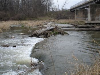
Big Bureau Creek in a rough area
|
|
| Country | United States |
| State | Illinois |
| Physical characteristics | |
| Main source | Near Compton, Lee County, Illinois 41°42′00″N 89°04′11″W / 41.70000°N 89.06972°W |
| River mouth | Illinois River South of Bureau, Bureau County, Illinois 41°14′53″N 89°22′27″W / 41.24806°N 89.37417°W |
| Length | 73 mi (117 km) |
The Big Bureau Creek is a 73-mile (117 km) long river in north central Illinois. It flows into the Illinois River. This creek starts about 10 miles (16 km) north of Mendota. It then flows southwest into Bureau County. At Princeton, it turns south. Finally, it flows east into the flat land near the Illinois River.
One cool spot along the creek is the Red Covered Bridge. It was built way back in 1863. This bridge goes over Big Bureau Creek. It used to be part of the Peoria Galena Trail. The bridge is just north of Interstate 80. It is listed on the National Register of Historic Places. This means it's an important historical site.
What's in a Name? The History of Big Bureau Creek
The Big Bureau Creek is named after Michel or Pierre Bureau. These brothers likely ran a trading post. This post was near where the creek meets the Illinois River. They were there from around 1776 to 1780 or 1790.
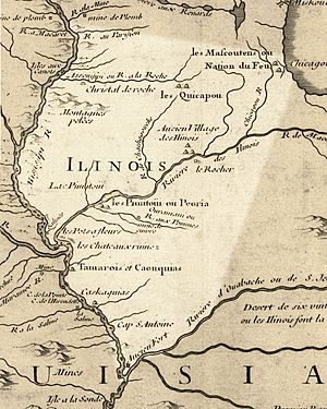
On old maps, the creek had different names. It was called "Chassagauch" or "Chachagouche" River. These names came from the Miami-Illinois language. The word šaahšaakweehsiiwa meant "copperhead snake" a long time ago. Now, it means "garter snake." A chief and diplomat named Šaahšaakweehsiiwa also lived nearby. He was from the Kaskaskia tribe in the late 1600s and early 1700s.
Protecting the Creek: Ecology Efforts
People are working to keep the Big Bureau Creek healthy. They are studying its condition. This effort started in 2003. The main problems they are looking at are:
- Too much Nitrogen from nearby farms.
- Sedimentation, which means too much dirt and sand building up.
- Low water levels in some parts of the creek.
These efforts help protect the creek's watershed. A watershed is an area of land where all the water drains into one river or creek.
Fun on the Water: Recreation
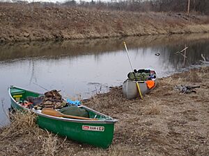
Most of the land along Big Bureau Creek is privately owned. This means it belongs to individuals, not the public. However, you can still go canoeing in some areas.
Some parts of the creek can have exciting rapids when the water is high. These are called Class II and III rapids. But watch out for things like brush, beaver dams, and rocks hidden underwater. These can make canoeing tricky.
 | Mary Eliza Mahoney |
 | Susie King Taylor |
 | Ida Gray |
 | Eliza Ann Grier |


