Illinois Route 29 facts for kids
Quick facts for kids
Illinois Route 29 |
||||
|---|---|---|---|---|
|
IL 29 highlighted in red
|
||||
| Route information | ||||
| Maintained by IDOT | ||||
| Length | 175.36 mi (282.21 km) | |||
| Existed | November 5, 1918–present | |||
| Major junctions | ||||
| South end | ||||
| North end | ||||
| Location | ||||
| Counties: | Christian, Sangamon, Menard, Mason, Tazewell, Peoria, Marshall, Putnam, Bureau | |||
| Highway system | ||||
| Illinois state highway system Illinois Tollway system
|
||||
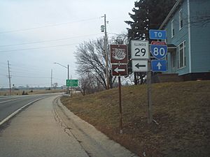
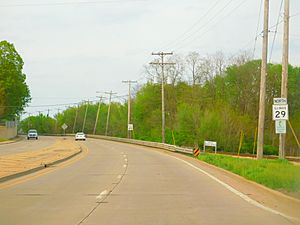
Illinois Route 29 (IL 29) is a state road in Illinois, USA. It has two to four lanes. The road runs for about 175 miles (282 kilometers). It goes from Spring Valley in the north to Pana in the south. Along the way, it passes through important cities like Pekin, Peoria, and Springfield.
What is Illinois Route 29 Like?
Illinois Route 29 generally follows the Illinois River. It stays on the north and west side of the river. The road starts in Spring Valley. From there, it goes through small towns like Putnam and Henry. In Henry, it crosses Illinois Route 18. Further south, in Sparland, it meets Illinois Route 17. The road then passes near a steep hill in Hopewell. After that, it becomes 4th Street in Chillicothe. This is the main road through that town.
As you travel south, Route 29 becomes Galena Road. This is true from Mossville through Peoria and Peoria Heights. It crosses U.S. Route 150 at the McClugage Bridge. After this bridge, it changes its name to Adams Street. In downtown Peoria, Route 29 joins Interstate 74. It crosses the Illinois River on the Murray Baker Bridge. This bridge takes you to East Peoria.
In East Peoria, Route 29 leaves Interstate 74. It continues south into Creve Coeur on Main Street. Here, you can connect to Interstate 474. The road then enters Pekin as 8th Street. It briefly shares the road with Illinois Route 9. After this, it splits into two one-way streets. Southbound traffic uses 2nd Street, and northbound uses 3rd Street. Route 29 then leaves Pekin as 2nd Street. It passes the Federal Correctional Institution, Pekin. From Pekin, the road goes mostly straight south. It travels through Mason City on its way to Springfield.
Route 29 enters Springfield near the Abraham Lincoln Capital Airport. It goes around the north and east sides of the city. After leaving Springfield, it meets Interstate 55, Interstate 72, and U.S. Route 36. From there, Route 29 heads southeast. It goes through Taylorville. It passes the end of Illinois Route 104 and crosses Illinois Route 48. Finally, Illinois Route 29 ends in Pana. Here, it connects with U.S. Route 51 and Illinois Route 16.
How the Road Changed Over Time
Illinois Route 29 was first created in 1918. Back then, it only went from DePue to Peoria. Over the years, the route was made longer. In 1936 and 1940, it was extended by taking over parts of an older road, Illinois Route 24. In 1942, it replaced a section of U.S. Route 6. This part went from Bureau Junction to Spring Valley.
The way Route 29 goes through Peoria was changed in 2012. At the same time, U.S. Route 24 was moved to a different path across the river. Route 29 was then moved from the Cedar Street Bridge to the Murray Baker Bridge. The Murray Baker Bridge is also used by Interstate 74.
See also
 In Spanish: Ruta de Illinois 29 para niños
 | William M. Jackson |
 | Juan E. Gilbert |
 | Neil deGrasse Tyson |


