
Peoria County, Illinois facts for kids
Quick facts for kids
Peoria County
|
|||
|---|---|---|---|

Peoria County Courthouse
|
|||
|
|||

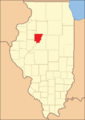
Location within the U.S. state of Illinois
|
|||
 Illinois's location within the U.S. |
|||
| Country | |||
| State | |||
| Founded | 1825 | ||
| Named for | Peoria tribe | ||
| Seat | Peoria | ||
| Largest city | Peoria | ||
| Area | |||
| • Total | 631 sq mi (1,630 km2) | ||
| • Land | 619 sq mi (1,600 km2) | ||
| • Water | 11 sq mi (30 km2) 1.8% | ||
| Population
(2020)
|
|||
| • Total | 181,830 | ||
| • Density | 288.16/sq mi (111.26/km2) | ||
| Time zone | UTC−6 (Central) | ||
| • Summer (DST) | UTC−5 (CDT) | ||
| ZIP Codes |
61451, 61517, 61523, 61525, 61526, 61528, 61529, 61531, 61533, 61536, 61539, 61547, 61552, 61559, 61562, 61569, 61601, 61602, 61603, 61604, 61605, 61606, 61607, 61612, 61613, 61614, 61615, 61616, 61625, 61629, 61630, 61633, 61634, 61636, 61637, 61638, 61639, 61641, 61643, 61650, 61651, 61652, 61653, 61654, 61655, 61656
|
||
| Congressional districts | 16th, 17th | ||


Peoria County is a county in the state of Illinois, USA. It's known for being part of the Peoria metropolitan area. In 2020, about 181,830 people lived here. The main city and county seat is Peoria.
Contents
History of Peoria County
Peoria County was created in 1825. It was formed from parts of Fulton County. The county got its name from the Peoria people, a Native American tribe. They were part of the larger Illiniwek group who lived in the area. At first, Peoria County covered a large part of the western Illinois River valley.
How Peoria County Changed Over Time
-
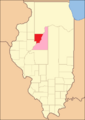
Peoria County when it was first created in 1825. It had other unorganized areas connected to it.
-
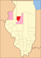
Peoria County from 1826 to 1827. New counties like Mercer and Warren were temporarily linked to Peoria.
-
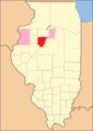
Peoria County from 1827 to 1830. When Tazewell County was formed, Peoria was left with a small part of unorganized land east of the Illinois River.
-
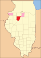
In 1830, Warren County started its own government.
-
In 1831, Peoria County got its current borders. Mercer County was then linked to Warren County.


Geography of Peoria County
Peoria County covers about 631 square miles. Most of this area, 619 square miles, is land. The remaining 11 square miles (about 1.8%) is water. Rivers and creeks like Spoon River, Kickapoo Creek, Elbow Creek, and Copperas Creek flow through the county.
Climate and Weather in Peoria
| Weather chart for Peoria, Illinois | |||||||||||||||||||||||||||||||||||||||||||||||
|---|---|---|---|---|---|---|---|---|---|---|---|---|---|---|---|---|---|---|---|---|---|---|---|---|---|---|---|---|---|---|---|---|---|---|---|---|---|---|---|---|---|---|---|---|---|---|---|
| J | F | M | A | M | J | J | A | S | O | N | D | ||||||||||||||||||||||||||||||||||||
|
1.5
31
14
|
1.7
37
20
|
2.8
49
30
|
3.6
62
40
|
4.2
73
51
|
3.8
82
60
|
4
86
65
|
3.2
84
63
|
3.1
77
54
|
2.8
64
42
|
3
49
31
|
2.4
35
20
|
||||||||||||||||||||||||||||||||||||
| temperatures in °F precipitation totals in inches source: The Weather Channel |
|||||||||||||||||||||||||||||||||||||||||||||||
|
Metric conversion
|
|||||||||||||||||||||||||||||||||||||||||||||||
The weather in Peoria County changes a lot throughout the year. In January, the average low temperature is about 14°F (about -10°C). In July, the average high temperature is around 86°F (about 30°C). The coldest temperature ever recorded was -27°F (-33°C) in January 1884. The hottest was 113°F (45°C) in July 1936.
The amount of rain and snow also varies. January usually gets about 1.50 inches of precipitation. May is the wettest month, with an average of 4.17 inches.
Neighboring Counties
Peoria County shares its borders with several other counties:
- Knox County – to the northwest
- Stark County – to the north
- Marshall County – to the northeast
- Woodford County – to the east
- Tazewell County – to the south
- Fulton County – to the southwest
Transportation in Peoria County
Getting around Peoria County is possible through various ways.
Public Transport and Buses
- Greater Peoria Mass Transit District (local buses)
- Burlington Trailways (long-distance buses)
- Peoria Charter Coach Company (charter buses)
- List of intercity bus stops in Illinois
Main Roads and Highways
Many important roads run through Peoria County, connecting it to other areas:
 Interstate 74
 Interstate 474
 U.S. Route 24
 U.S. Route 150
 Illinois Route 6
 Illinois Route 8
 Illinois Route 9
 Illinois Route 29
 Illinois Route 40
 Illinois Route 78
 Illinois Route 90
 Illinois Route 91
 Illinois Route 116
Past Highways
Some highways that used to be important in the area are no longer in use:
 Illinois Route 174
 Illinois Route 175
Airports in the County
- General Wayne A. Downing Peoria International Airport (PIA) – This is the main airport, formerly called Greater Peoria Regional Airport.
- Mount Hawley Auxiliary Airport (3MY) – A smaller airport located in Peoria.
Population and People
| Historical population | |||
|---|---|---|---|
| Census | Pop. | %± | |
| 1840 | 6,153 | — | |
| 1850 | 17,547 | 185.2% | |
| 1860 | 36,601 | 108.6% | |
| 1870 | 47,540 | 29.9% | |
| 1880 | 55,355 | 16.4% | |
| 1890 | 70,378 | 27.1% | |
| 1900 | 88,608 | 25.9% | |
| 1910 | 100,255 | 13.1% | |
| 1920 | 111,710 | 11.4% | |
| 1930 | 141,344 | 26.5% | |
| 1940 | 153,374 | 8.5% | |
| 1950 | 174,347 | 13.7% | |
| 1960 | 189,044 | 8.4% | |
| 1970 | 195,318 | 3.3% | |
| 1980 | 200,466 | 2.6% | |
| 1990 | 182,827 | −8.8% | |
| 2000 | 183,433 | 0.3% | |
| 2010 | 186,494 | 1.7% | |
| 2020 | 181,830 | −2.5% | |
| 2023 (est.) | 177,513 | −4.8% | |
| US Decennial Census 1790–1960 1900–1990 1990–2000 2010–2019 |
|||
In 2020, Peoria County had 181,830 residents. There were 73,253 households. The county had about 301 people per square mile.
Most people in the county (73.5%) identified as white. About 18.8% were black or African American. Around 4.1% were Asian. People of Hispanic or Latino origin made up 5.1% of the population. Many residents have German (28.3%), Irish (14.8%), or English (10.4%) backgrounds.
About 30.5% of households had children under 18 living with them. The average household had 2.39 people. The average age of people in the county was 36.8 years.
The median income for a household was $49,747. For families, it was $63,163. This means half of the households earned more than this amount, and half earned less. About 14.5% of the population lived below the poverty line.
Fun Places to Visit
Peoria County has many interesting places to explore:
- Glasford crater – A natural area with a unique geological feature.
- Jubilee College State Park – A park offering outdoor activities and historical insights.
- WMBD World's Most Beautiful Drive (Grandview Drive/Prospect) – A scenic road with great views.
- Forest Park Nature Center – A place to learn about local wildlife and nature.
- Peoria Heights Tower Park – A park with a tall tower offering panoramic views.
- Rock Island Trail – A popular trail for biking and walking.
Communities in Peoria County
Peoria County is made up of several cities, villages, and smaller communities.
Cities in Peoria County
- Chillicothe
- Peoria (This is the county seat, where the main government offices are)
- West Peoria
Villages in Peoria County
Census-Designated Places
These are areas that are like towns but are not officially incorporated as cities or villages:
- Lake Camelot
- Mossville
- Rome
- Smithville
- Trivoli
Unincorporated Communities
These are small settlements that are not part of any city or village government:
Townships in Peoria County
Townships are smaller local government areas within the county. The cities of Peoria and West Peoria are separate from these townships.
- Akron
- Brimfield
- Chillicothe
- Elmwood
- Hallock
- Hollis
- Jubilee
- Kickapoo
- Limestone
- Logan
- Medina
- Millbrook
- Princeville
- Radnor
- Richwoods
- Rosefield
- Timber
- Trivoli
- West Peoria (This township no longer exists and is now part of West Peoria)
Education in Peoria County
Peoria County has many school districts that serve students from kindergarten through 12th grade.
School Districts for All Grades (K-12)
- Brimfield Community Unit School District 309
- Dunlap Community Unit School District 323
- Elmwood Community Unit School District 322
- Farmington Central Community Unit School District 265
- Illini Bluffs Community Unit School District 327
- Illinois Valley Central Unit School District 321
- Peoria School District 150
- Peoria Heights Community Unit School District 325
- Princeville Community Unit School District 326
- Stark County Community Unit School District 100
- Williamsfield Community Unit School District 210
High School Districts
- Limestone Community High School District 310
Elementary School Districts
- Bartonville School District 66
- Hollis Consolidated School District 328
- Limestone Walters Community Consolidated School District 316
- Monroe School District 70
- Norwood Elementary School District 63
- Oak Grove School District 68
- Pleasant Hill School District 69
- Pleasant Valley School District 62
Famous People from Peoria County
Many notable individuals have come from Peoria County, especially from areas outside the city of Peoria:
- Chris Brackett – Host of a TV show called Arrow Affliction.
- Mike Dunne – A pitcher who played for several Major League Baseball teams.
- Mary Emma Holmes – A reformer, suffragist (someone who fought for women's right to vote), and educator.
- Bill Krieg – A Major League Baseball player.
- Lance (Henry) LeGault – An actor known for playing Colonel Roderick Decker on The A-Team.
- Zach McAllister – A pitcher for the Cleveland Indians baseball team.
- Johnston McCulley – An author who created the famous character Zorro.
- Richard Pryor – A very well-known actor and comedian.
- David Ogden Stiers – An actor famous for playing Major Charles Emerson Winchester III on the TV show M*A*S*H.
- Josh Taylor – A TV actor known for his role on the soap opera Days of Our Lives.
- Jim Thome – A first baseman who played for several Major League Baseball teams.
See also
 In Spanish: Condado de Peoria para niños
