Knox County, Illinois facts for kids
Quick facts for kids
Knox County
|
|
|---|---|

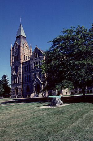
Knox County Courthouse
|
|

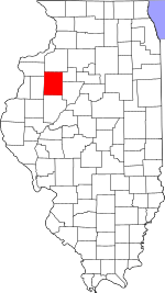
Location within the U.S. state of Illinois
|
|
 Illinois's location within the U.S. |
|
| Country | |
| State | |
| Founded | 1825 |
| Named for | Henry Knox |
| Seat | Galesburg |
| Largest city | Galesburg |
| Area | |
| • Total | 720 sq mi (1,900 km2) |
| • Land | 716 sq mi (1,850 km2) |
| • Water | 3.4 sq mi (9 km2) 0.5% |
| Population
(2020)
|
|
| • Total | 49,967 |
| • Density | 69.4/sq mi (26.79/km2) |
| Time zone | UTC−6 (Central) |
| • Summer (DST) | UTC−5 (CDT) |
| Congressional district | 17th |
Knox County is a county located in the state of Illinois in the United States. In 2020, about 49,967 people called Knox County home. The main town and center of the county government is Galesburg. Knox County is also part of the Galesburg Micropolitan Statistical Area.
Contents
Discovering Knox County's Past
Knox County was named after Henry Knox. He was the very first Secretary of War for the United States.
The modern Knox County, Illinois, was officially created in 1825. It was formed from a part of Fulton County.
Just like its neighbor, Fulton County, Knox County has a special fall festival. It's called the Knox County Drive. This scenic drive happens during the first two weekends of October.
Exploring Knox County's Geography
Knox County covers a total area of about 720 square miles. Most of this, about 716 square miles, is land. The remaining 3.4 square miles, or 0.5%, is water.
Weather and Climate in Knox County
| Weather chart for Galesburg, Illinois | |||||||||||||||||||||||||||||||||||||||||||||||
|---|---|---|---|---|---|---|---|---|---|---|---|---|---|---|---|---|---|---|---|---|---|---|---|---|---|---|---|---|---|---|---|---|---|---|---|---|---|---|---|---|---|---|---|---|---|---|---|
| J | F | M | A | M | J | J | A | S | O | N | D | ||||||||||||||||||||||||||||||||||||
|
1.4
29
13
|
1.6
35
19
|
2.8
48
29
|
3.8
61
40
|
4
73
51
|
4.2
81
61
|
4.4
85
65
|
4.1
82
63
|
3.5
75
55
|
2.5
63
43
|
2.7
47
31
|
2.3
33
19
|
||||||||||||||||||||||||||||||||||||
| temperatures in °F precipitation totals in inches source: The Weather Channel |
|||||||||||||||||||||||||||||||||||||||||||||||
|
Metric conversion
|
|||||||||||||||||||||||||||||||||||||||||||||||
In Galesburg, the county seat, temperatures usually range from 13°F in January to 85°F in July. The coldest temperature ever recorded was -25°F in January 1982. The hottest was 102°F in July 1983. The amount of rain or snow each month varies. It can be as little as 1.41 inches in January or as much as 4.37 inches in July.
Getting Around: Public Transit
- Galesburg station
- Burlington Trailways
- Galesburg Transit
- List of intercity bus stops in Illinois
Major Roads in Knox County
 Interstate 74
 U.S. Highway 34
 U.S. Highway 150
 Illinois Route 8
 Illinois Route 17
 Illinois Route 41
 Illinois Route 78
 Illinois Route 97
 Illinois Route 116
 Illinois Route 164
 Illinois Route 167
 Illinois Route 180
Neighboring Counties
- Mercer County - to the northwest
- Henry County - to the north
- Stark County - to the east
- Peoria County - to the southeast
- Fulton County - to the south
- Warren County - to the west
Knox County's Population Story
| Historical population | |||
|---|---|---|---|
| Census | Pop. | %± | |
| 1830 | 274 | — | |
| 1840 | 7,060 | 2,476.6% | |
| 1850 | 13,279 | 88.1% | |
| 1860 | 28,663 | 115.9% | |
| 1870 | 39,522 | 37.9% | |
| 1880 | 38,344 | −3.0% | |
| 1890 | 38,752 | 1.1% | |
| 1900 | 43,612 | 12.5% | |
| 1910 | 46,159 | 5.8% | |
| 1920 | 46,727 | 1.2% | |
| 1930 | 51,336 | 9.9% | |
| 1940 | 52,250 | 1.8% | |
| 1950 | 54,366 | 4.0% | |
| 1960 | 61,280 | 12.7% | |
| 1970 | 61,280 | 0.0% | |
| 1980 | 61,607 | 0.5% | |
| 1990 | 56,393 | −8.5% | |
| 2000 | 55,836 | −1.0% | |
| 2010 | 52,919 | −5.2% | |
| 2020 | 49,967 | −5.6% | |
| 2023 (est.) | 48,411 | −8.5% | |
| U.S. Decennial Census 1790-1960 1900-1990 1990-2000 2010-2013 |
|||
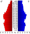
In 2010, there were 52,919 people living in Knox County. These people lived in 21,535 households. About 27% of these households had children under 18. The average age of people in the county was 42 years old.
The average income for a household in the county was about $39,545. For families, the average income was about $51,740.
Communities in Knox County
Knox County has several different types of communities.
Cities
Villages
Census-Designated Places
These are areas that are like towns but are not officially incorporated as cities or villages.
Other Unincorporated Communities
These are smaller communities that are not part of any city or village.
Townships
Knox County is divided into twenty-one smaller areas called townships.
- Cedar
- Chestnut
- Copley
- Elba
- Galesburg
- Galesburg City
- Haw Creek
- Henderson
- Indian Point
- Knox
- Lynn
- Maquon
- Ontario
- Orange
- Persifer
- Rio
- Salem
- Sparta
- Truro
- Victoria
- Walnut Grove
Images for kids
See also
 In Spanish: Condado de Knox (Illinois) para niños
 | Chris Smalls |
 | Fred Hampton |
 | Ralph Abernathy |


