
Mercer County, Illinois facts for kids
Quick facts for kids
Mercer County
|
|
|---|---|

Mercer County Courthouse
|
|

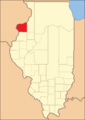
Location within the U.S. state of Illinois
|
|
 Illinois's location within the U.S. |
|
| Country | |
| State | |
| Founded | January 13, 1825 |
| Named for | Hugh Mercer |
| Seat | Aledo |
| Largest city | Aledo |
| Area | |
| • Total | 569 sq mi (1,470 km2) |
| • Land | 561 sq mi (1,450 km2) |
| • Water | 7.5 sq mi (19 km2) 1.3% |
| Population
(2020)
|
|
| • Total | 15,699 |
| • Estimate
(2021)
|
15,582 |
| • Density | 27.591/sq mi (10.653/km2) |
| Time zone | UTC−6 (Central) |
| • Summer (DST) | UTC−5 (CDT) |
| Congressional districts | 15th, 17th |
Mercer County is a county in Illinois. It is located in the western part of the state. In 2020, about 15,699 people lived there. The main town and county seat is Aledo.
Mercer County is part of a larger area called the Quad Cities. This area includes cities like Davenport, Moline, and Rock Island.
Contents
History of Mercer County
Mercer County is named after Hugh Mercer. He was a doctor and a general during the American Revolution. General Mercer sadly died in 1777 from injuries he got at the Battle of Princeton.
How Mercer County Was Formed
In May 1812, the U.S. Congress passed a law. This law set aside land in places like Illinois. This land was meant as payment for soldiers who volunteered in the War of 1812. Mercer County was part of this special "Military Tract" land.
Illinois became a state in 1818. Seven years later, on January 13, 1825, Mercer County was officially created. At first, it didn't have its own government. It was managed by other counties like Schuyler, Peoria, and Warren.
More people started moving to the area after the Black Hawk War. Because of this, Mercer County finally set up its own government in 1835.
-
Mercer County when it was first created in 1825.
-

Mercer County in 1827, showing its current borders.


Geography of Mercer County
The U.S. Census Bureau says Mercer County covers about 569 square miles. Most of this area, about 561 square miles, is land. The rest, about 7.5 square miles, is water.
Weather and Climate
| Weather chart for Aledo, Illinois | |||||||||||||||||||||||||||||||||||||||||||||||
|---|---|---|---|---|---|---|---|---|---|---|---|---|---|---|---|---|---|---|---|---|---|---|---|---|---|---|---|---|---|---|---|---|---|---|---|---|---|---|---|---|---|---|---|---|---|---|---|
| J | F | M | A | M | J | J | A | S | O | N | D | ||||||||||||||||||||||||||||||||||||
|
1.3
29
11
|
1.3
35
17
|
2.4
47
26
|
3.7
61
37
|
3.9
72
48
|
4.4
81
59
|
4.2
84
62
|
4.3
82
60
|
3.3
75
51
|
2.7
64
40
|
2.5
47
28
|
1.9
34
17
|
||||||||||||||||||||||||||||||||||||
| temperatures in °F precipitation totals in inches source: The Weather Channel |
|||||||||||||||||||||||||||||||||||||||||||||||
|
Metric conversion
|
|||||||||||||||||||||||||||||||||||||||||||||||
The weather in Aledo, the county seat, changes a lot throughout the year. In January, the average low temperature is about 11 degrees Fahrenheit. In July, the average high is about 84 degrees Fahrenheit.
The coldest temperature ever recorded was -30 degrees Fahrenheit in February 1905. The hottest was 113 degrees Fahrenheit in July 1936. The county gets the most rain in June, and the least in January.
Main Roads in Mercer County
 U.S. Highway 67
 Illinois Route 17
 Illinois Route 94
 Illinois Route 135
Neighboring Counties
Mercer County shares borders with these other counties:
- Rock Island County - to the north
- Henry County - to the east
- Knox County - to the southeast
- Henderson County - to the south
- Warren County - to the south
- Des Moines County, Iowa - to the southwest
- Louisa County, Iowa - to the west
Population Changes in Mercer County
| Historical population | |||
|---|---|---|---|
| Census | Pop. | %± | |
| 1830 | 26 | — | |
| 1840 | 2,352 | 8,946.2% | |
| 1850 | 5,246 | 123.0% | |
| 1860 | 15,042 | 186.7% | |
| 1870 | 18,769 | 24.8% | |
| 1880 | 19,502 | 3.9% | |
| 1890 | 18,545 | −4.9% | |
| 1900 | 20,945 | 12.9% | |
| 1910 | 19,723 | −5.8% | |
| 1920 | 18,800 | −4.7% | |
| 1930 | 16,641 | −11.5% | |
| 1940 | 17,701 | 6.4% | |
| 1950 | 17,374 | −1.8% | |
| 1960 | 17,149 | −1.3% | |
| 1970 | 17,294 | 0.8% | |
| 1980 | 19,286 | 11.5% | |
| 1990 | 17,290 | −10.3% | |
| 2000 | 16,957 | −1.9% | |
| 2010 | 16,434 | −3.1% | |
| 2020 | 15,699 | −4.5% | |
| 2023 (est.) | 15,487 | −5.8% | |
| U.S. Decennial Census 1790-1960 1900-1990 1990-2000 2010 |
|||
The population of Mercer County has changed over time. In 1830, only 26 people lived there. By 1900, the population grew to over 20,000. In 2020, the county had 15,699 residents.
Most people in Mercer County are white (98.3%). A small number are Black or African American (0.3%), Asian (0.3%), or American Indian (0.1%). About 1.9% of the population is of Hispanic or Latino origin. Many families in the county have German, Irish, English, or Swedish backgrounds.
Towns and Villages in Mercer County
Mercer County has several communities, including cities, villages, and smaller unincorporated areas.
Cities
Villages
- Alexis
- Joy
- Matherville
- North Henderson
- Reynolds (Part in Rock Island County)
- Seaton
- Sherrard
- Viola
- Windsor
Unincorporated Communities
Townships
Mercer County is divided into fifteen smaller areas called townships:
- Abington
- Duncan
- Eliza
- Greene
- Keithsburg
- Mercer
- Millersburg
- New Boston
- North Henderson
- Ohio Grove
- Perryton
- Preemption
- Richland Grove
- Rivoli
- Suez
See also
 In Spanish: Condado de Mercer (Illinois) para niños
