
Rock Island County, Illinois facts for kids
Quick facts for kids
Rock Island County
|
||
|---|---|---|

Rock Island County Justice Center
|
||
|
||

Location within the U.S. state of Illinois
|
||
 Illinois's location within the U.S. |
||
| Country | ||
| State | ||
| Founded | 1831 | |
| Named for | Rock (Arsenal) Island | |
| Seat | Rock Island | |
| Largest city | Moline | |
| Area | ||
| • Total | 451 sq mi (1,170 km2) | |
| • Land | 428 sq mi (1,110 km2) | |
| • Water | 24 sq mi (60 km2) 5.2% | |
| Population
(2020)
|
||
| • Total | 144,672 | |
| • Estimate
(2023)
|
141,236 |
|
| • Density | 320.8/sq mi (123.85/km2) | |
| Time zone | UTC−6 (Central) | |
| • Summer (DST) | UTC−5 (CDT) | |
| Congressional district | 17th | |
Rock Island County is a county in the state of Illinois, USA. It is located on the western side of Illinois, right next to the mighty Mississippi River. In 2020, about 144,672 people lived here.
The main city and government center of the county is Rock Island. However, the biggest city is its neighbor, Moline. Rock Island County is part of a larger area called the Quad Cities. This area includes Davenport and Bettendorf in Iowa, and Moline and Rock Island in Illinois.
Contents
History of Rock Island County

Rock Island County was created in 1831. It was formed from parts of Jo Daviess County. The county got its name from Rock Island, an island in the Mississippi River. This island is now known as Arsenal Island.
The Rock River also flows through the county. The Native American tribes, the Sauk and Meskwaki, called this river Sinnissippi. This word means "rocky waters." The Rock River joins the Mississippi River at Rock Island.
Geography and Climate
Rock Island County covers a total area of about 451 square miles. Most of this area, 428 square miles, is land. The rest, about 24 square miles, is water. This means about 5.2% of the county is covered by water.
Weather in Rock Island County
| Weather chart for Rock Island, Illinois | |||||||||||||||||||||||||||||||||||||||||||||||
|---|---|---|---|---|---|---|---|---|---|---|---|---|---|---|---|---|---|---|---|---|---|---|---|---|---|---|---|---|---|---|---|---|---|---|---|---|---|---|---|---|---|---|---|---|---|---|---|
| J | F | M | A | M | J | J | A | S | O | N | D | ||||||||||||||||||||||||||||||||||||
|
1.3
30
13
|
1.4
36
19
|
2.6
48
29
|
3.6
61
41
|
4.4
72
52
|
4.8
81
63
|
3
85
68
|
4.3
83
66
|
2.9
76
57
|
2.4
65
45
|
2.5
48
32
|
1.9
35
20
|
||||||||||||||||||||||||||||||||||||
| temperatures in °F precipitation totals in inches source: The Weather Channel |
|||||||||||||||||||||||||||||||||||||||||||||||
|
Metric conversion
|
|||||||||||||||||||||||||||||||||||||||||||||||
The weather in Rock Island County changes a lot throughout the year. In January, the average temperature is around 13°F (about -11°C). In July, it can get as warm as 85°F (about 29°C).
The county has seen very cold days, like -22°F (-30°C) in February 1996. It has also had very hot days, reaching 103°F (39°C) in July 2006. Rain and snow also vary. January usually has about 1.28 inches of precipitation. June is often the wettest month, with about 4.75 inches of rain.
Major Roads and Transportation
Many important roads cross Rock Island County. These highways help people travel to other cities and states.
 Interstate 74
 Interstate 80
 Interstate 88
 Interstate 280
 U.S. Highway 6
 U.S. Highway 67
 U.S. Highway 150
 Illinois Route 5
 Illinois Route 84
 Illinois Route 92
 Illinois Route 94
 Illinois Route 110
 Illinois Route 192
The county also has public transportation. Quad Cities MetroLINK provides bus services. There are also stops for intercity buses that travel between different cities.
Neighboring Counties
Rock Island County shares borders with several other counties. Some are in Illinois, and some are across the river in Iowa.
- Clinton County, Iowa (north)
- Whiteside County (northeast)
- Henry County (southeast)
- Mercer County (south)
- Louisa County, Iowa (southwest)
- Muscatine County, Iowa (west)
- Scott County, Iowa (northwest)
Protected Natural Areas
Part of the Upper Mississippi River National Wildlife and Fish Refuge is located in Rock Island County. This area helps protect wildlife and fish along the Mississippi River.
People of Rock Island County
| Historical population | |||
|---|---|---|---|
| Census | Pop. | %± | |
| 1840 | 2,610 | — | |
| 1850 | 6,937 | 165.8% | |
| 1860 | 21,005 | 202.8% | |
| 1870 | 29,783 | 41.8% | |
| 1880 | 38,302 | 28.6% | |
| 1890 | 41,917 | 9.4% | |
| 1900 | 55,249 | 31.8% | |
| 1910 | 70,404 | 27.4% | |
| 1920 | 92,297 | 31.1% | |
| 1930 | 98,191 | 6.4% | |
| 1940 | 113,323 | 15.4% | |
| 1950 | 133,558 | 17.9% | |
| 1960 | 150,991 | 13.1% | |
| 1970 | 166,734 | 10.4% | |
| 1980 | 165,968 | −0.5% | |
| 1990 | 148,723 | −10.4% | |
| 2000 | 149,374 | 0.4% | |
| 2010 | 147,546 | −1.2% | |
| 2020 | 144,672 | −1.9% | |
| 2023 (est.) | 141,236 | −4.3% | |
| U.S. Decennial Census 1790-1960 1900-1990 1990-2000 2010 |
|||
In 2010, there were about 147,546 people living in Rock Island County. These people lived in over 61,300 homes. The average age of people in the county was 40 years old.
Many different backgrounds make up the population. About 25.9% of people had German roots. Others had Irish (14.2%), English (8.7%), or Swedish (6.8%) ancestors. About 11.6% of the population was of Hispanic or Latino origin.
The average yearly income for a household in 2010 was about $46,226. For families, it was around $58,962. About 12.3% of the people in the county lived below the poverty line. This included 19.0% of children under 18.
Economy and Jobs
Rock Island County has a strong economy. A very important company headquartered here is John Deere. Its main office is in Moline. John Deere is famous for making farm machinery and equipment.
Cities and Towns
Rock Island County is home to several cities and many smaller towns and villages.
Cities in Rock Island County
Villages in Rock Island County
Other Communities
There are also some smaller communities that are not officially cities or villages. These include:
- Coyne Center
- Rock Island Arsenal
- Barstow
- Buffalo Prairie
- Campbell's Island
- Edgington
- Illinois City
- Joslin
- Taylor Ridge
Townships in Rock Island County
The county is divided into eighteen smaller areas called townships. These help organize local government and services.
- Andalusia
- Blackhawk
- Bowling
- Buffalo Prairie
- Canoe Creek
- Coal Valley
- Coe
- Cordova
- Drury
- Edgington
- Hampton
- Moline
- Port Byron
- Rock Island
- Rural
- South Moline
- South Rock Island
- Zuma
Historic Forts
- Fort Armstrong was an important fort in the area's history.
Images for kids
-
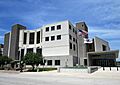
The Rock Island County Justice Center, where county government takes place.
See also
 In Spanish: Condado de Rock Island para niños
