Whiteside County, Illinois facts for kids
Quick facts for kids
Whiteside County
|
||
|---|---|---|

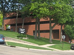
Whiteside County Courthouse, Morrison
|
||
|
||

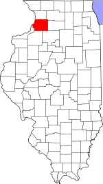
Location within the U.S. state of Illinois
|
||
 Illinois's location within the U.S. |
||
| Country | ||
| State | ||
| Founded | 1836 | |
| Named for | Samuel Whiteside | |
| Seat | Morrison | |
| Largest city | Sterling | |
| Area | ||
| • Total | 697 sq mi (1,810 km2) | |
| • Land | 684 sq mi (1,770 km2) | |
| • Water | 12 sq mi (30 km2) 1.8% | |
| Population
(2020)
|
||
| • Total | 55,691 | |
| • Estimate
(2023)
|
54,498 |
|
| • Density | 79.90/sq mi (30.850/km2) | |
| Time zone | UTC−6 (Central) | |
| • Summer (DST) | UTC−5 (CDT) | |
| Congressional district | 17th | |
Whiteside County is a county in the state of Illinois, USA. In 2020, about 55,691 people lived there. The main town, or county seat, is Morrison. The Mississippi River forms the western border of the county.
Whiteside County is part of a larger area around Sterling and Dixon. A famous person, U.S. President Ronald Reagan, was born in 1911 in Tampico, a small town in Whiteside County.
Contents
History of Whiteside County
Long ago, different groups of Native Americans lived in this area.
Whiteside County was officially created in 1836. It was formed from parts of Jo Daviess and Henry counties. The county was named after General Samuel Whiteside. He was an officer from Illinois who fought in the War of 1812 and the Black Hawk War.
The borders of Whiteside County have stayed the same since it was created in 1836.
Geography of Whiteside County
Whiteside County covers a total area of about 697 square miles (1,805 square kilometers). Most of this is land, about 684 square miles (1,772 square kilometers). The rest, about 12 square miles (31 square kilometers), is water.
Weather in Whiteside County
| Weather chart for Morrison, Illinois | |||||||||||||||||||||||||||||||||||||||||||||||
|---|---|---|---|---|---|---|---|---|---|---|---|---|---|---|---|---|---|---|---|---|---|---|---|---|---|---|---|---|---|---|---|---|---|---|---|---|---|---|---|---|---|---|---|---|---|---|---|
| J | F | M | A | M | J | J | A | S | O | N | D | ||||||||||||||||||||||||||||||||||||
|
1.5
29
10
|
1.5
34
15
|
2.8
47
27
|
3.7
60
37
|
4.4
72
48
|
4.6
82
58
|
3.7
85
62
|
4.7
83
59
|
2.9
76
51
|
2.8
64
39
|
2.9
47
28
|
2.1
34
16
|
||||||||||||||||||||||||||||||||||||
| temperatures in °F precipitation totals in inches source: The Weather Channel |
|||||||||||||||||||||||||||||||||||||||||||||||
|
Metric conversion
|
|||||||||||||||||||||||||||||||||||||||||||||||
In Morrison, the county seat, temperatures usually range from 10°F (-12°C) in January to 85°F (29°C) in July. The coldest temperature ever recorded was -30°F (-34°C) in February 1905. The hottest was 112°F (44°C) in July 1936.
The amount of rain and snow changes throughout the year. It can be as little as 1.51 inches (3.8 cm) in February. It can be as much as 4.69 inches (11.9 cm) in August.
Main Roads in Whiteside County
 Interstate 88
 U.S. Highway 30
 Illinois Route 2
 Illinois Route 40
 Illinois Route 78
 Illinois Route 84
 Illinois Route 110
 Illinois Route 136
 Illinois Route 172
Neighboring Counties
- Carroll County (north)
- Ogle County (northeast)
- Lee County (east)
- Bureau County (southeast)
- Henry County (south)
- Rock Island County (southwest)
- Clinton County, Iowa (west)
Protected Natural Areas
People of Whiteside County
| Historical population | |||
|---|---|---|---|
| Census | Pop. | %± | |
| 1840 | 2,514 | — | |
| 1850 | 5,361 | 113.2% | |
| 1860 | 18,737 | 249.5% | |
| 1870 | 27,503 | 46.8% | |
| 1880 | 30,885 | 12.3% | |
| 1890 | 30,854 | −0.1% | |
| 1900 | 34,710 | 12.5% | |
| 1910 | 34,507 | −0.6% | |
| 1920 | 36,174 | 4.8% | |
| 1930 | 39,019 | 7.9% | |
| 1940 | 43,338 | 11.1% | |
| 1950 | 49,336 | 13.8% | |
| 1960 | 59,887 | 21.4% | |
| 1970 | 62,877 | 5.0% | |
| 1980 | 65,970 | 4.9% | |
| 1990 | 60,186 | −8.8% | |
| 2000 | 60,653 | 0.8% | |
| 2010 | 58,498 | −3.6% | |
| 2020 | 55,691 | −4.8% | |
| 2023 (est.) | 54,498 | −6.8% | |
| U.S. Decennial Census 1790-1960 1900-1990 1990-2000 2010 |
|||
In 2010, there were 58,498 people living in Whiteside County. Most people (92.2%) were white. About 11% of the population was of Hispanic or Latino background.
Many families live in the county. About 30.4% of households had children under 18. The average age of people in the county was 41.8 years old.
The average income for a household was about $45,266. For a family, it was about $54,242. About 11.2% of all people in the county lived below the poverty line. This included 17.6% of those under 18.
Towns and Villages
Cities
- Fulton
- Morrison (county seat)
- Prophetstown
- Rock Falls
- Sterling
Villages
Other Communities
These are smaller places that are not officially cities or villages.
- Agnew
- Fenton
- Galt
- Hahnaman
- Oliver
- Round Grove
- Spring Hill
- Union Grove
- Unionville
- Yeoward Addition
Census-Designated Place
Townships
Whiteside County is divided into these local government areas called townships:
- Albany
- Clyde
- Coloma
- Erie
- Fenton
- Fulton
- Garden Plain
- Genesee
- Hahnaman
- Hopkins
- Hume
- Jordan
- Lyndon
- Montmorency
- Mount Pleasant
- Newton
- Portland
- Prophetstown
- Sterling
- Tampico
- Union Grove
- Ustick
Education in Whiteside County
Here are the school districts for students from kindergarten to 12th grade:
- Bureau Valley Community Unit School District 340
- Chadwick-Milledgeville Community Unit School District 399
- Erie Community Unit School District 1
- Morrison Community Unit School District 6
- Polo Community Unit School District 222
- Prophetstown-Lyndon-Tampico Community Unit School District 3
- River Bend Community Unit District 2
- Sterling Community Unit District 5
There is one high school district: Rock Falls Township High School District 301.
Here are the elementary school districts:
- East Coloma-Nelson Consolidated Elementary School District 20
- Montmorency Community Consolidated School District 145
- Rock Falls Elementary School District 13
See also
 In Spanish: Condado de Whiteside para niños
 | John T. Biggers |
 | Thomas Blackshear |
 | Mark Bradford |
 | Beverly Buchanan |


