Erie, Illinois facts for kids
Quick facts for kids
Erie
|
|
|---|---|

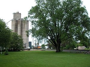
Grain elevator and the BNSF Railway in Erie.
|
|

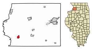
Location of Erie in Whiteside County, Illinois.
|
|

Location of Illinois in the United States
|
|
| Country | United States |
| State | Illinois |
| County | Whiteside |
| Area | |
| • Total | 1.39 sq mi (3.60 km2) |
| • Land | 1.38 sq mi (3.58 km2) |
| • Water | 0.01 sq mi (0.03 km2) |
| Population
(2020)
|
|
| • Total | 1,518 |
| • Density | 1,100.00/sq mi (424.57/km2) |
| Time zone | UTC-6 (CST) |
| • Summer (DST) | UTC-5 (CDT) |
| ZIP Code(s) |
61250
|
| Area code(s) | 309 |
| FIPS code | 17-24374 |
| GNIS ID | 2398840 |
Erie is a small village located in Whiteside County, Illinois, in the United States. In 2020, about 1,518 people lived there. Erie is special because of its unique "town triangle" layout.
History of Erie
Erie got its name from Erie County, New York.
Geography of Erie
Erie is located at 41°39′28″N 90°4′44″W / 41.65778°N 90.07889°W. This means it's in the northern part of Illinois.
The village covers a total area of about 1.45 square miles (3.75 square kilometers). Most of this area is land, about 1.44 square miles (3.73 square kilometers). A very small part, about 0.009 square miles (0.023 square kilometers), is water.
Population and People
| Historical population | |||
|---|---|---|---|
| Census | Pop. | %± | |
| 1880 | 537 | — | |
| 1890 | 535 | −0.4% | |
| 1900 | 768 | 43.6% | |
| 1910 | 804 | 4.7% | |
| 1920 | 957 | 19.0% | |
| 1930 | 888 | −7.2% | |
| 1940 | 1,052 | 18.5% | |
| 1950 | 1,180 | 12.2% | |
| 1960 | 1,215 | 3.0% | |
| 1970 | 1,566 | 28.9% | |
| 1980 | 1,725 | 10.2% | |
| 1990 | 1,572 | −8.9% | |
| 2000 | 1,589 | 1.1% | |
| 2010 | 1,602 | 0.8% | |
| 2020 | 1,518 | −5.2% | |
| U.S. Decennial Census | |||
In 2000, there were 1,589 people living in Erie. The village had 630 households and 466 families. The population density was about 1,133 people per square mile (438 people per square kilometer).
Most people in Erie were White (98.80%). A small number were African American, Native American, or from other backgrounds. About 0.88% of the population was Hispanic or Latino.
About 33.5% of households had children under 18 living with them. Most households (61.4%) were married couples living together. The average household had 2.52 people, and the average family had 2.98 people.
The population was spread out by age. About 26% were under 18 years old. About 17.3% were 65 years or older. The average age in the village was 39 years.
Education in Erie
The public schools in Erie are part of the Erie Community Unit School District 1.
See also
 In Spanish: Erie (Illinois) para niños
 | George Robert Carruthers |
 | Patricia Bath |
 | Jan Ernst Matzeliger |
 | Alexander Miles |

