National Register of Historic Places listings in Calhoun County, Illinois facts for kids
Have you ever wondered about really old places and buildings that tell stories about the past? In Calhoun County, Illinois, there are some special spots listed on the National Register of Historic Places. This list helps protect important places in the United States. It's like a hall of fame for historic buildings, sites, and objects.
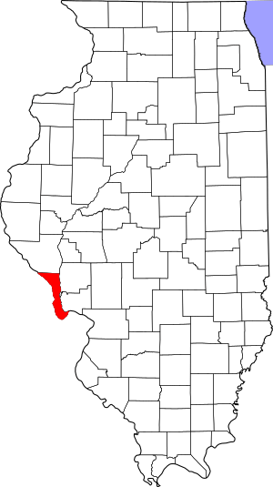
There are 7 amazing places in Calhoun County that are on this list. One of them is even a National Historic Landmark, which means it's super important to the whole country! Let's explore these cool historic treasures.
Discovering Calhoun County's Historic Places
Brussels Historic District
The Brussels Historic District is a special area in the town of Brussels, Illinois. It's mostly found along Main and Community Streets. This district was added to the National Register in 1998. It's important because it shows what a small American town looked like a long time ago. Walking through this district is like taking a step back in time! You can see many old buildings that have been kept just as they were.
Golden Eagle-Toppmeyer Site
The Golden Eagle-Toppmeyer Site is an archaeological site near Brussels, Illinois. It's located on the western side of Quarry Road. This site was recognized in 1979. Archaeological sites are places where scientists study human history by digging up old tools, pottery, and other things people left behind. This site helps us learn about the ancient people who lived in Calhoun County many years ago.
The GOLDENROD Showboat
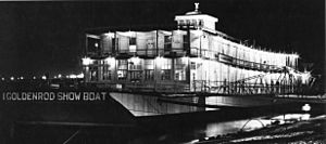
The GOLDENROD is a very special boat located on the Kampsville riverfront in Kampsville, Illinois. It was added to the National Register in 1967. What makes the GOLDENROD so unique? It's a showboat! Imagine a theater that floats on the water. Showboats used to travel along rivers, bringing plays, music, and entertainment to towns that didn't have theaters. The GOLDENROD is a rare example of these floating stages. It's so important that it's also a National Historic Landmark!
Kamp Mound Site
The Kamp Mound Site is another important archaeological site. You can find it along Illinois Route 100, north of Kampsville, Illinois. This site was listed in 1978. It likely contains ancient mounds built by Native American people. These mounds were often used for burials or for special ceremonies. Studying them helps us understand the cultures and traditions of the first people who lived in this area.
Kamp Store
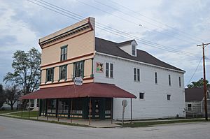
The Kamp Store is a historic building in Kampsville, Illinois. It's located at the corner of Oak and Broadway streets. This old store was added to the National Register in 1994. For many years, general stores like this were the heart of small towns. People would come here to buy everything from food to tools. The Kamp Store shows us what daily life was like in Kampsville in the past.
Michael Klunk Farmstead
The Michael Klunk Farmstead is a historic farm located on Crater Creek Road, south of Michael, Illinois. It was recognized in 1982. A farmstead includes the farmhouse, barns, and other buildings that make up a working farm. This farmstead gives us a glimpse into the history of farming in Calhoun County. It shows how families lived and worked on the land many years ago.
Schudel No. 2 Site
The Schudel No. 2 Site is another archaeological site in Calhoun County. It's located at 200N, west of Mississippi River Road, near Hamburg, Illinois. This site was added to the National Register in 1979. Like the other archaeological sites, it helps experts learn about the ancient history of the region. It provides clues about the early inhabitants and their way of life along the Mississippi River.


