
National Register of Historic Places listings in Camden County, Georgia facts for kids
Camden County, Georgia, is home to many special places listed on the National Register of Historic Places. This is a list of important buildings and areas in the county that have been recognized for their history. The National Register helps protect these places so future generations can learn from them.
Discovering Camden County's Historic Treasures
Camden County has many cool spots that tell stories from the past. Let's explore some of these historic places!
Camden County Courthouse
The Camden County Courthouse in Woodbine is a grand building. It was listed on the National Register in 1980. This courthouse has been a central part of the community for many years. It's where important decisions for the county are made.
,_Woodbine,_GA,_US.jpg)
Historic Places on Cumberland Island
Cumberland Island is a large, mostly wild island off the coast of Georgia. It's famous for its beautiful nature and rich history. Many historic places on the island are protected.
- Duck House: This unique house on Cumberland Island was added to the list in 1984.
- Dungeness Historic District: This area on Cumberland Island is a historic district. It was listed in 1984. It includes the ruins of a large mansion called Dungeness.
- Greyfield: Also on Cumberland Island, Greyfield was listed in 2003. It's a beautiful mansion that still stands today.
- High Point-Half Moon Bluff Historic District: This historic area is located northeast of St. Marys on Cumberland Island. It was recognized in 1978.
- Main Road: Even a road on Cumberland Island is historic! The Main Road was listed in 1984. It's an important path that connects different parts of the island.
- Plum Orchard Historic District: This historic district on Cumberland Island was listed in 1984. It includes the Plum Orchard mansion, another beautiful old home.
- Stafford Plantation: Also on Cumberland Island, Stafford Plantation was listed in 1984. The only parts of the old plantation that remain are the chimneys and ruins of slave cabins. These ruins remind us of a difficult time in history.


Kingsland Commercial Historic District
The Kingsland Commercial Historic District in Kingsland was listed in 1994. This district includes the area around South Lee Street. It shows what the town's business center looked like in the past.

Little Cumberland Island Lighthouse
The Little Cumberland Island Lighthouse is found at the north end of Little Cumberland Island. This lighthouse was added to the National Register in 1989. Lighthouses are important because they helped guide ships safely to shore.

John Houstoun McIntosh Sugarhouse
The John Houstoun McIntosh Sugarhouse is located near St. Marys. It was listed in 1992. This sugarhouse is a reminder of the sugar cane industry that once thrived in this area.

Orange Hall
Orange Hall is a historic home in St. Marys. It was recognized in 1973. This beautiful building stands at 311 Osborne Street.

St. Marys Historic District
The St. Marys Historic District covers a large part of the city of St. Marys. It was listed in 1976. This district includes many old buildings and streets that show the town's long history.

Woodbine Historic District
The Woodbine Historic District was listed in 1999. It includes the area where Bedell Avenue meets 3rd and 4th Streets. This district helps preserve the historic look and feel of downtown Woodbine.

Images for kids
-
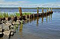
Crooked River State Park, possibly near the Crooked River Site.

