National Register of Historic Places listings in Clay County, Mississippi facts for kids
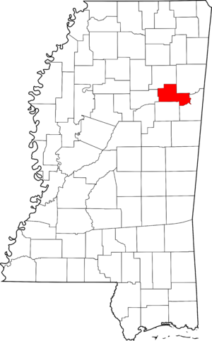
This page lists special places in Clay County, Mississippi, United States, that are on the National Register of Historic Places. Think of it like a national scrapbook of important buildings, areas, and sites that tell a story about America's past. These places are officially recognized because they are important to history, architecture, archaeology, engineering, or culture.
There are 28 places in Clay County on this list. One of them is even more special and is called a National Historic Landmark. This means it's super important to the whole country's history! One other place used to be on the list but has been removed.
Contents
- Historic Places in Clay County
- Homes with History
- Historic Districts and Communities
- Brandtown Gin Historic District
- Commerce Street Historic District
- Court Street Historic District
- East Main Street Historic District
- Montpelier Historic District
- Pheba Historic District
- South Division Street Historic District
- Town of Palo Alto
- West Point Central City Historic District
- West Point School Historic District
- West Point Unified Historic District
- Important Buildings and Sites
- Former Listing
Historic Places in Clay County
This section tells you about the cool historic places you can find in Clay County. Each one has a unique story!
Homes with History
Many old houses in Clay County are on the National Register because of their special architecture or the important people who lived there.
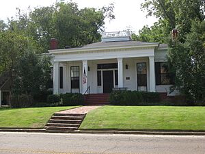
Dewitt Anderson House
The Dewitt Anderson House is located at 104 West Broad Street in West Point, Mississippi. It was added to the list in 1990. Imagine living in a house that's been around for so long!
Charles R. Jordan House
This house is on Tibbee-Columbus Road, south of New Hope Church, near West Point, Mississippi. It was recognized in 1991.
Moses Jordan House
Another historic home, the Moses Jordan House, is at 940 East Broad Street in West Point, Mississippi. It joined the list in 1990.
Nathan Mathews House and Mathews Cotton Gin
This special spot includes both a house and an old cotton gin. It's found on Mathews Gin Road, north of Union Staff Church, near West Point, Mississippi. It was listed in 1991. A cotton gin is a machine that quickly separates cotton fibers from their seeds, which was very important for farming in the past.
Powell-Vail House
The Powell-Vail House is on the east side of Vail Road, about 1.2 miles north of Mississippi Highway 50, near Pheba, Mississippi. It was added to the Register in 1991.
Turnage House
The Turnage House is on Turnage Road, northeast of Palestine Church, near Montpelier, Mississippi. This house also became a historic place in 1991.
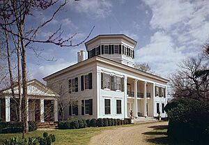
Waverley Mansion
Waverley is a huge, beautiful mansion located about 10 miles east of West Point, Mississippi. It's so important that it's a National Historic Landmark! It was recognized in 1973. This means it's one of the most significant historic places in the entire country.
Historic Districts and Communities
Some whole areas or groups of buildings are considered historic districts. This means they have many old buildings that together tell a story about how a town grew and looked in the past.
Brandtown Gin Historic District
This district is located on Mississippi Highway 47 at Brandtown, west of Prairie, Mississippi. It was listed in 1991 and likely shows how cotton farming and processing shaped the area.
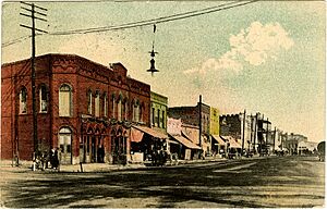
Commerce Street Historic District
This district in West Point, Mississippi, includes buildings from 508 to 731 Commerce Street. It was added in 1990. It's a great example of an old business street.
Court Street Historic District
Also in West Point, Mississippi, this district covers Court Street between Travis and East Broad Streets. It became historic in 1982.
East Main Street Historic District
You can find this district in West Point, Mississippi, along East Main Street from 510 to 1030. It was listed in 1990.
Montpelier Historic District
This district is at the junction of Mississippi Highway 46 and Mississippi Highway 389 in Montpelier, Mississippi. It was recognized in 1991.
Pheba Historic District
The Pheba Historic District is on Pheba Street No. 2, just west of Mississippi Highway 389, in Pheba, Mississippi. It was added in 1991.
South Division Street Historic District
This district in West Point, Mississippi, runs from 447 to 646 South Division Street. It was listed in 1990.
Town of Palo Alto
The entire town of Palo Alto, Mississippi, located on Mississippi Highway 47 northwest of West Point, is a historic place. It was recognized in 1987.
West Point Central City Historic District
This district in West Point, Mississippi, is along Mississippi Highway 50. It was listed in 1982.
West Point School Historic District
This area in West Point, Mississippi, is roughly bordered by East Westbrook, Calhoun, Travis, and East Streets. It became a historic district in 1990.
West Point Unified Historic District
This large district in West Point, Mississippi, covers a big part of the city. It was first listed in 2009 and later expanded in 2012 to include more buildings on West Broad Street.
Important Buildings and Sites
Beyond homes and districts, other types of places are important enough to be on the National Register.
Clay County Agricultural High School
This old school is located between Pheba Streets Nos. 7 and 8, south of Mississippi Highway 50, in Pheba, Mississippi. It was listed in 1991. Agricultural high schools were important for teaching farming skills.
Colbert and Barton Townsites
These are the sites of old towns located on the western bank of the Tombigbee River, northeast of West Point, Mississippi. They were recognized in 1977. These sites tell us about early settlements.
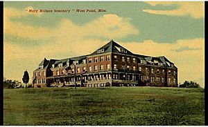
Mary Holmes Junior College Historic District
This historic district is located on Mississippi Highway 50, west of its junction with U.S. Highway 45, in West Point, Mississippi. It was listed in 1991. This college played an important role in education.
Tibbee Bridge
This bridge spans Tibbee Creek on Old Tibbee Road, near West Point, Mississippi. It was listed in 1988. Old bridges are often recognized for their engineering and how they helped people travel.
Tibbee School
The Tibbee School is on Tibbee-Columbus Road, at Tibbee, near West Point, Mississippi. It was added to the Register in 1991.
Una Consolidated School
This school is on Una-Prairie Road, east of Pleasant Grove Church, near Prairie, Mississippi. It was listed in 1991.
Waide Archeological Site
This site near Palo Alto, Mississippi, is an "Address Restricted" location, meaning its exact spot isn't shared to protect it. It was listed in 1999 and is important for understanding ancient cultures.
Waverly Bridge
This bridge crosses the Tombigbee River on the Columbus and Greenville Railway line, near Waverly, Mississippi. It was listed in 1989 and also extends into Lowndes County.
Former Listing
Sometimes, a place is removed from the National Register. This usually happens if the building is destroyed or changed so much that it no longer has its historic importance.
Robert L. Cooper House
The Robert L. Cooper House was located on Mhoon Valley Road, west of West Point, Mississippi. It was listed in 1991 but was removed from the Register in 2003.


