National Register of Historic Places listings in Currituck County, North Carolina facts for kids
This list includes properties and districts listed on the National Register of Historic Places in Currituck County, North Carolina. Click the "Map of all coordinates" link to the right to view an online map of all properties and districts with latitude and longitude coordinates in the table below.
Current listings
| Name on the Register | Image | Date listed | Location | City or town | Description | |
|---|---|---|---|---|---|---|
| 1 | Baum Site |
(#80002818) |
Address Restricted |
Poplar Branch | ||
| 2 | Coinjock Colored School |
(#12001156) |
4358 Caratoke Hwy. 36°21′46″N 75°58′00″W / 36.362779°N 75.966772°W |
Coinjock vicinity | ||
| 3 | Culong |
(#80002819) |
South of Shawboro on SR 1147 36°21′58″N 76°04′29″W / 36.366111°N 76.074722°W |
Shawboro | ||
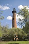
| 4 | Currituck Beach Lighthouse |
(#73001333) |
Northern North Carolina Outer Banks; also NC 12, north of NC 1185 36°22′36″N 75°49′50″W / 36.376658°N 75.830636°W |
Corolla | Second location represents a boundary increase of January 12, 2000, the Currituck Beach Lighthouse Complex | |
| 5 | Currituck County Courthouse and Jail |
(#79001697) |
SR 1242 36°27′00″N 76°01′01″W / 36.45°N 76.016944°W |
Currituck | ||
| 6 | Currituck Shooting Club |
(#80002816) |
South of Corolla 36°17′08″N 75°48′13″W / 36.285497°N 75.803617°W |
Corolla | Oldest active shooting club in the United States; burned to the ground March 20, 2003 | |
| 7 | Flyway Club |
(#15000238) |
221 Marsh Causeway Rd. 36°32′31″N 76°00′17″W / 36.5419°N 76.0046°W |
Knotts Island | ||
| 8 | Grandy School |
(#98001210) |
Junction of US 158 and Poplar Branch Rd. 36°14′29″N 75°52′41″W / 36.241483°N 75.878172°W |
Grandy | ||
| 9 | Jarvisburg Colored School |
(#09001104) |
7301 NC 158 36°11′12″N 75°51′52″W / 36.186546°N 75.864374°W |
Jarvisburg | Historic Jarvisburg Colored School web site | |
| 10 | Shaw House |
(#80002820) |
NC 34 and SR 1203 36°24′25″N 76°05′34″W / 36.406814°N 76.0927°W |
Shawboro | ||
| 11 | Twin Houses |
(#72000959) |
On NC 168 at the junction of SR 1203 and 1147 36°24′19″N 76°05′38″W / 36.405269°N 76.093936°W |
Shawboro | ||
| 12 | Whalehead Club |
(#80002817) |
Currituck Banks 36°22′27″N 75°50′01″W / 36.374167°N 75.833611°W |
Corolla |

All content from Kiddle encyclopedia articles (including the article images and facts) can be freely used under Attribution-ShareAlike license, unless stated otherwise. Cite this article:
National Register of Historic Places listings in Currituck County, North Carolina Facts for Kids. Kiddle Encyclopedia.


