National Register of Historic Places listings in Daviess County, Kentucky facts for kids
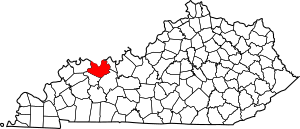
Welcome to Daviess County, Kentucky! Did you know that many special places here are protected because of their history? This article is about the National Register of Historic Places listings in Daviess County, Kentucky.
The National Register of Historic Places is like a special list kept by the United States government. It helps protect buildings, sites, and objects that are important to American history, architecture, archaeology, engineering, or culture. When a place is on this list, it means it's recognized as a valuable part of our past. It also helps make sure these places are cared for and preserved for future generations, like you!
In Daviess County, there are 38 different places and areas that are on this important list. These include old houses, unique buildings, and even archaeological sites where people lived long ago. One place was on the list but has since been removed. Let's explore some of these amazing historic spots!
Contents
Discovering Daviess County's Historic Treasures
What is the National Register of Historic Places?
The National Register of Historic Places is the official list of the nation's historic places. It's managed by the National Park Service. Being on the list means a place is recognized for its importance. It also means it might get special attention or funding to help keep it safe and sound. These places tell stories about how people lived, worked, and built communities in the past.
Exploring Current Historic Listings
Here is a list of the places in Daviess County that are currently on the National Register of Historic Places. Each entry tells you the name of the place, its address, and when it was added to the list. Many of these are in Owensboro, the largest city in Daviess County.
| Name on the Register | Image | Date listed | Location | City or town | Description | |
|---|---|---|---|---|---|---|
| 1 | Archeological Site 15 Da 39 |
(#78001310) |
Off the Ohio River shoreline northeast of Owensboro 37°51′30″N 87°01′54″W / 37.858333°N 87.031667°W |
Maceo | This site near the Ohio River holds clues about ancient people who lived here. | |
| 2 | D.D. Bogard House |
(#80001503) |
303 E. 4th St. 37°46′23″N 87°06′30″W / 37.773056°N 87.108333°W |
Owensboro | A historic home in Owensboro. | |
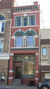
| 3 | Breidenbach Building |
(#86000660) |
208 W. 3rd St. 37°46′25″N 87°06′46″W / 37.773611°N 87.112667°W |
Owensboro | An important building in downtown Owensboro. | |
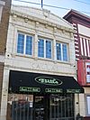
| 4 | Callas Sweet Shop |
(#86000661) |
420 Frederica Ave. 37°46′19″N 87°06′49″W / 37.771944°N 87.113611°W |
Owensboro | This building once housed a popular sweet shop. | |
| 5 | Carnegie Free Public Library (DAOB 41) |
(#86002234) |
901 Frederica Ave. 37°46′02″N 87°06′45″W / 37.767222°N 87.112500°W |
Owensboro | A beautiful old library, built with money from Andrew Carnegie. | |
| 6 | Le Vega Clements House |
(#86000663) |
1500 N. Highland Ave. 37°46′27″N 87°05′31″W / 37.774167°N 87.091944°W |
Owensboro | Another historic house in Owensboro. | |
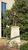
| 7 | Confederate Monument in Owensboro |
(#97000708) |
1 block north of the junction of U.S. Routes 60 and 431 37°46′26″N 87°06′48″W / 37.773889°N 87.113222°W |
Owensboro | A monument with historical significance. | |
| 8 | Howell J. Davis House |
(#90001168) |
3301 Veach Rd. 37°44′17″N 87°06′08″W / 37.738056°N 87.102222°W |
Owensboro | This house is recognized for its historical value. | |
| 9 | Doctors' Row Historic District |
(#86000662) |
W. 4th St. between Frederica and Saint Ann Sts. 37°46′22″N 87°06′44″W / 37.772778°N 87.112222°W |
Owensboro | An area with several historic buildings, once home to many doctors' offices. | |
| 10 | Federal Building and US Post Office-Owensboro |
(#89000295) |
5th and Frederica 37°46′18″N 87°06′46″W / 37.771667°N 87.112778°W |
Owensboro | This building served as a post office and federal office. | |
| 11 | Gillim House |
(#86000664) |
517 Frederica St. 37°46′15″N 87°06′46″W / 37.770833°N 87.112778°W |
Owensboro | A historic residence on Frederica Street. | |
| 12 | Felix Grimes House |
(#75000746) |
1301 Leitchfield Rd. 37°45′55″N 87°05′22″W / 37.765278°N 87.089444°W |
Owensboro | This house has been recognized for its historical importance. | |
| 13 | Haphazard |
(#75000747) |
Pleasant Valley Rd. 37°46′56″N 87°04′24″W / 37.782222°N 87.073333°W |
Owensboro | A historic property located near Owensboro. | |
| 14 | Kentucky Buggy Company Building |
(#15000649) |
301 E. 9th St. 37°46′04″N 87°06′28″W / 37.7677°N 87.1079°W |
Owensboro | This building was once home to a company that made buggies. | |
| 15 | Thomas Krahwinkel House |
(#13000556) |
10501 U.S. Route 60 37°50′37″N 87°18′39″W / 37.843611°N 87.310833°W |
Owensboro | A historic house along U.S. Route 60. | |
| 16 | McKay-Thornberry House |
(#84001408) |
S. Hampton Rd. 37°45′42″N 86°58′00″W / 37.761667°N 86.966667°W |
Owensboro | This house is listed for its historical significance. | |
| 17 | Medley House |
(#80001504) |
1220 Frederica St. 37°45′52″N 87°06′47″W / 37.764444°N 87.113056°W |
Owensboro | Another historic home on Frederica Street. | |
| 18 | George Mischel and Sons Building |
(#86000756) |
412 E. 2nd St. 37°46′30″N 87°06′25″W / 37.775000°N 87.107083°W |
Owensboro | A building recognized for its architectural or historical value. | |
| 19 | Monarch-Payne House |
(#86000757) |
1432 E. 4th St. 37°46′26″N 87°05′34″W / 37.773750°N 87.092778°W |
Owensboro | This house is part of Daviess County's rich history. | |
| 20 | J.Z. Moore Historic District |
(#86000659) |
Roughly bounded by W. and E. 12th, Daviess, E. and W. 14th, and Saint Ann Sts. 37°45′51″N 87°06′37″W / 37.764167°N 87.110278°W |
Owensboro | A historic district with many important buildings. | |
| 21 | Moorman House |
(#92000140) |
2731 W. 2nd St. 37°46′29″N 87°08′40″W / 37.774722°N 87.144444°W |
Owensboro | A historic house located near Owensboro. | |
| 22 | Mount St. Joseph Academy |
(#79000970) |
Kentucky Route 56 37°41′35″N 87°19′29″W / 37.693056°N 87.324722°W |
Saint Joseph | An academy with a long history in Saint Joseph. | |
| 23 | Odd Fellows Building |
(#86000758) |
200-204 W. 3rd St. 37°46′25″N 87°06′45″W / 37.773611°N 87.112500°W |
Owensboro | This building was once home to the Odd Fellows organization. | |
| 24 | Owensboro Armory |
(#02000919) |
1501 Parrish Ave. 37°45′40″N 87°07′34″W / 37.761111°N 87.126111°W |
Owensboro | This building was demolished in 2012, but it was once a significant armory. | |
| 25 | Owensboro Historic Commercial District |
(#83002626) |
2nd St. between St. Ann and Lewis Sts. 37°46′29″N 87°06′38″W / 37.774722°N 87.110556°W |
Owensboro | A district with many old commercial buildings. | |
| 26 | Owensboro Historic Downtown Commercial District |
(#04001251) |
Roughly between Frederica, Clay, 2nd, and 4th Sts. 37°46′27″N 87°06′38″W / 37.774167°N 87.110556°W |
Owensboro | This larger district covers much of downtown Owensboro. | |
| 27 | Phillip's Court District |
(#86000658) |
Roughly bounded by Technical High School, Cruze Dr., W. 18th St., and Frederica Ave. 37°45′39″N 87°06′40″W / 37.760833°N 87.111111°W |
Owensboro | A historic neighborhood known as Phillip's Court. | |
| 28 | Camden Riley House |
(#86000760) |
112 E. 4th St. 37°46′21″N 87°06′51″W / 37.772500°N 87.114167°W |
Owensboro | This house is a historic landmark in Owensboro. | |
| 29 | St. Joseph Church |
(#83003651) |
4th and Clay Sts. 37°46′22″N 87°06′22″W / 37.772778°N 87.106111°W |
Owensboro | A beautiful and historic church in Owensboro. | |
| 30 | Maj. Hampden Smith House |
(#76000865) |
909 Frederica St. 37°46′01″N 87°06′44″W / 37.767056°N 87.112222°W |
Owensboro | The former home of Major Hampden Smith. | |
| 31 | James J. Sweeney House |
(#80001505) |
121 E. 5th St. 37°46′19″N 87°06′36″W / 37.771944°N 87.110000°W |
Owensboro | Another historic house in Owensboro. | |
| 32 | Temple Adath Israel |
(#86000761) |
429 Daviess St. 37°46′19″N 87°06′34″W / 37.771833°N 87.109444°W |
Owensboro | A historic temple building. | |
| 33 | Thompson and Powell Martyrs Monument |
(#97000707) |
Junction of Kentucky Routes 56 and 500 37°41′44″N 87°19′30″W / 37.695556°N 87.325111°W |
Saint Joseph | A monument dedicated to historical figures. | |
| 34 | Trinity Episcopal Church |
(#72000530) |
403 W. 5th St. 37°46′18″N 87°06′53″W / 37.771667°N 87.114722°W |
Owensboro | A historic church building. | |
| 35 | Union Station |
(#79000969) |
1039 Frederica St. 37°45′57″N 87°06′43″W / 37.765833°N 87.111944°W |
Owensboro | This building was once a busy train station. | |
| 36 | Willow Hill |
(#82004621) |
Jones Rd. 37°47′01″N 87°00′47″W / 37.783611°N 87.013056°W |
Owensboro | A historic property known as Willow Hill. | |
| 37 | Yewell House |
(#86000762) |
630 Clay St. 37°46′12″N 87°06′23″W / 37.770000°N 87.106389°W |
Owensboro | The Yewell House is another historic home in Owensboro. |
Former Listings: Places No Longer on the List
Sometimes, a place might be removed from the National Register. This can happen if it is destroyed, moved, or if its historical importance changes. Here is one place that was once on the list in Daviess County.
| Name on the Register | Image | Date listed | Date removed | Location | City or town | Summary | |
|---|---|---|---|---|---|---|---|
| 1 | Ames Building |
(#86000657) |
|
401 W. Third St. |
Owensboro | The Ames Building was once a historic site but was removed from the list in 1988. |


