National Register of Historic Places listings in Davis County, Iowa facts for kids
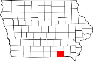
This article is about special places in Davis County, Iowa that are listed on the National Register of Historic Places. This register is like a national list of important buildings, sites, and objects that are worth saving because of their history or special design. When a place is on this list, it means it's recognized as a significant part of American history and culture.
In Davis County, there are 12 places on this list. One of them is even more special and is called a National Historic Landmark. Let's explore some of these cool historic spots!
Historic Places in Davis County
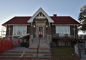
Bloomfield Public Library
The Bloomfield Public Library is a beautiful building located at 107 N. Columbia in Bloomfield, Iowa. It was added to the National Register of Historic Places on October 13, 2015. Libraries are important community centers, and this one has a rich history.
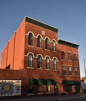
Bloomfield Square
Bloomfield Square is a historic area in the heart of Bloomfield, Iowa. It includes the streets Madison, Jefferson, Franklin, and Washington. This square was listed on the National Register on November 7, 1976. Town squares often served as central gathering places and markets in early American towns.
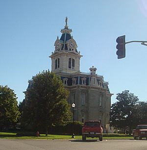
Davis County Courthouse
The Davis County Courthouse is a very important building in Bloomfield, Iowa, located right on the Bloomfield Town Square. It was added to the National Register on May 3, 1974. Courthouses are usually grand buildings where local government and justice take place.
William Findley House
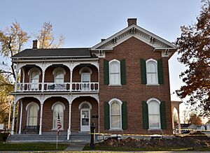
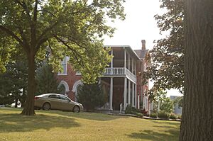
The William Findley House is a historic home at 302 E. Franklin Street in Bloomfield, Iowa. It was listed on the National Register on June 9, 1978. Historic homes like this one tell us a lot about how people lived in the past.
"Lockkeeper's" House
The "Lockkeeper's" House is found on Whitefish Trail near Eldon, Iowa. It was added to the National Register on October 14, 2009. A lockkeeper's house would have been home to someone who managed a canal lock, which helps boats move between different water levels. This suggests a history of waterways in the area.
Stringtown House
The Stringtown House is located east of Centerville, right off Iowa Highway 2. It was listed on the National Register on April 16, 1974. Old houses like this often have unique stories and architectural styles from their time.
Trimble-Parker Historic Farmstead District
The Trimble-Parker Historic Farmstead District is a historic farm located at 23981 240th Street near Bloomfield, Iowa. It was recognized on the National Register on March 21, 2003. Historic farmsteads show us how farming communities were set up and how people lived and worked on farms long ago.
Troy Academy
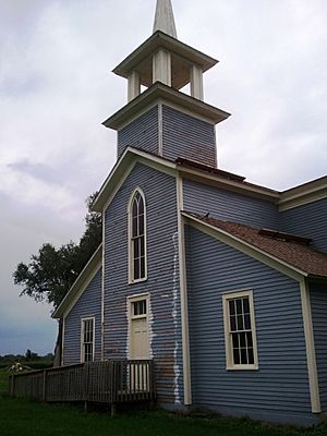
The Troy Academy is located off Iowa Highway 2 in Troy, Iowa. It was added to the National Register on June 23, 1976. Academies were often early schools or places of learning, playing a big role in educating people in the past.
James B. Weaver House
The James B. Weaver House is a very special place in Bloomfield, Iowa, located on Weaver Park Road (near U.S. Route 63). It was listed on the National Register on May 15, 1975, and is also a National Historic Landmark. This means it's one of the most important historic places in the entire country! James B. Weaver was a famous politician from Iowa.
West Grove United Methodist Church
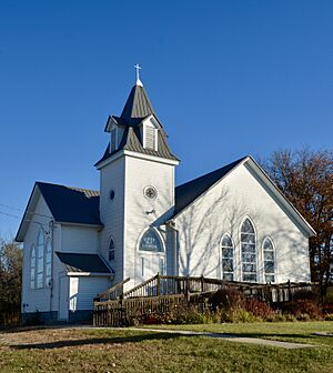
The West Grove United Methodist Church is located at 21944 Echo Avenue in West Grove, Iowa. It was added to the National Register on May 26, 2004. Churches are often central to communities and hold a lot of local history.
Asa Wilson House
The Asa Wilson House is a historic home at 207 S. Washington in Bloomfield, Iowa. It was listed on the National Register on December 10, 1982. This house is another example of the historic architecture found in Davis County.
Henry Wishard House
The Henry Wishard House is located at 406 W. Jefferson Street in Bloomfield, Iowa. It was added to the National Register on December 15, 2004. Like other historic homes, it helps us understand the past of the area.
Former Listings
Sometimes, a historic place might be removed from the National Register. This can happen if the building is destroyed, moved, or changed so much that it no longer has its historic importance. Here are a few places that were once on the list for Davis County:
- Clay Avenue Bridge: This bridge was near Drakesville, Iowa. It was listed in 1998 but removed in 2002.
- Russell Octagon House: This unique eight-sided house was southwest of Bloomfield, Iowa. It was listed in 1976 but removed in 1998.
- Tarrence Round Barn: This round barn was near Bloomfield, Iowa. It was listed in 1986 but removed in 1998.
Images for kids


