National Register of Historic Places listings in Del Norte County, California facts for kids
Have you ever wondered about the special places in your community that tell a story about the past? In Del Norte County, California, there are many such places! These important spots are listed on the National Register of Historic Places. This is like a special list kept by the United States government. It helps protect buildings, sites, and objects that are important to history, architecture, archaeology, engineering, or culture.
When a place is on this list, it means it's recognized as a valuable part of our country's heritage. It also helps preserve these sites for future generations to learn from and enjoy. In Del Norte County, there are 14 amazing places on this list, each with its own unique story. Let's explore some of them!
Contents
Historic Treasures of Del Norte County
Shipwrecks and Lighthouses
The Brother Jonathan Shipwreck Site
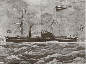
Imagine a ship that sank long ago, now resting deep underwater. The Brother Jonathan was a steamship that sank in 1865. It was carrying many people and a lot of gold. This shipwreck site, located about 4.5 miles west of Crescent City, California's Point St. George, is now a protected historic place. It reminds us of the dangers of sea travel in the past.
Crescent City Lighthouse (Battery Point Light)
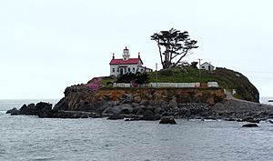
Standing proudly on Battery Point Island in Crescent City, California, the Crescent City Lighthouse is also known as Battery Point Light. This beautiful lighthouse was built in 1856 and has guided ships safely for many years. It's a classic example of a lighthouse and a popular spot to visit today.
St. George Reef Light Station
This lighthouse is truly unique! The St. George Reef Light Station is located on a small rock called Northwest Seal Rock, about 6 miles off the coast from Point St. George near Crescent City, California. Building this lighthouse was a huge challenge because of its remote and stormy location. It's a symbol of human determination and engineering.
Ancient Village Sites and Cultural Landscapes
Endert's Beach Archeological Sites
Near Crescent City, California, Endert's Beach holds secrets from the past. These are archaeological sites, meaning places where scientists have found evidence of ancient human life. These sites help us understand how people lived here thousands of years ago.
Mus-yeh-sait-neh Village and Cultural Landscape Property
This important site near Gasquet, California is a historic Native American village and its surrounding cultural landscape. It's a place that holds deep meaning and history for the local indigenous communities, showing how they lived and connected with the land.
O'Men Village Site
Another significant Native American village site is the O'Men Village Site, located near Klamath, California. Like Mus-yeh-sait-neh, this site provides valuable insights into the rich history and culture of the Native American people who lived in this region.
Old Requa
Old Requa is a historic site located within the Redwood National and State Parks. It represents an old settlement, possibly a Native American village or an early European settlement. It's a reminder of the different communities that have called this area home over time.
Point St. George Site
The Point St. George Site near Crescent City, California is another archaeological treasure. It's a place where researchers can learn about the ancient history of the area, including the lives of the earliest inhabitants.
Yontocket Historic District
Near Fort Dick, California, the Yontocket Historic District is a very important cultural site. It's recognized for its historical significance, especially to the Tolowa Dee-ni' Nation, as a traditional village and ceremonial site.
Historic Buildings and Infrastructure
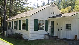
Gasquet Ranger Station Historic District
The Gasquet Ranger Station Historic District, located at 10600 CA 199 in Gasquet, California, is a collection of buildings important to the history of forest management. Ranger stations like this played a key role in protecting our forests and managing natural resources.
Osgood Ditch
The Osgood Ditch is a historic water channel found in the Siskiyou National Forest. This ditch was built a long time ago to move water for mining operations, showing how people used the land's resources during the gold rush era. Parts of it even extend into Oregon!
Radar Station B-71
Located west of Klamath, California, Radar Station B-71 is a historic military site. This radar station played a role in national defense, likely during a time of war, by tracking aircraft or ships. It's a piece of military history preserved in Del Norte County.
Redwood Highway
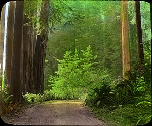
A section of the famous U.S. Route 101, known as the Redwood Highway, is also on the National Register. This part of the highway goes through the magnificent Redwood National and State Parks. It's not just a road; it's a historic route that connects people to the incredible redwood forests.
Upper Ditch
Similar to the Osgood Ditch, the Upper Ditch is another historic water channel in the Siskiyou National Forest. Built in 1854, this ditch was used to supply water to hydraulic mines, which were a common way to extract gold back then. It was very profitable for its owners and operated until 1942. This ditch shows the history of mining and how people engineered solutions to get water to their operations. It also extends into Oregon.
These 14 sites in Del Norte County are more than just old places; they are windows into the past, helping us understand the natural world, the people who lived here, and the events that shaped this beautiful part of California.


