National Register of Historic Places listings in Deuel County, South Dakota facts for kids
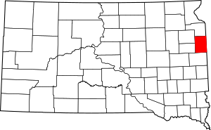
This is a list of the National Register of Historic Places listings in Deuel County, South Dakota.
This is intended to be a complete list of the properties and districts on the National Register of Historic Places in Deuel County, South Dakota, United States. The locations of National Register properties and districts for which the latitude and longitude coordinates are included below, may be seen in a map.
There are 10 properties and districts listed on the National Register in the county.
Current listings
| Name on the Register | Image | Date listed | Location | City or town | Description | |
|---|---|---|---|---|---|---|
| 1 | Deuel County Courthouse and Jail |
(#76001730) |
Highway 22 44°45′17″N 96°41′25″W / 44.754722°N 96.690278°W |
Clear Lake | ||
| 2 | East Highland Lutheran Church |
(#00000120) |
Approximately 6 miles northeast of Brandt 44°40′29″N 96°31′31″W / 44.674722°N 96.525278°W |
Brandt | ||
| 3 | First National Bank Building |
(#77001242) |
Off Highway 22 44°47′34″N 96°27′24″W / 44.792778°N 96.456667°W |
Gary | ||
| 4 | Herrick Barn |
(#05000628) |
0.5 miles northwest of the junction of County Road 310 and Highway 101 44°47′43″N 96°28′01″W / 44.795278°N 96.466944°W |
Gary | ||
| 5 | Hoffman Barn |
(#05001188) |
16937 482 Ave. 44°55′47″N 96°33′31″W / 44.929722°N 96.558611°W |
Revillo | ||
| 6 | Kliegle Garage |
(#99001213) |
Lots 1 and 2 of the original townsite of Goodwin 44°52′41″N 96°51′02″W / 44.878056°N 96.850556°W |
Goodwin | ||
| 7 | Odd Fellows Building |
(#76001731) |
Main St. 44°47′34″N 96°27′24″W / 44.792778°N 96.456667°W |
Gary | ||
| 8 | Old Cochrane Road Bridge |
(#93001268) |
Abandoned local road over the inlet to Lake Cochrane 44°42′03″N 96°29′15″W / 44.700833°N 96.4875°W |
Brandt | ||
| 9 | South Dakota Dept. of Transportation Bridge No. 20-153-210 |
(#93001286) |
Local road over Cobb Creek 44°40′27″N 96°34′28″W / 44.674167°N 96.574444°W |
Brandt | ||
| 10 | South Dakota School for the Blind |
(#88000570) |
Coteau and 3rd Sts. 44°47′46″N 96°27′18″W / 44.796111°N 96.455°W |
Gary |

All content from Kiddle encyclopedia articles (including the article images and facts) can be freely used under Attribution-ShareAlike license, unless stated otherwise. Cite this article:
National Register of Historic Places listings in Deuel County, South Dakota Facts for Kids. Kiddle Encyclopedia.


