
National Register of Historic Places listings in Franklin County, Ohio facts for kids

Welcome to Franklin County, Ohio! Did you know that many special places here are protected because of their history? This list tells you about the buildings, areas, and other spots in Franklin County that are on the National Register of Historic Places.
The National Register of Historic Places is like a special club for important historical sites in the United States. When a place is added to this list, it means it's recognized for its history, architecture, or what it means to American culture. It helps protect these places for future generations to enjoy and learn from.
Franklin County has a lot of these amazing places – 345, to be exact! Three of them are even more special and are called National Historic Landmarks. Most of these historic spots (170 of them) are in Columbus, and they have their own separate list. This article will focus on the other 175 cool places found outside of Columbus.
What are Historic Places?
Historic places can be many things! They might be old houses where important people lived, churches, schools, bridges, or even entire neighborhoods. Each one has a story to tell about the past.
Why are they important?
These places help us understand how people lived long ago. They show us different styles of buildings, how towns grew, and what was important to communities in the past. Protecting them means we keep these stories alive.
Historic Spots in Franklin County (Outside Columbus)
Let's explore some of the interesting places on the National Register in Franklin County, outside of Columbus.
Worthington's Gems
Worthington is home to many historic buildings.
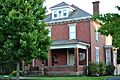
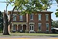
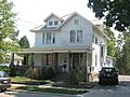
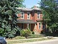
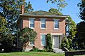
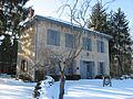
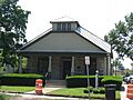
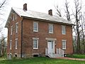
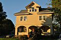
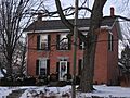
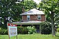
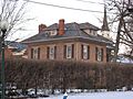
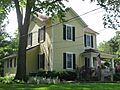
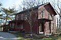
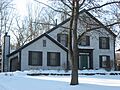
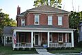
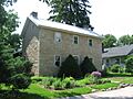
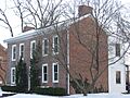
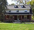
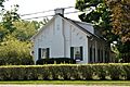
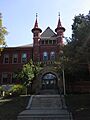
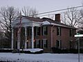
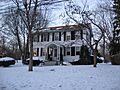
- The Demas Adams House at 721 High Street was listed in 1980. It's a great example of old architecture.
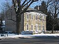
- The Aurora Buttles House (also known as the Sidney Brown House) on E. Strafford Avenue, listed in 1980, is another beautiful historic home.
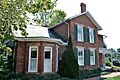
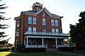
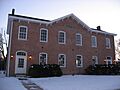
- The Buttles-Johnson House at 956 High Street, listed in 1973, is one of the older historic homes in Worthington.
- The Jonathan Park House and the Ripley House, both on Granville Road and High Street respectively, were added in 1980.
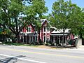
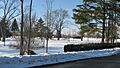
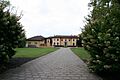
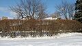
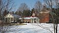
- The Worthington Public Square, also known as the Village Green, is a central historic spot listed in 1980. It's a lovely open space that has been important to the town for a long time.
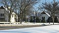
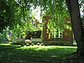
- The Worthington Historic District itself, listed in 2010, includes many buildings around North, South, Morning, and Evening Streets, showing how the town grew.
Canal Winchester's History
Canal Winchester also has a rich history with many listed buildings.
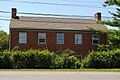
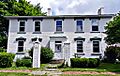
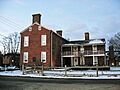
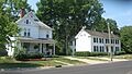
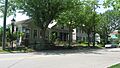
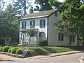
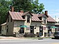
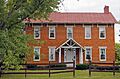
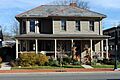
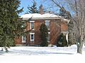
- The Arendt-Seymour House and the Barnhardt-Bolenbaugh House, both on Columbus and Waterloo Streets, were listed in 1989.
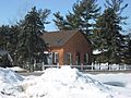
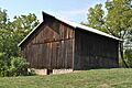
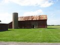
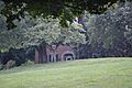
- The Bergstresser Covered Bridge, west of State Route 674 over Walnut Creek, is a unique historic bridge listed in 1974. Covered bridges are special because they are rare and show old building methods.
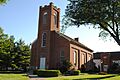
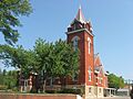
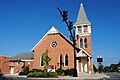
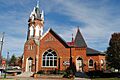
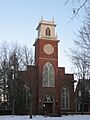
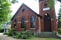
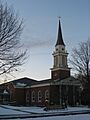
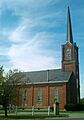
- The Canal Winchester Methodist Church and the Canal Winchester School, both on Columbus and Washington Streets, are important community buildings listed in 1982 and 2007.
- The Columbus Street Historic District, listed in 1988, highlights a whole section of historic homes and buildings.
- The O.P. Chaney Grain Elevator, listed in 1988, reminds us of the area's farming past.
Dublin's Old Buildings
Dublin has many historic homes and structures.
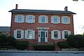
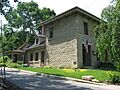
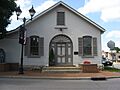
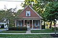
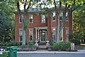
- The Artz House on N. High Street, listed in 1979, is a notable historic home.
- The Dublin Cemetery Vaults, located west of Dublin River Road, are interesting old structures listed in 1979.
- The Dublin Christian Church has two historic locations, one on Bridge Street and another on High Street, both listed in 1979.
- The Dublin High Street Historic District, listed in 1979, covers a large part of the historic downtown area.
- The Alexander Davis Cabin and Alexander Davis House on Dublin Road, listed in 1979, show early settler life.
- The Karrer Barn and Henry Karrer House on Dublin Road and Riverview Street, listed in 1979, are examples of historic farm buildings.
- The William Kilbourn House and Dr. Eli Pinney House on S. Riverview Street, listed in 1979, are also important historic homes.
Westerville's Heritage
Westerville also boasts several historic sites.
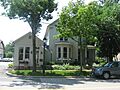
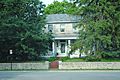
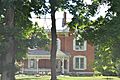
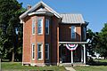
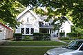
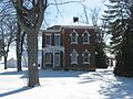
- The Alkire House on N. State Street, listed in 1978, is a significant historic home.
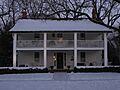
- The Benjamin Hanby House on W. Main Street, listed in 1970, is a very important site. Benjamin Hanby was a famous American composer.
- The John W. Everal Farm Buildings on Cleveland Avenue, listed in 1975, show the agricultural history of the area.
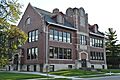
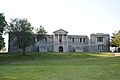
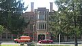
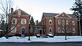
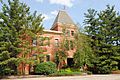
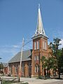
- Towers Hall at Otterbein College, listed in 1971, is a grand building on the college campus.
- The Temperance Row Historic District, listed in 2008, includes several streets and buildings related to the temperance movement, which was a big part of Westerville's history.
Other Notable Places
- The Capital University Historic District in Bexley, listed in 1982, includes important buildings of the university.
- The Drexel Theater in Bexley, listed in 2015, is a historic movie theater.
- The Gantz Homestead in Grove City, listed in 1979, is a historic farm.
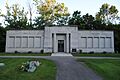
- The Green Lawn Abbey in Franklin Township, listed in 2007, is a beautiful and historic mausoleum.
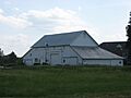
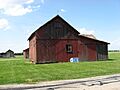
- The Groveport Log Houses in Groveport, listed in 1976, are rare examples of early log construction.
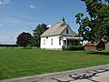
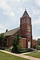
- The Hilliard Methodist Episcopal Church in Hilliard, listed in 1988, is an important religious building.
- The Alexander W. Livingston House in Reynoldsburg, listed in 1994, is a historic residence.
- The Nafzger-Miller House in Gahanna, listed in 1999, is another historic home.
- The Zion Evangelical Lutheran Church in Obetz, listed in 2004, is a historic church.
These are just a few examples of the many amazing historic places you can find in Franklin County, Ohio! Each one helps us connect with the past and understand the rich history of the area.
Images for kids
-
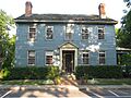
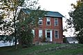
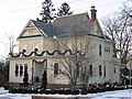
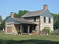
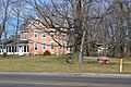
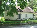
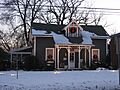
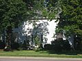
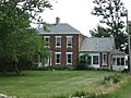
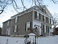
The Demas Adams House in Worthington.
-
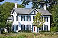
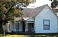
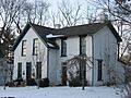
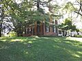
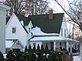
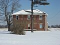
The Agler-La Follette House in Mifflin Township.
-
The Alkire House in Westerville.
-
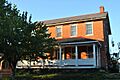
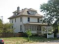
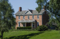
The Arendt-Seymour House in Canal Winchester.
-
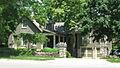
The Artz House in Dublin.
-
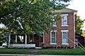
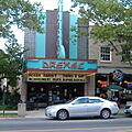
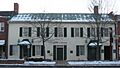
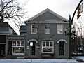
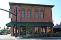
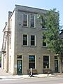
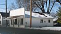
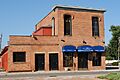
The Bank Block Building in Grandview Heights.
-
The Barnhardt-Bolenbaugh House in Canal Winchester.
-
The Dr. L.W. Beery House in Canal Winchester.
-
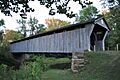
The Bergstresser Covered Bridge near Canal Winchester.
-
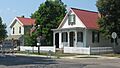
The E. Boles Cottage site in Hilliard.
-
The Asher Brand Residence in Dublin.
-
The Brelsford-Seese House in Dublin.
-
The Bruns-Wynkoop House in Canal Winchester.
-
The J.G. Butler House in Dublin.
-
The Aurora Buttles House in Worthington.
-
The Buttles-Johnson House in Worthington.
-
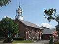
The Canal Winchester Methodist Church.
-
The Canal Winchester School.
-
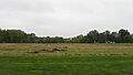
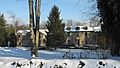
The Tom Cannon Mound in Pleasant Township.
-
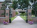
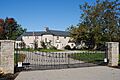
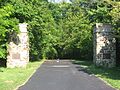
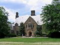
The front gate of Capital University in Bexley.
-
The Carty-Tussing House in Canal Winchester.
-
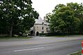
The Central College Presbyterian Church in Westerville.
-
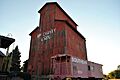
The O.P. Chaney Grain Elevator in Canal Winchester.
-
The Chapman-Hutchinson House in Dublin.
-
The Fletcher Coffman House in Dublin.
-
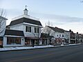
Historic houses on Columbus Street in Canal Winchester.
-
The Columbus, Hocking Valley and Toledo Railway Depot.
-
The Walter Datz House site in Dublin.
-
David's Reformed Church in Canal Winchester.
-
The Alexander Davis Cabin site in Dublin.
-
The Alexander Davis House site in Dublin.
-
The James Davis Barn site in Dublin.
-
The James Davis Farmhouse in Dublin.
-
The Samuel Henry Davis House site in Dublin.
-
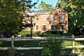
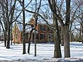
The Samuel Davis House in Mifflin Township.
-
The Elias Decker Farmhouse in Canal Winchester.
-
The Samuel Deitz Farmhouse in Canal Winchester.
-
The Drexel Theater in Bexley.
-
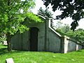
One of the Dublin Cemetery Vaults.
-
The Dublin Christian Church on Bridge Street.
-
The Dublin Christian Church on High Street.
-
A view of the Dublin High Street Historic District.
-
The Dublin Veterinary Clinic.
-
The John Dun Homestead in Dublin.
-
The Robert P. Duncan House in Bexley.
-
The George and Christina Ealy House in New Albany.
-
The Henry J. Epley House in Canal Winchester.
-

The Richard W. Evans House in Worthington.
-
The John W. Everal Farm Buildings in Westerville.
-
The Foor-Alspach House in Canal Winchester.
-
The Frantz House site in Dublin.
-
The John Galbreath Mound in Pleasant Township.
-
The Gantz Homestead in Grove City.
-
The Gardner House in Worthington.
-
The Christian Gayman House in Canal Winchester.
-
The Eleanor A. Gelpi House in Dublin.
-
The Gilbert House in Worthington.
-
The Gilbert-Wilcox House in Worthington.
-
The A.G. Grant Homestead in Grove City.
-
The Green Lawn Abbey in Franklin Township.
-
The James Griffith House in Canal Winchester.
-
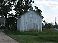
A Groveport log house.
-
The entrance to Groveport School.
-
The Groveport Town Hall.
-
The Groveport United Methodist Church.
-
The Parley Haffey Farmhouse in Canal Winchester.
-
The J.L. Hamilton Residence in Washington Township.
-
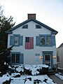
The Benjamin Hanby House in Westerville.
-
The Gideon Hart House in Westerville.
-
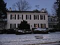
The Lucy Hart House in Worthington.
-
The Helpman-Chaney House in Canal Winchester.
-
The Christian S. Herr House in Hamilton Township.
-
The Hilliard Methodist Episcopal Church.
-
The Holder-Wright Works in Dublin.
-
The Home for the Aged Deaf in Westerville.
-
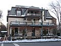
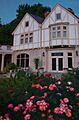
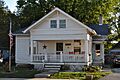
The Hotel Central (Worthington Inn).
-
The Franz Huntington House in Bexley.
-
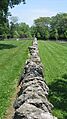
The Indian Run Cemetery Stone Walls in Dublin.
-
Jackson Fort in Blendon Township.
-
The H.P. Jeffers Mound in Worthington.
-
The Malcolm Jeffrey House (Ohio Governor's Mansion) in Bexley.
-
The site of The Kahiki (demolished).
-
The Karrer Barn in Dublin.
-
The Henry Karrer House in Dublin.
-
The Kilbourn Commercial Building in Worthington.
-
The William Kilbourn House in Dublin.
-
The Frederick G. Kilgour House in Upper Arlington.
-
The William King House in Canal Winchester.
-
The Abraham Lehman Farmhouse in Canal Winchester.
-
The C. Leppert Barn site in Dublin.
-
The C. Leppert Cabin site in Dublin.
-
The C. Leppert Farmhouse site in Dublin.
-
The Alexander W. Livingston House in Reynoldsburg.
-
The Doctor Longenecker Office Building in Worthington.
-
The David Marshall House in Washington Township.
-
The Mattoon-Woodrow House in Worthington.
-
The McCracken-Sells House in Mifflin Township.
-
The Austin McDowell House in Dublin.
-
The Dr. McKitrick House in Dublin.
-
The Dr. McKitrick Office in Dublin.
-
The Dr. James Merryman House in Hilliard.
-
The Methodist Church Parsonage in Canal Winchester.
-
The J.F. Miller House in Marble Cliff.
-

The Charles Mitchell House in Washington Township.
-
The Myer House in Dublin.
-
The Nafzger-Miller House in Gahanna.
-
The New England Lodge in Worthington.
-
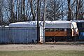
The Niles Car & Manufacturing Company Electric Railway Interurban Combine No. 21.
-
The Lewis Noble House in Worthington.
-
The North High Street Historic District in Canal Winchester.
-
The Odd Fellows Hall in Hilliard.
-
The Old Peace Lutheran Church in Gahanna.
-
The Charles S. Osborn House in Blendon Township.
-
The Otterbein Mausoleum in Westerville.
-
The Jonathan Park House in Worthington.
-
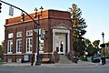
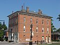
The Peoples Bank Company Building in Canal Winchester.
-
The Pinney Road Log Cabin site in Dublin.
-
The Dr. Eli Pinney House in Dublin.
-
The Presbyterian Parsonage in Westerville.
-
The Principal's Cottage in Worthington.
-
The John Rager Farmhouse in Madison Township.
-
The F. Riley House in Dublin.
-
Louis Rings Barn No. 1 in Dublin.
-
Louis Rings Barn No. 2 in Dublin.
-
The Louis Rings Residence in Dublin.
-
The Ripley House in Worthington.
-
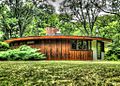
A round house in Rush Creek Village Historic District.
-
The Mark Russell House in Riverlea.
-
Benjamin Sells Barn No. 1 in Washington Township.
-
Benjamin Sells Barn No. 2 in Washington Township.
-
The Benjamin Sells House in Washington Township.
-
The Benjamin Sells Wash House in Washington Township.
-
The David Sells Barn site in Washington Township.
-
The Eliud Sells House in Dublin.
-
The William Henry Sells House in Dublin.
-
Sessions Village in Bexley.
-
The Sharon Township Town Hall in Worthington.
-
The Shepard Street School in Gahanna.
-
The Carl H. Shier Barn in Washington Township.
-
The Carl H. Shier Chicken House in Washington Township.
-
The Carl H. Shier House in Washington Township.
-
The Capt. J.S. Skeele House in Worthington.
-
The John Snow House in Worthington.
-
The gates of Squire's Glen Farm in Westerville.
-
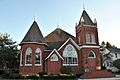
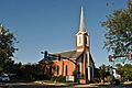
St. John's Episcopal Church in Worthington.
-
St. John's Lutheran Church in Dublin.
-
The Joshua Stevenson House in Madison Township.
-
A view of the Temperance Row Historic District in Westerville.
-
The Thompson-Builder House in Dublin.
-
The Morgan Thrush Farm Complex in Canal Winchester.
-
The Times Building-Lodge Hall in Canal Winchester.
-
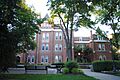
Towers Hall at Otterbein College.
-
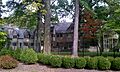
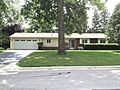
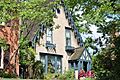
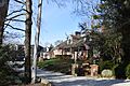
A mansion in the Upper Arlington Historic District.
-
The Rev. Ebenezer Washburn House in Westerville.
-
The Washington Township School in Dublin.
-
The Washington Township Voting Hall in Washington Township.
-
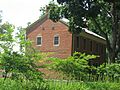
Wesley Chapel near Hilliard.
-
A building in the West Mound Street Historic District in Canal Winchester.
-
The Westerville High School-Vine Street School.
-
The Frieda Whitmer House in Washington Township.
-
The Jacob Wilcox Farm in Washington Township.
-
The James Wilcox House in Washington Township.
-
The Winterringer Building and House in Hilliard.
-
Downtown Worthington, part of the Worthington Historic District.
-
The Worthington Historical Society Museum.
-
The Worthington Manufacturing Company Boardinghouse.
-
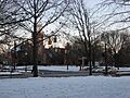
The Worthington Public Square.
-
The Worthington Presbyterian Church.
-
The Horace Wright House in Worthington.
-
The George Karrer Farm in Dublin.
-
The Potter Wright House in Worthington.
-
The Zellers-Langel House in Canal Winchester.
-
Zion's Evangelical Lutheran Church in Obetz.


