
National Register of Historic Places listings in Greenville, South Carolina facts for kids

This article is about the cool historic places in Greenville, South Carolina, that are listed on the National Register of Historic Places. The National Register of Historic Places is like a special list of buildings, places, and areas in the United States that are important because of their history, architecture, or what happened there. It helps protect these places so future generations can learn from them.
Greenville County has 88 places on this list. This article focuses on the 45 special spots found right here in the city of Greenville.
Contents
- Historic Buildings and Churches
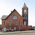
- Allen Temple A.M.E. Church
- American Cigar Factory
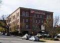
- Carolina Supply Company
- Chamber of Commerce Building
- Christ Church (Episcopal) and Churchyard
- Davenport Apartments
- T.Q. Donaldson House
- Downtown Baptist Church
- Earle Town House
- Imperial Hotel
- Mills Mill
- E. W. Montgomery Cotton Warehouse
- Poinsett Hotel
- Whitehall
- Parks and Historic Districts
- Images for kids
Historic Buildings and Churches
Allen Temple A.M.E. Church

The Allen Temple A.M.E. Church was started in 1876, right after the Reconstruction Era (a time when the United States was rebuilding after the Civil War). It was a very important place because it was one of the only churches where formerly enslaved people could worship freely. Even presidents, like Rutherford B. Hayes and Barack Obama, have given speeches here!
American Cigar Factory

The American Cigar Factory was built in 1902 by a famous businessman named James B. Duke. He wanted to make cigars for people in the southern states. When it first opened, about 150 women worked there. Today, this historic building is used as an office for a company called Hitachi Solutions America, Ltd.
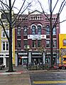
Carolina Supply Company

The Carolina Supply Company building was designed by J.E. Sirrine. It was built to provide equipment and goods to local factories. The building has a special design called "utilitarian renaissance revival," which means it's practical but also has fancy details from an older style. Now, a Wells Fargo Bank is located here.
Chamber of Commerce Building

The Chamber of Commerce Building was built in 1925. It was one of the very first tall buildings, or "skyscrapers," to be built in Greenville.
Christ Church (Episcopal) and Churchyard
.jpg)
Christ Church was founded by Reverend Rodolphus Dickerson. The plans for this church were made by Joel Pansett, and the first stone was laid on September 15, 1825. The church property also has a large cemetery with gravestones that are very old, some from the late 1700s and 1800s.
Davenport Apartments

The Davenport Apartments were built in 1914 by G.D. Davenport. This was the very first apartment building in Greenville! Today, parts of this building are still owned by companies like Love Thornton and Arnold Thompson.
T.Q. Donaldson House

The T.Q. Donaldson House was built for Thomas Q. Donaldson. He was a lawyer and also served in the South Carolina Senate from 1872 to 1876. The house was first built as a one-and-a-half-story home, but soon after, a second story was added.
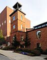
Downtown Baptist Church
.jpg)
In 1854, the First Baptist Church decided to build a new church. They hired a famous architect named Samuel Sloan, and the Downtown Baptist Church was finished in 1858. It's built in a "Greek revival" style, which means it looks like ancient Greek temples.
Earle Town House

The Earle Town House was likely built between 1829 and 1834. It was once owned by Charles A. David, who was a local humorist and cartoonist. Later, a famous author named Mary Simms Oliphant owned the house and made many changes to it.
Imperial Hotel
.jpg)
The Imperial Hotel was the first known hotel in Greenville. It was built by Joseph G. Cunningham and Frank Harrison. This building is still used today as a nursing home for people aged 55 and older who have disabilities.
Mills Mill

Mills Mill was built by Otis Prentiss Mills to make fabrics like fine cotton sheets, twills, and satins. In the 2000s, the old factory building was changed into modern apartments, which is a great way to reuse historic spaces!
E. W. Montgomery Cotton Warehouse
The E. W. Montgomery Cotton Warehouse was built in the late 1920s and 1930s by Edmund Warren Montgomery. It was a place where cotton was stored. The warehouse closed in 1933, and like Mills Mill, it was turned into apartments in the 1980s.
Poinsett Hotel

The Poinsett Hotel is named after Joel Roberts Poinsett, who was an important person in government. It was one of the first tall buildings built in Greenville. A New York architect named William Lee Stoddart designed it, and it cost $1.5 million to build. The Poinsett Hotel opened its doors on June 20, 1925.
Whitehall

Whitehall is one of the oldest homes in Greenville. It was built in 1813 by Henry Middleton and was his summer house until 1820. Henry's father, Arthur Middleton, was a very important person who signed the Declaration of Independence! In 1820, Whitehall was sold to George Washington Earle.
Parks and Historic Districts
Reedy River Falls Historic Park and Greenway

In the 1770s, a Virginian Indian trader named Richard Pearis settled near the beautiful falls of the Reedy River. He built a grist mill (to grind grain), a sawmill (to cut wood), a home, a store, and other buildings. Later, in 1815, a man named Vardry McBee bought the property. He started developing a town called Pleasantburg, which later changed its name to Greenville in 1831. This park is a great place to learn about Greenville's beginnings!
Richland Cemetery

The Richland Cemetery was created because of an idea from Ana Butler. She thought the area would be a perfect place for a graveyard, and she placed it in the middle of an African American community. Many famous African Americans are buried here, which makes it a very important historical site.
Springwood Cemetery
.JPG)
Springwood Cemetery is the final resting place for some of Greenville's most important people. It was once a garden belonging to the Thompson family, and Elizabeth Williams Thompson asked to be buried there. Even with over 10,000 graves, it is still known for its beauty and peaceful atmosphere.
Pettigru Street Historic District

The Pettigru Street Historic District is just east of downtown Greenville. Most of the homes here were built between 1910 and 1930. This area was originally designed for wealthy businessmen and mill owners. It's famous for its old English architectural styles, like Bungalow, Queen Anne, and Victorian homes, and the beautiful tree-lined streets. It's a popular spot for visitors and people looking for a historic home.
Images for kids
-
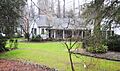
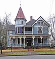
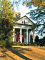
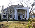
Hugh Aiken House
-
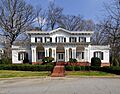
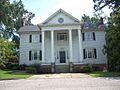
Fountain Fox Beattie House
-
Broad Margin
-
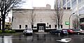
First National Bank
-
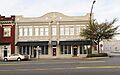
Gilfillin and Houston Building
-
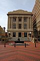
Greenville County Courthouse
-
Greenville Gas and Electric Light Company
-
Hampton-Pinckney Historic District
-
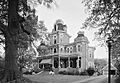
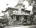
Isaqueena, also known as the Gassaway Mansion.
-
Josiah Kilgore House
-
Lanneau-Norwood House
-
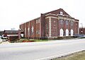
Parker High School Auditorium
-
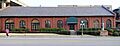
Reedy River Industrial District
-
Stradley and Barr Dry Goods Store
-
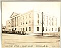
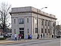
U.S. Post Office and Courthouse
-
John Wesley Methodist Episcopal Church
-
West End Commercial Historic District
-
William and Harriet Wilkins House
-
Working Benevolent Temple and Professional Building
-
C. Granville Wyche House


.jpg)


.JPG)
.jpg)


