National Register of Historic Places listings in Hancock County, Illinois facts for kids
Welcome to Hancock County, Illinois! This area is full of amazing places that have been around for a long time and hold special stories. These important spots are listed on something called the National Register of Historic Places. Think of it like a special list of buildings, areas, or objects across the United States that are worth protecting because of their history or unique design.
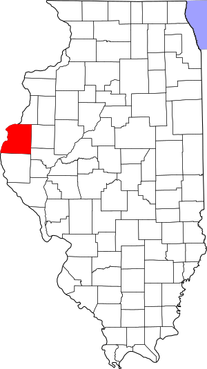
In Hancock County, there are 13 different places that have made it onto this important list. These places help us learn about the past and understand how people lived, worked, and built things many years ago. From old homes and jails to big bridges and dams, each one has a tale to tell. Let's take a look at some of these cool historic treasures!
Contents
Exploring Hancock County's Historic Treasures
Homes and Buildings with History
Cambre House and Farm
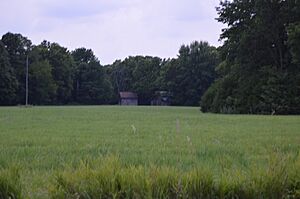
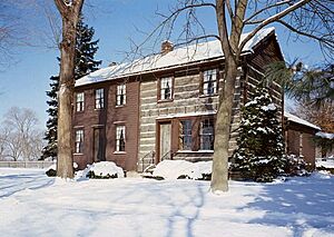
Imagine living on a farm that's been around for ages! The Cambre House and Farm is one of those places. It's located southwest of Niota and was added to the National Register in 1984. This old farm gives us a peek into what farming life was like in the past.
Cyrus Felt House
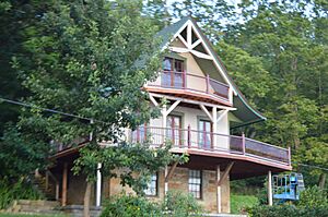
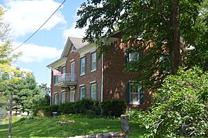
The Cyrus Felt House is another historic home, found about three miles north of Hamilton. It was recognized in 1980. This house is a great example of the kind of homes people built in this area long ago.
La Harpe City Hall
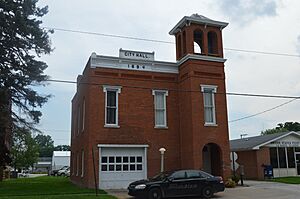
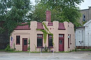
Even city halls can be historic! The La Harpe City Hall, located at 207 East Main Street in La Harpe, was added to the list in 1991. This building has served the community for many years, being the center of local government.
William J. Reimbold House
In Nauvoo, you can find the William J. Reimbold House at 950 White Street. This house became a historic site in 1987. It's another example of the unique architecture and history found in Nauvoo.
Important Districts and Areas
Carthage Courthouse Square Historic District
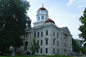
The heart of Carthage is its Courthouse Square Historic District. This area, roughly bounded by Main, Adams, Wabash, and Madison Streets, was recognized in 1986. It includes many old buildings around the courthouse, showing what a busy town center looked like in earlier times.
La Harpe Historic District
Just like Carthage, La Harpe also has a special historic district. This area includes parts of West Main Street, East Main Street, South Center Street, and the City Park. It was added to the National Register in 1987 and helps preserve the look and feel of old La Harpe.
Nauvoo Historic District
Nauvoo is a very famous historic city, and its entire historic district, including the city and its surroundings, was one of the first places in Hancock County to be listed on the National Register in 1966. This district protects many important sites related to the city's unique past.
Warsaw Historic District
The city of Warsaw also has a historic district, roughly bordered by the Mississippi River, Marion, and 11th Streets. It was recognized in 1977. This district helps keep the historic character of Warsaw, especially its connection to the mighty Mississippi River.
Structures with Big Stories
Carthage Jail
One of the most well-known historic sites in Hancock County is the Carthage Jail, located at Walnut and North Fayette Streets in Carthage. It was listed in 1973 and is famous for an important event in history.
Fort Madison Bridge
The Fort Madison Bridge is a really cool structure! It's a swinging truss toll bridge that crosses the Mississippi River, connecting Niota with Fort Madison in Iowa. This bridge was added to the National Register in 1999. It's amazing to think about how people built such a long bridge that can even swing open for boats!
Keokuk Lock and Dam
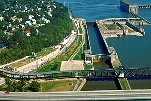
The Keokuk Lock and Dam, also known as Lock and Dam No. 19, is a massive structure on the Mississippi River near Hamilton. It was listed in 1978. This huge dam is over 4,600 feet long and helps control the river's flow. It also has giant locks, which are like water elevators, that are 1,200 feet long and 110 feet wide, allowing boats to move up and down the river.
Lock and Dam No. 19 Historic District
Because the Keokuk Lock and Dam is so important, the area around it, west of central Hamilton, was also named a historic district in 2004. This district includes several buildings, structures, and even an object related to the dam's operation, showing its long history and importance.
These historic places in Hancock County are like open-air museums, helping us connect with the past and understand the rich history of Illinois!


