
National Register of Historic Places listings in Henry County, Iowa facts for kids

Have you ever wondered about old buildings or special places in your town that tell a story? In Henry County, Iowa, there are many such places! This article is about the amazing historic spots in Henry County that are listed on the National Register of Historic Places. This special list helps protect and celebrate buildings, areas, and objects that are important to American history.
When a place is added to the National Register, it means it's recognized for its unique history, architecture, or what it means to the community. It's like giving a medal to a building or a park for being super important! In Henry County, there are 52 different places on this list, from old houses to banks and even a state park. Let's explore some of them!
Contents
What is the National Register of Historic Places?
The National Register of Historic Places is the official list of places in the United States that are worth saving. It's managed by the National Park Service. Think of it as a hall of fame for historic buildings, sites, and structures. When a place is listed, it gets special recognition and sometimes even help to keep it safe and sound for future generations.
Why are places listed?
Places are listed for many reasons. Maybe they are:
- Very old: They show us how people lived long ago.
- Beautifully designed: They are great examples of certain types of architecture.
- Connected to important events: Something big happened there.
- Linked to famous people: A well-known person lived or worked there.
- Important to a community's story: They represent a group of people or a way of life.
Historic Homes in Henry County
Many of the places on the list in Henry County are historic homes. These houses often show us how families lived and what kind of architecture was popular many years ago.
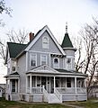
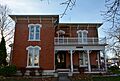
G. W. S. Allen House
The G. W. S. Allen House is located in Mount Pleasant, Iowa. It was added to the National Register in 1985. This house is a great example of the kind of homes people built in the past.
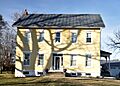
Henry Ambler House
Also in Mount Pleasant, the Henry Ambler House was listed in 1986. It's another beautiful old home that helps us understand the history of the area.
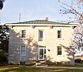
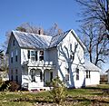
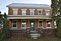
Dr. J.O. and Catherine Ball House
The Dr. J.O. and Catherine Ball House, listed in 1994, is another significant home in Mount Pleasant. It reminds us of the people who helped build the community.
John and Lavina Bangs House
Found in New London, Iowa, the John and Lavina Bangs House joined the list in 2003. It's a piece of New London's history.
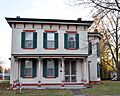
Brazelton House Hotel
The Brazelton House Hotel in Mount Pleasant, listed in 1986, was once a busy hotel. Imagine travelers staying there long ago!
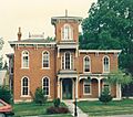
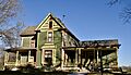
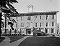
Harlan-Lincoln House
The Harlan-Lincoln House in Mount Pleasant is very special. It was listed way back in 1973. This house has a connection to the famous Abraham Lincoln! His son, Robert Todd Lincoln, married Mary Harlan, whose family owned this house.
Important Public Buildings and Sites
It's not just houses that are historic! Many public buildings and special sites are also on the National Register because they played a big role in the community.
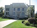
Henry County Courthouse
The Henry County Courthouse in Mount Pleasant, listed in 1981, is where important government decisions are made. It's a symbol of justice and community.
Mount Pleasant Public Library
The Mount Pleasant Public Library, added in 1983, has been a place for learning and stories for many years. Libraries are vital parts of any town.
Old Main (Iowa Wesleyan College)
Old Main is a building on the Iowa Wesleyan College campus in Mount Pleasant. It was listed in 1973. This building has seen countless students learn and grow over the years.
Geode State Park
Geode State Park near Danville, Iowa is not just a building, but a whole park! The Civilian Conservation Corps Area within the park was listed in 1990. This area shows the work done by young men during the Great Depression to build parks and infrastructure.
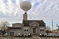
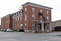
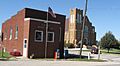
City Hall (Mount Pleasant, Iowa)
The City Hall in Mount Pleasant, listed in 1991, is where the city's leaders work to keep the town running smoothly.
Other Unique Historic Places
Henry County has many other interesting places on the National Register, showing the diverse history of the area.
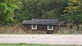
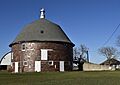
Holtkamp Round Barn
The Holtkamp Round Barn near Salem, Iowa, listed in 1986, is a unique type of barn. Round barns were thought to be more efficient for farming.
Henderson Lewelling House
The Henderson Lewelling House in Salem, listed in 1982, is important because it was part of the Underground Railroad. This was a secret network that helped enslaved people find freedom.
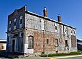
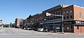
Swedesburg Historic Commercial District
The Swedesburg Historic Commercial District in Swedesburg, Iowa, listed in 1999, includes several buildings that show what the town's main street looked like long ago. It tells the story of the Swedish immigrants who settled there.
Second Baptist Church (Mount Pleasant, Iowa)
The Second Baptist Church in Mount Pleasant, listed in 2011, is a significant place of worship and community gathering, reflecting the history of its congregation.
Images for kids
-
G. W. S. Allen House
-
Henry Ambler House
-

Dr. J.O. and Catherine Ball House
-
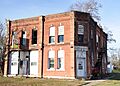
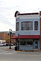
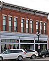
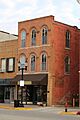
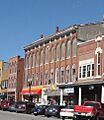
Bicksler Block
-

Brazelton House
-
Brazelton House Hotel
-

Camp Harlan-Camp McKean Historic District
-
City Hall
-

Collins-Bond House
-
Cook-Johnson House
-
George and Margaret Cooper House
-
Joseph A. and Lydia A. Edwards House
-

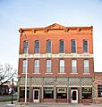
Farmers Savings Bank
-
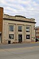
First National Bank
-
Owen A. and Emma J. Garretson House
-
Geode State Park, Civilian Conservation Corps Area
-
Harlan House Hotel
-

Harlan-Lincoln House
-
Henry County Courthouse
-
Henry County Savings Bank
-
Holtkamp Round Barn
-
Charles E. Hult House Summer Kitchen and Wood Shed
-

John Hultquist House
-

Henderson Lewelling House
-
Lamm-Pollmiller Farmstead District
-
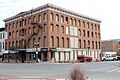
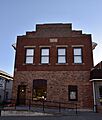
Louisa Building
-
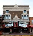
Masonic Temple Theater
-
Masters Building
-
McCandless Building
-

Mount Pleasant Public Library
-

National State Bank
-
Old Main, Iowa Wesleyan College
-
Peterson Manufacturing Building
-
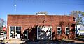
Red Ball Garage
-
Isaac and Agnes (Bells) Reeves House
-

Second Baptist Church
-
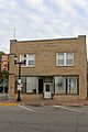
Smith and Weller Building
-

Swedesburg Historic Commercial District
-
Swedish Evangelical Lutheran Church
-
Timmerman-Burd Building
-
Union Block
-
Zuhn Building


