
National Register of Historic Places listings in Horry County, South Carolina facts for kids

This article is about the cool historic places in Horry County, South Carolina, that are listed on the National Register of Historic Places. Think of this register as a special list of buildings, areas, and objects that are important to American history. When a place is on this list, it means it's worth protecting and remembering for future generations.
You can even see where these places are on a map if their exact location (latitude and longitude) is shared. Horry County has 34 places on this special list, and there were 2 others that used to be listed but aren't anymore.
Contents
What is the National Register of Historic Places?
The National Register of Historic Places is the official list of the United States' historic places that are worth saving. It's part of a program by the federal government to help people understand and protect important parts of our past. When a place is added to this list, it gets special recognition. It also means that certain rules apply to make sure these places are not damaged or destroyed.
Why are places listed?
Places are listed because they are important in history, architecture, archaeology, engineering, or culture. For example, a building might be listed because a famous person lived there, or because it shows a special way of building that was popular long ago. A whole neighborhood might be listed if it tells a story about how a town grew.
Historic Places in Horry County
Horry County has many interesting places that tell stories about its past. These places include old homes, churches, schools, and even entire neighborhoods. They show how people lived, worked, and built their communities over many years.
Conway's Historic Gems
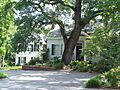
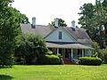
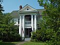
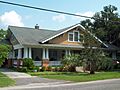
Many of Horry County's historic listings are in the city of Conway. This includes several old houses, like the H.W. Ambrose House and the Beaty-Little House, which show the styles of homes from long ago. The Burroughs School is another important building, reminding us of how education happened in the past.
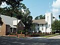
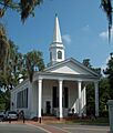
Churches also play a big role in Conway's history. The Conway Methodist Church and the Kingston Presbyterian Church are both on the list, along with the Kingston Presbyterian Church Cemetery. These places show the importance of faith and community in the area's development.
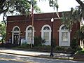
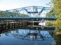
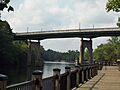
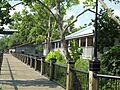
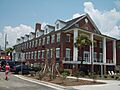
The Old Horry County Courthouse is a key landmark in Conway, showing where important decisions were made. There are also entire areas listed, like the Conway Downtown Historic District and the Conway Residential Historic District. These districts include many buildings that together paint a picture of Conway's history. Even the Waccamaw River Memorial Bridge and the Waccamaw River Warehouse Historic District are recognized, highlighting the importance of the river for trade and travel.
Myrtle Beach's Historic Spots
Myrtle Beach also has its own special historic places. The Myrtle Beach Atlantic Coast Line Railroad Station reminds us of the days when trains were a main way to travel and bring goods. The Myrtle Heights-Oak Park Historic District is a neighborhood that shows the early development of this famous beach town.
Other interesting places include the Ocean Forest Country Club, a historic spot for recreation, and the Pleasant Inn, an old place where visitors used to stay. The Rainbow Court is another unique listing, showing the kind of places people stayed at when Myrtle Beach was first becoming a popular vacation spot.
Other Notable Places
Beyond Conway and Myrtle Beach, Horry County has other historic sites. The Buck's Upper Mill Farm near Bucksville gives us a glimpse into the county's farming history. The Hebron Church in Bucksville is another old church with a rich past.
The John P. Derham House in Green Sea is a historic home in a more rural part of the county. The Galivants Ferry Historic District is a unique area that shows a historic crossing point over a river. Lastly, the Socastee Historic District near the Intracoastal Waterway highlights another important community with its own story.
Former Listing
Sometimes, a place that was once on the National Register of Historic Places might be removed. This usually happens if the building is destroyed or changed so much that it no longer has its historic importance.
The Chesterfield Inn in Myrtle Beach was once on the list. It was a historic hotel located on North Ocean Boulevard. However, it was taken off the list in 2013 because it was torn down in 2012.
Images for kids
-
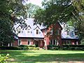
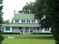
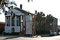
H.W. Ambrose House
-
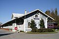
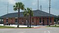
Atlantic Coast Line Railroad Depot
-
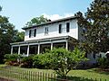
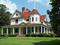
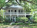
Beaty-Little House
-
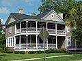
Beaty-Spivey House
-
Buck's Upper Mill Farm
-
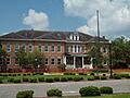
Burroughs School
-
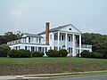
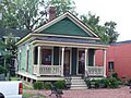
Arthur M. Burroughs House
-
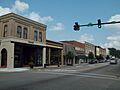
Conway Downtown Historic District
-
Conway Methodist Church, 1898 and 1910 Sanctuaries
-
Conway Post Office
-
Conway Residential Historic District
-
John P. Derham House
-
Galivants Ferry Historic District
-
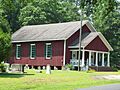
Hebron Church
-
J.W. Holliday Jr. House
-
Kingston Presbyterian Church
-
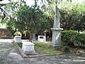
Kingston Presbyterian Church Cemetery
-
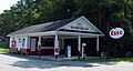
Myrtle Beach Atlantic Coast Line Railroad Station
-
Myrtle Heights-Oak Park Historic District
-
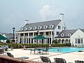
Ocean Forest Country Club
-
Old Horry County Courthouse
-
Pleasant Inn
-
C.P. Quattlebaum House
-
C.P. Quattlebaum Office
-

Paul Quattlebaum House
-

Rainbow Court
-
Socastee Historic District
-
Waccamaw River Memorial Bridge
-
Waccamaw River Warehouse Historic District
-
W. H. Winborne House
-
Chesterfield Inn (Former Listing)


