National Register of Historic Places listings in Jefferson County, Wisconsin facts for kids
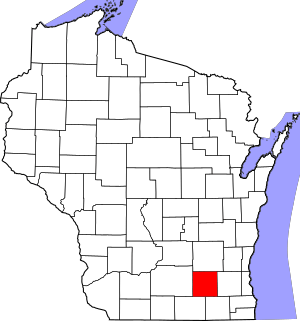
Welcome to a special list of amazing places in Jefferson County, Wisconsin! These places are super important because they are listed on the National Register of Historic Places. Think of it like a Hall of Fame for buildings, parks, and sites that have a cool story or a special history. There are 58 of these special spots in Jefferson County. Let's explore some of them!
Contents
- Historic Treasures in Jefferson County
- Ancient Sites and Mounds
- Cool Buildings to See
- Beals and Torrey Shoe Co. Building
- Chicago and Northwest Railroad Passenger Station
- City of Waterloo Carousel
- Copeland-Ryder Company
- David W. and Jane Curtis House
- Enterprise Building
- Enoch J. Fargo House
- L. D. Fargo Public Library
- First Kindergarten
- Fort Atkinson Water Tower
- August and Eliza Fuermann Jr. House
- Hebron Town Hall
- Hoard's Dairyman Farm
- Arthur R. Hoard House
- Jefferson Fire Station
- Jefferson High School
- Jefferson Public Library
- Jones Dairy Farm
- Eli May House
- Monroe McKenzie House
- Octagon House
- Puerner Block-Breunig's Brewery
- Saint Bernard's Church Complex
- Albert and Mary Shekey House
- Richard C. Smith House
- Albert F. Solliday House
- St. Paul's Episcopal Church
- St. Wenceslaus Roman Catholic Church
- Historic Districts
- Clyman Street Historic District
- Main Street Commercial Historic District (Watertown)
- Main Street Commercial Historic District (Jefferson)
- Main Street Historic District (Fort Atkinson)
- Merchants Avenue Historic District
- North Washington Street Historic District (Watertown)
- Richards Hill Residential Historic District
- South Washington Street Historic District (Watertown)
- Waterloo Downtown Historic District
- Images for kids
Historic Treasures in Jefferson County
Ancient Sites and Mounds
Some of the oldest and most mysterious places on the list are ancient sites. These often include mounds built by Native American people long, long ago.
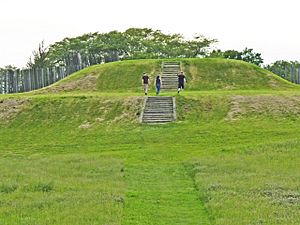
Aztalan State Park
Imagine a city built by ancient people right here in Wisconsin! Aztalan State Park is near Lake Mills, Wisconsin. It was once a large village where people lived between A.D. 1000 and 1300. They built tall mounds and a wooden fence around their town. It's a National Historic Landmark, which means it's super important to the whole country! It was added to the list in 1966.
Bean Lake Islands Archeological District
This area near Lake Mills, Wisconsin is a special place where archaeologists study ancient history. It was listed in 1982.
Carcajou Point (47 Je 2)
Near Busseyville, Wisconsin, this site is another important archaeological spot. It was added to the list in 1979.
Crab Apple Point Site
This historic site near Edgerton, Wisconsin was recognized in 1978 for its archaeological value.
Haight Creek Mound Group (47-Je-38)
Near Fort Atkinson, Wisconsin, this group of mounds tells us about the ancient people who lived here. It was listed in 1985.
Hoard Mound Group (47JE33)
Another important group of mounds near Fort Atkinson, Wisconsin, added to the list in 1984.
Panther Intaglio Effigy Mound
This unique mound near Fort Atkinson, Wisconsin is shaped like a panther! It's an "intaglio" mound, meaning it's dug into the ground instead of built up. It was listed in 1970.
Pioneer Aztalan Site
This site near Aztalan, Wisconsin is connected to the ancient Aztalan village. It was listed in 1975.
Pitzner Site (47 Je 676)
This archaeological site near Jefferson, Wisconsin was added to the list in 1982.
Telfer Site
Near Milford, Wisconsin, the Telfer Site is another important archaeological discovery. It was listed in 2000.
Cool Buildings to See
Many historic buildings in Jefferson County show us how people lived and worked long ago. They have interesting designs and stories!
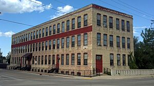
Beals and Torrey Shoe Co. Building
This old shoe factory building at 100 W. Milwaukee St. in Watertown, Wisconsin was built a long time ago. It was added to the list in 1984.
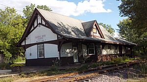
Chicago and Northwest Railroad Passenger Station
Train stations were once very busy places! This one at 725 W. Main St. in Watertown, Wisconsin was where people would catch trains. It was listed in 1979.
City of Waterloo Carousel
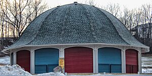
Who doesn't love a carousel? This one at 500 Park Ave. in Waterloo, Wisconsin is a true treasure! It even survived a flood in 2008 and was beautifully restored. It was added to the list in 1997.
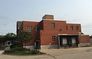
Copeland-Ryder Company
This building at 411 Wisconsin Dr. in Jefferson, Wisconsin shows an old industrial design. It was listed in 1989.
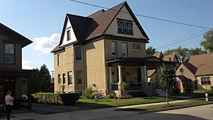
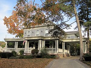
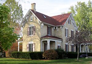
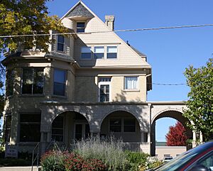
David W. and Jane Curtis House
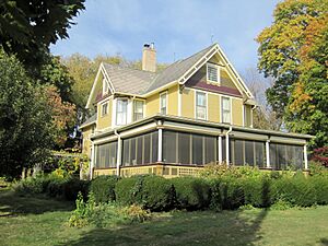
This beautiful house at 213 E. Sherman Ave. in Fort Atkinson, Wisconsin was added to the list in 2009.
Enterprise Building
The Enterprise Building at 125 W. Main St. in Palmyra, Wisconsin is a historic landmark from 1975.
Enoch J. Fargo House
This house at 406 Mulberry St. in Lake Mills, Wisconsin belonged to Enoch J. Fargo. It was listed in 1982.
L. D. Fargo Public Library
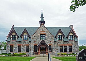
Libraries are important places for learning! This library at 120 E. Madison St. in Lake Mills, Wisconsin was built between 1899 and 1902. It has a cool Gothic Revival style, which looks a bit like old castles or churches. It was listed in 1982.
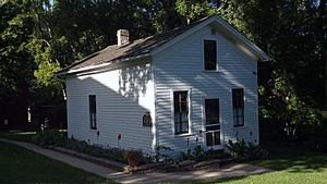
First Kindergarten
Did you know the very first kindergarten in the United States was started in Watertown, Wisconsin? This building at 919 Charles St. is where it happened! It was listed in 1972.
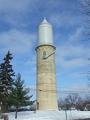
Fort Atkinson Water Tower
Water towers are often important parts of a town's history. This one at S. High and Fourth Sts. in Fort Atkinson, Wisconsin was listed in 2005.
August and Eliza Fuermann Jr. House
This house at 500 S. Third St. in Watertown, Wisconsin was added to the list in 1989.
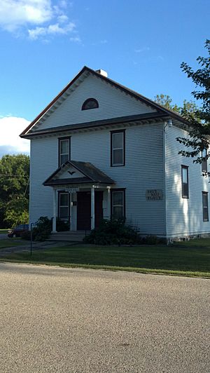
Hebron Town Hall
Town halls are where local government happens. The Hebron Town Hall at W3087 Green Isle Dr. in Hebron, Wisconsin was listed in 2002.
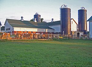
Hoard's Dairyman Farm
This farm north of Fort Atkinson, Wisconsin is famous for its history in dairy farming. It was listed in 1978.
Arthur R. Hoard House
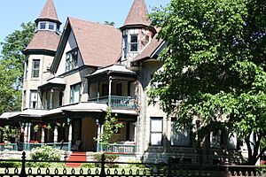
This house at 323 Merchants Ave. in Fort Atkinson, Wisconsin was the home of Arthur R. Hoard. It was listed in 1982.
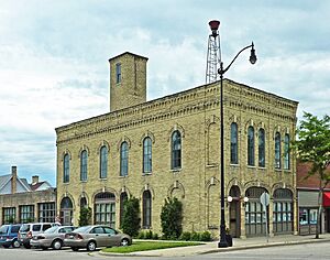
Jefferson Fire Station
Fire stations are important community buildings. This one at 146 E. Milwaukee St. in Jefferson, Wisconsin was built in the Italianate style, which was popular in the mid-1800s. It was listed in 1984.
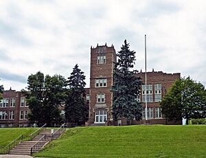
Jefferson High School
This old high school building at 201 S. Copeland Ave. in Jefferson, Wisconsin has a Gothic Revival style, similar to the library in Lake Mills. It was listed in 2001.
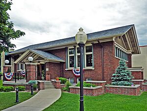
Jefferson Public Library
Another beautiful library! This one at 305 S. Main St. in Jefferson, Wisconsin was designed in the Prairie School style. This style was made famous by architect Frank Lloyd Wright. It was listed in 1980.
Jones Dairy Farm
This farm on Jones Ave. in Fort Atkinson, Wisconsin is another historic dairy farm. It was listed in 1978.
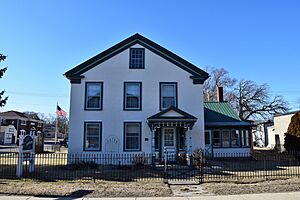
Eli May House
The Eli May House at 407 E. Milwaukee Ave. in Fort Atkinson, Wisconsin was listed in 1972.
Monroe McKenzie House
This house at 226 Main St. in Palmyra, Wisconsin was listed in 1985.
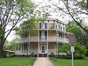
Octagon House
This house at 919 Charles St. in Watertown, Wisconsin is super unique because it's shaped like an octagon (an eight-sided figure)! It was listed in 1971.
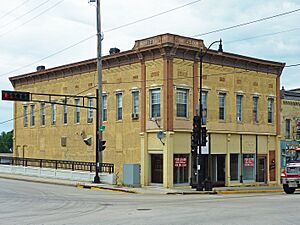
Puerner Block-Breunig's Brewery
This building at 101-115 E. Racine in Jefferson, Wisconsin once housed a brewery and other businesses. It has an Italianate style. It was listed in 1984.
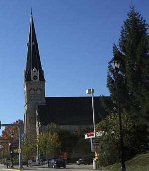
Saint Bernard's Church Complex
This church complex at 100 and 108 S. Church St. in Watertown, Wisconsin is a beautiful and historic religious site. It was listed in 2003.
Albert and Mary Shekey House
This house at W7526 Koshkonong Mounds Rd. in Koshkonong, Wisconsin was listed in 2015.
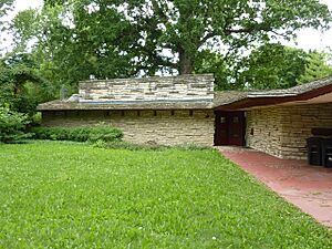
Richard C. Smith House
This house at 332 E. Linden St. in Jefferson, Wisconsin is special because it was designed by the famous architect Frank Lloyd Wright in 1950! It's a great example of his "Usonian" style, designed to fit into nature. It was listed in 1979.
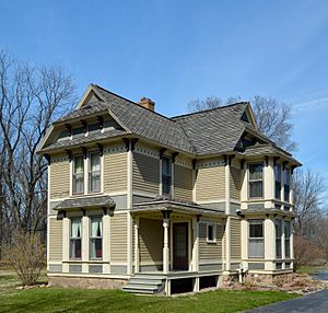
Albert F. Solliday House
This house at 114 S. Church St. in Watertown, Wisconsin was listed in 2003.
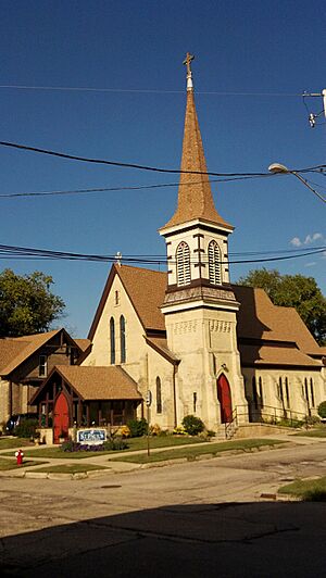
St. Paul's Episcopal Church
This church at 413 S 2nd St. in Watertown, Wisconsin is another historic religious building. It was listed in 1979.
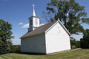
St. Wenceslaus Roman Catholic Church
This church southeast of Waterloo, Wisconsin at the junction of Blue Point and Island Rds. was listed in 1975.
Historic Districts
Sometimes, a whole group of buildings or an area is historic, not just one building. These are called historic districts.
Clyman Street Historic District
This area in Watertown, Wisconsin, roughly bounded by Western Ave., Clyman, S. 10th & S. 5th Sts., is a historic district. It was listed in 2015.
Main Street Commercial Historic District (Watertown)
The main street in Watertown, Wisconsin, from N. Washington St. to S. Seventh St., is a historic area with many old shops and buildings. It was listed in 1989.
Main Street Commercial Historic District (Jefferson)
Similarly, the main street area in Jefferson, Wisconsin, roughly bounded by Dodge St., Center Ave., Mechanic St., and Rock River, is a historic district. It was listed in 1998.
Main Street Historic District (Fort Atkinson)
The main street in Fort Atkinson, Wisconsin, from Sherman Ave. to S. 3rd St., is also a historic district. It was listed in 1984.
Merchants Avenue Historic District
This district in Fort Atkinson, Wisconsin, roughly bounded by S. Third St. E and S. Milwaukee Ave. E, Foster St., Whitewater, and Merchant Aves., was listed in 1986.
North Washington Street Historic District (Watertown)
This area in Watertown, Wisconsin, including N. Church St. and N. Washington St., is a historic district. It was listed in 2009.
Richards Hill Residential Historic District
This neighborhood in Watertown, Wisconsin, roughly bounded by Western, Richards, Thomas & Harvey Aves., Livsey Pl. & Charles St., is a historic residential area. It was listed in 2013.
South Washington Street Historic District (Watertown)
Another historic district in Watertown, Wisconsin, including parts of S. Church St. and S. Washington St., was listed in 2003.
Waterloo Downtown Historic District
The downtown area of Waterloo, Wisconsin, around the junction of Madison and Monroe Sts., is a historic district. It was listed in 2000.
Images for kids


