Jefferson County, Wisconsin facts for kids
Quick facts for kids
Jefferson County
|
|
|---|---|

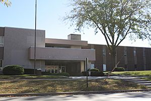
Jefferson County courthouse
|
|

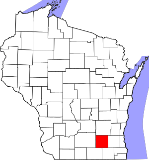
Location within the U.S. state of Wisconsin
|
|
 Wisconsin's location within the U.S. |
|
| Country | |
| State | |
| Founded | 1839 |
| Named for | Thomas Jefferson |
| Seat | Jefferson |
| Largest city | Watertown |
| Area | |
| • Total | 583 sq mi (1,510 km2) |
| • Land | 556 sq mi (1,440 km2) |
| • Water | 26 sq mi (70 km2) 4.5% |
| Population
(2020)
|
|
| • Total | 84,900 |
| • Estimate
(2023)
|
85,743 |
| • Density | 145.63/sq mi (56.23/km2) |
| Time zone | UTC−6 (Central) |
| • Summer (DST) | UTC−5 (CDT) |
| Congressional district | 5th |
Jefferson County is a county located in the state of Wisconsin in the United States. In 2020, about 84,900 people lived here. The main town, or county seat, is Jefferson. Jefferson County is part of a larger area that includes Watertown and Fort Atkinson.
Contents
History of Jefferson County
Jefferson County was created in 1836 when Wisconsin was still a territory. It officially became organized in 1839. Many of the first settlers came from New England.
The county was named after Jefferson County, New York. Some of the early settlers came from that county. Even the town of Watertown, Wisconsin was named after Watertown, New York.
Geography and Nature
Jefferson County covers an area of about 583 square miles. Most of this area, about 556 square miles, is land. The rest, about 26 square miles, is water. This means about 4.5% of the county is covered by water.
Main Roads and Travel
Many important roads pass through Jefferson County. These roads help people travel easily across the county and to other places.
 Interstate 94
 U.S. Highway 12
 U.S. Highway 18
 Wisconsin Highway 16
 Wisconsin Highway 19
 Wisconsin Highway 26
 Wisconsin Highway 59
 Wisconsin Highway 89
 Wisconsin Highway 106
 Wisconsin Highway 134
Railroads in the County
Trains also help move people and goods in and out of Jefferson County.
- Amtrak
- Canadian Pacific
- Union Pacific
- Wisconsin and Southern Railroad
Airports for Local Travel
The county has a few airports that serve the local communities.
- Watertown Municipal Airport (KRYV)
- Fort Atkinson Municipal Airport (61C)
Neighboring Counties
Jefferson County shares its borders with several other counties.
- Dodge County - to the north
- Waukesha County - to the east
- Walworth County - to the southeast
- Rock County - to the southwest
- Dane County - to the west
People of Jefferson County
| Historical population | |||
|---|---|---|---|
| Census | Pop. | %± | |
| 1840 | 914 | — | |
| 1850 | 15,317 | 1,575.8% | |
| 1860 | 30,438 | 98.7% | |
| 1870 | 34,040 | 11.8% | |
| 1880 | 32,156 | −5.5% | |
| 1890 | 33,530 | 4.3% | |
| 1900 | 34,789 | 3.8% | |
| 1910 | 34,306 | −1.4% | |
| 1920 | 35,022 | 2.1% | |
| 1930 | 36,785 | 5.0% | |
| 1940 | 38,868 | 5.7% | |
| 1950 | 43,069 | 10.8% | |
| 1960 | 50,094 | 16.3% | |
| 1970 | 60,060 | 19.9% | |
| 1980 | 66,152 | 10.1% | |
| 1990 | 67,783 | 2.5% | |
| 2000 | 74,021 | 9.2% | |
| 2010 | 83,686 | 13.1% | |
| 2020 | 84,900 | 1.5% | |
| 2023 (est.) | 85,743 | 2.5% | |
| U.S. Decennial Census 1790–1960 1900–1990 1990–2000 2010 2020 |
|||
In 2020, the county had a population of 84,900 people. This means there were about 152 people living in each square mile. Most people in the county (88.5%) are White. Other groups include Black or African American (1.0%), Asian (0.8%), and Native American (0.4%). About 8.3% of the population is Hispanic or Latino.
The Dwight Foster Public Library is an important resource for the county. It serves over 19,000 people and is part of the Bridges Library System.
Cities, Towns, and Villages
Jefferson County has many different communities. These include cities, smaller villages, and towns.
Cities
- Fort Atkinson
- Jefferson (This is the county seat!)
- Lake Mills
- Waterloo
- Watertown (Part of this city is in another county, Dodge County)
- Whitewater (Most of this city is in Walworth County)
Villages
- Cambridge (Mostly in Dane County)
- Johnson Creek
- Lac La Belle (Mostly in Waukesha County)
- Palmyra
- Sullivan
Towns
Census-Designated Places
These are areas that are like towns but are not officially incorporated.
Unincorporated Communities
These are smaller communities that are not part of any city or village.
- Aztalan
- Blackhawk Island
- Busseyville
- Carcajou
- Cold Spring
- Concord
- Ebenezer
- Farmington
- Glenn Oaks Beach
- Heath Mills
- Hoopers Mill
- Hubbleton
- Jefferson Junction
- Koshkonong (partial)
- Koshkonong Manor
- Koshkonong Mounds
- Kroghville
- Lake Lac La Belle
- London (partial)
- Maranatha Baptist University (College Campus)
- Milford
- North Shore
- Oakland
- Pipersville
- Portland (partial)
- Slabtown
- Sylvan Mounds
- Vinnie Ha Ha
Education in Jefferson County
Many school districts serve the students of Jefferson County, from kindergarten through 12th grade.
- Cambridge School District
- Edgerton School District
- Fort Atkinson School District
- Jefferson School District
- Johnson Creek School District
- Kettle Moraine School District
- Lake Mills Area School District
- Oconomowoc Area School District
- Palmyra-Eagle Area School District
- Waterloo School District
- Watertown School District
- Whitewater School District
Images for kids
See also
 In Spanish: Condado de Jefferson (Wisconsin) para niños
 | James B. Knighten |
 | Azellia White |
 | Willa Brown |


