
Jefferson County, New York facts for kids
Quick facts for kids
Jefferson County
|
|||
|---|---|---|---|

Panoramic view of Boldt Castle on Heart Island
|
|||
|
|||

Location within the U.S. state of New York
|
|||
 New York's location within the U.S. |
|||
| Country | |||
| State | |||
| Founded | 1805 | ||
| Named for | Thomas Jefferson | ||
| Seat | Watertown | ||
| Largest town | Le Ray | ||
| Area | |||
| • Total | 1,857 sq mi (4,810 km2) | ||
| • Land | 1,269 sq mi (3,290 km2) | ||
| • Water | 589 sq mi (1,530 km2) 32% | ||
| Population
(2020)
|
|||
| • Total | 116,721 |
||
| • Density | 63/sq mi (24/km2) | ||
| Time zone | UTC−5 (Eastern) | ||
| • Summer (DST) | UTC−4 (EDT) | ||
| Congressional districts | 21st, 24th | ||


Jefferson County is a county located in the northern part of New York State, right next to the border with Canada. As of 2020, about 116,721 people live here. The main town, or county seat, is Watertown. The county is named after Thomas Jefferson, who was the third President of the United States. It sits next to Lake Ontario and is part of a region called the North Country. Many people visit Jefferson County in the summer, making it a popular tourist spot. The United States Army's 10th Mountain Division has its home base at Fort Drum in the county.
In 2014, Colleen M. O'Neill made history by becoming the first woman county sheriff in New York State. She had worked with the New York State Police for 32 years before her election.
Contents
Discover Jefferson County, New York
A Look at Jefferson County's Past
Early Beginnings of the County
When New York State first created counties in 1683, the area that is now Jefferson County was part of a much larger county called Albany County. Over many years, this large area was divided into smaller counties. Eventually, in 1805, Jefferson County was officially created from a part of Oneida County.
In 1817, Carleton Island, which was captured from the British during the War of 1812, became part of Jefferson County. During the late 1700s and 1800s, the county mostly grew through farming.
By the early 1900s, the city of Watertown became very successful. Many local business owners made their money from industries that used water power from the Black River. Mills were built along the river's waterfalls starting in the early 1800s.
Exploring Jefferson County's Landscape
Jefferson County covers about 1,857 square miles. About 1,269 square miles of this is land, and 589 square miles (about 32%) is water. This makes it the fourth-largest county in New York State by area.
The county is located in the northern part of New York State. It's right where the Saint Lawrence River flows out of Lake Ontario. You can find it northeast of Syracuse and northwest of Utica. The county also shares an international border with Canada.
Important Rivers and Islands
The Black River is a very important waterway in the county. It flows into Lake Ontario. Part of the Tug Hill Plateau, a high area of land, is in the southern part of the county. Jefferson County also includes some of the beautiful Thousand Islands in the St. Lawrence River. These include large islands like Carleton Island, Grindstone Island, and Wellesley Island.
Nearby Counties to Know
Jefferson County shares borders with these other counties:
- St. Lawrence County – to the northeast
- Lewis County – to the southeast
- Oswego County – to the southwest
- Leeds and Grenville United Counties, Ontario – to the north (in Canada)
- Frontenac County, Ontario – to the northwest (in Canada)
Main Roads and Routes
Here are some of the major highways that run through Jefferson County:
 Interstate 81
 Interstate 781
 U.S. Route 11
 New York State Route 3
 New York State Route 3A
 New York State Route 12
 New York State Route 12E
 New York State Route 12F
 New York State Route 26
 New York State Route 37
 New York State Route 180
People and Schools in Jefferson County
Who Lives in Jefferson County?
In 2020, the population of Jefferson County was 116,721 people. The county has grown quite a bit over the years. For example, in 1810, only about 15,140 people lived here! The population often increases during the summer because many tourists come to visit.
The people living in Jefferson County come from many different backgrounds. Most residents are White, but there are also significant numbers of Black or African American, Asian, Native American, and multiracial people. Many residents also identify as Hispanic or Latino. This mix of cultures makes the community diverse and interesting.
Learning Opportunities for Kids
For students who want to continue their education after high school, Jefferson Community College is located in Watertown.
Here are some of the school districts that serve students in Jefferson County:
- Alexandria Central School District
- Belleville Henderson Central School District
- Carthage Central School District
- Copenhagen Central School District
- General Brown Central School District
- Gouverneur Central School District
- Hammond Central School District
- Indian River Central School District
- La Fargeville Central School District
- Lyme Central School District
- Sackets Harbor Central School District
- Sandy Creek Central School District
- South Jefferson Central School District
- Thousand Islands Central School District
- Watertown City School District
Some parts of Fort Drum send their K-12 students to the Carthage or Indian River school districts.
Towns and Villages to Explore
Jefferson County has many different communities, including cities, towns, and villages. The largest town is Le Ray, and the county seat is the city of Watertown.
Larger Settlements in Jefferson County
| # | Location | Population | Type | Area |
|---|---|---|---|---|
| 1 | Le Ray | 25,574 | Town | North |
| 2 | †Watertown | 24,685 | City | Center |
| 3 | Fort Drum | 15,896 | CDP | Center |
| 4 | Calcium | 3,573 | CDP | Center |
| 5 | Carthage | 3,236 | Village | Center |
| 6 | West Carthage | 1,780 | Village | Center |
| 7 | Clayton | 1,705 | Village | River Delta |
| 8 | Adams | 1,633 | Village | South |
| 9 | Adams Center | 1,568 | CDP | South |
| 10 | Sackets Harbor | 1,450 | Village | Upper Lakeshore |
| 11 | Black River | 1,348 | Village | Center |
| 12 | Philadelphia | 1,252 | Village | North |
| 13 | Brownville | 1,119 | Village | Center |
| 14 | Alexandria Bay | 1,078 | Village | River Delta |
| 15 | Dexter | 1,052 | Village | Center |
| 16 | Theresa | 863 | Village | North |
| 17 | Great Bend | 843 | CDP | Center |
| 18 | Cape Vincent | 726 | Village | River Delta |
| 19 | Antwerp | 686 | Village | North |
| 20 | Chaumont | 624 | Village | Upper Lakeshore |
| 21 | Evans Mills | 621 | Village | Center |
| 22 | ††La Fargeville | 606 | CDP | River Delta |
| 23 | Redwood | 605 | CDP | River Delta |
| 24 | Depauville | 577 | CDP | River Delta |
| 25 | Glen Park | 502 | Village | Center |
| 26 | Felts Mills | 372 | CDP | Center |
| 27 | Natural Bridge | 365 | CDP | North |
| 28 | Mannsville | 354 | Village | South |
| 29 | Deferiet | 294 | Village | Center |
| 30 | Pamelia Center | 264 | CDP | Center |
| 31 | Ellisburg | 244 | Village | South |
| 32 | Three Mile Bay | 227 | CDP | Upper Lakeshore |
| 33 | Belleville | 226 | CDP | South |
| 34 | Henderson | 224 | CDP | South |
| 35 | Pierrepont Manor | 212 | CDP | South |
| 36 | Lorraine | 174 | CDP | South |
| 37 | Plessis | 164 | CDP | North |
| 38 | Rodman | 153 | CDP | South |
| 39 | Herrings | 116 | CDP | Center |
| 40 | Oxbow | 108 | CDP | North |
| 41 | Thousand Island Park | 96 | CDP | River Delta |
† - County Seat
†† - Former Village
Towns in Jefferson County
Hamlets in Jefferson County
How Jefferson County is Governed
Local Leaders and Decisions
Jefferson County is governed by a Board of Legislators. This board has 15 members, and each one is elected from a different area (called a single member district) for a two-year term. As of 2018, most of the legislators are from the Republican party.
Jefferson County usually votes for Republican candidates in presidential elections. Since 1884, the county has only voted for a Democratic president twice.
| District | Legislator | Party | Residence |
|---|---|---|---|
| 1 | Robert W. Cantwell III | Republican | Cape Vincent |
| 2 | William W. Johnson | Republican | Lyme |
| 3 | Philip N. Reed, Sr. | Republican | Orleans |
| 4 | Allen T. Drake | Democrat | Theresa |
| 5 | Michael Montigelli | Republican | Le Ray |
| 6 | Daniel R. McBride | Republican | Wilna |
| 7 | John D. Peck | Republican | Champion |
| 8 | James A. Nabywaniec | Republican | Le Ray |
| 9 | Patrick R. Jareo | Republican | Ellisburg |
| 10 | Jeremiah J. Maxon | Republican | Adams |
| 11 | Robert D. Ferris | Republican | Watertown |
| 12 | Francee A. Calarco | Republican | Watertown |
| 13 | Scott A. Gray chairman | Republican | Watertown |
| 14 | Corey Y. Grant | Republican | Watertown |
| 15 | Anthony J. Doldo | Republican | Watertown |
Law Enforcement in the County
As of 2021, the sheriff of Jefferson County is Colleen M. O'Neill. She was first elected in 2014 and is the first female sheriff in New York State.
Fun Places to Visit in Jefferson County
There are many interesting places to visit and explore in Jefferson County:
- Antique Boat Museum
- Boldt Castle
- Burnham Point State Park
- Canoe-Picnic Point State Park
- Cape Vincent
- Carleton Island
- Cedar Point State Park
- Clayton
- Dewolf Point State Park
- Duffy Fairgrounds
- Fairview Manor
- Fort Drum
- Grass Point State Park
- Grenadier Island
- Grindstone Island Upper Schoolhouse
- Lake Ontario National Marine Sanctuary
- National Register of Historic Places listings in Jefferson County, New York
- Orleans
- Paddock Arcade
- Paddock Mansion
- Public Square Historic District
- Roswell P. Flower Memorial Library
- Sackets Harbor
- Sackets Harbor Battlefield State Historic Site
- Thousand Islands
- Thousand Islands National Park
- Tibbetts Point Lighthouse
- Union Hotel (Sackets Harbor, New York)
- Watertown
- Wellesley Island State Park
- Thousand Islands Arts Center
Images for kids
-
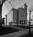
Old Jefferson County Courthouse
.jpg)
See also
 In Spanish: Condado de Jefferson (Nueva York) para niños
