Antwerp, New York facts for kids
Quick facts for kids
Antwerp, New York
|
|
|---|---|
| Country | United States |
| State | New York |
| County | Jefferson |
| Settled | 1803 |
| Named for | Antwerp, Belgium |
| Government | |
| • Type | Town council |
| Area | |
| • Total | 108.56 sq mi (281.16 km2) |
| • Land | 106.18 sq mi (275.01 km2) |
| • Water | 2.38 sq mi (6.16 km2) |
| Population
(2020)
|
|
| • Total | 1,683 |
| • Density | 15.85/sq mi (6.12/km2) |
| Time zone | UTC-5 (EST) |
| • Summer (DST) | UTC-4 (EDT) |
| ZIP |
13608, 13671
|
| FIPS code | {{{1}}}-{{{2}}} |
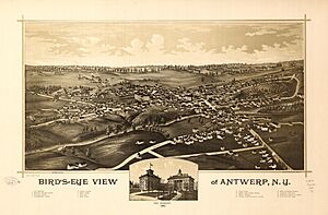
Antwerp is a town in Jefferson County, New York, USA. In 2020, about 1,683 people lived there.
It's named after the city of Antwerp, Belgium. Early investors from Belgium formed a group called the Antwerp Company and helped start the town. There's also a small village inside the town, which is also called Antwerp. The town is in the eastern part of Jefferson County, northeast of Watertown.
Contents
History of Antwerp
People first started settling in the area around 1803. This was near what is now Oxbow. The town of Antwerp was officially created in 1810. It was formed from a part of the town of Le Ray. By 1855, Antwerp was known for having the second-largest number of cows in all of New York State!
Geography of Antwerp
Antwerp covers a total area of about 281.2 square kilometers (108.6 square miles). Most of this is land, about 275.0 square kilometers (106.2 square miles). The rest, about 6.2 square kilometers (2.4 square miles), is water.
The town's northeastern edge is the border with St. Lawrence County. Its southeastern edge borders Lewis County.
The Oswegatchie River flows through the northern part of the town. It makes a loop near the area called Oxbow.
U.S. Route 11, a major highway, runs through the town. It goes from the northeast to the southwest.
A part of the Fort Drum Military Reservation is located in the southeastern section of Antwerp.
Antwerp's Population Changes
| Historical population | |||
|---|---|---|---|
| Census | Pop. | %± | |
| 1820 | 1,319 | — | |
| 1830 | 2,412 | 82.9% | |
| 1840 | 3,109 | 28.9% | |
| 1850 | 2,665 | −14.3% | |
| 1860 | 3,313 | 24.3% | |
| 1870 | 3,310 | −0.1% | |
| 1880 | 3,414 | 3.1% | |
| 1890 | 3,095 | −9.3% | |
| 1900 | 3,008 | −2.8% | |
| 1910 | 2,848 | −5.3% | |
| 1920 | 2,569 | −9.8% | |
| 1930 | 2,292 | −10.8% | |
| 1940 | 2,187 | −4.6% | |
| 1950 | 1,781 | −18.6% | |
| 1960 | 1,905 | 7.0% | |
| 1970 | 1,794 | −5.8% | |
| 1980 | 1,859 | 3.6% | |
| 1990 | 1,856 | −0.2% | |
| 2000 | 1,793 | −3.4% | |
| 2010 | 1,846 | 3.0% | |
| 2020 | 1,683 | −8.8% | |
| US Decennial Census | |||
This chart shows how the number of people living in Antwerp has changed over many years. It uses information from the US Decennial Census, which counts the population every ten years. You can see how the population grew in the early years and then changed over time.
Places in the Town of Antwerp
- Antwerp – This is a village right in the middle of the town. It's located by the Indian River and US-11 highway.
- Bentleys Corners – You can find this spot in the western part of the town, along County Road 23.
- Bishops Corners – This is another location in the western corner of the town, on County Road 194.
- Fort Drum – A large military base that partly extends into the southeastern part of the town.
- Halls Corners – This spot is in the western part of the town, on County Road 28.
- Indian River – A stream that flows past the village of Antwerp. It's also a popular place for canoeing.
- Keenes – A small community located on the northeastern border of the town. Part of it is in St. Lawrence County.
- Oxbow – A small community near the northeast border, on County Road 25. It's located on the Oswegatchie River and was where the first settlement in the area began.
- Payne Lake – A small lake in the northern part of the town, close to Oxbow.
- Rices Corner – A community in the eastern corner of the town. It's inside the Fort Drum area and is on County Road 24.
- Spragueville – A community on the northeastern town line, partly in St. Lawrence County. It used to be called "Spragues Corners."
Famous People from Antwerp
Antwerp has been home to several interesting and important people:
- Albert Woolson – He was a veteran of the American Civil War. He was the very last surviving member of the Grand Army of the Republic, a group for Union Army veterans. Albert Woolson was born in Antwerp.
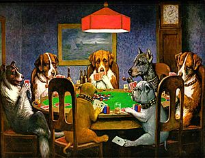
- Cassius Marcellus Coolidge – This artist is most famous for his funny paintings of dogs playing cards, like "Dogs Playing Poker." He was born and grew up in Antwerp. He even started the town's first bank! He is buried in Antwerp. He also came up with the idea for "carnival cut-outs," which are painted backgrounds with holes for faces where people can pose for funny photos.
- Charles B. Hoard – A businessman who also served as a member of the United States House of Representatives. He lived in Antwerp and worked as the postmaster before moving to Watertown in the 1840s.
- John Harris – He was a state senator and businessman in Wisconsin. John Harris was born in Antwerp.
- Helen Hinsdale Rich – A writer known as "The Poet of the Adirondacks." She was also born in Antwerp.
See also
 In Spanish: Antwerp (Nueva York) para niños
 | Precious Adams |
 | Lauren Anderson |
 | Janet Collins |


