National Register of Historic Places listings in Kosciusko County, Indiana facts for kids
This article is all about the amazing historic places in Kosciusko County, Indiana, that are listed on the National Register of Historic Places. Think of the National Register as a special list of important buildings, sites, and objects across the United States. When a place is added to this list, it means it's really important to history, architecture, archaeology, engineering, or culture. It helps protect these places so future generations can enjoy and learn from them!
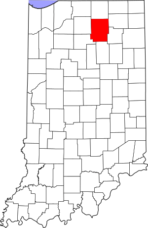
In Kosciusko County, Indiana, there are 16 different properties and areas that have earned a spot on this special list. We'll explore some of these cool places, from old bridges and barns to historic homes and even a famous boat! Knowing about these places helps us understand the past and why they matter today.
Contents
- Cool Historic Places in Kosciusko County
- Chinworth Bridge: A Historic Crossing
- The DIXIE: A Famous Sternwheeler Boat
- East Fort Wayne Street Historic District: Old Homes in Warsaw
- Hall Farm: A Historic Farm at Clunette
- Kosciusko County Jail: A Look at the Past
- Leesburg Historic District: A Small Town's History
- Mock School: A One-Room Schoolhouse
- Robert Orr Polygonal Barn: A Unique Farm Building
- Pierceton Historic District: Downtown History
- John Pound Store: An Old General Store
- Silver Lake Historic District: A Village's Past
- Warsaw Courthouse Square Historic District: The Heart of Warsaw
- Warsaw Cut Glass Company: Craftsmanship from the Past
- Winona Lake Historic District: A Lakeside Community
- Justin Zimmer House: A Historic Home
Cool Historic Places in Kosciusko County
Here are some of the interesting places in Kosciusko County that are listed on the National Register of Historic Places. Each one has a unique story!
Chinworth Bridge: A Historic Crossing
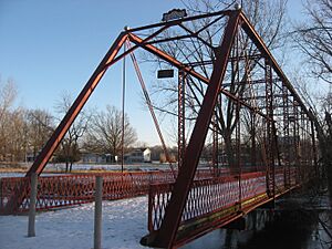
The Chinworth Bridge is an old bridge located west of Warsaw. It crosses the Tippecanoe River. This bridge was added to the National Register in 1997. It's a great example of early bridge building and helps us imagine how people traveled long ago.
The DIXIE: A Famous Sternwheeler Boat
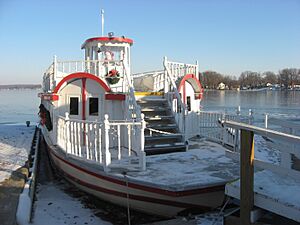
The DIXIE is a special kind of boat called a sternwheeler. It's located in North Webster. This historic boat was added to the National Register in 2009. The DIXIE has been giving rides on Webster Lake for many years, making it one of the oldest operating sternwheelers in Indiana!
East Fort Wayne Street Historic District: Old Homes in Warsaw
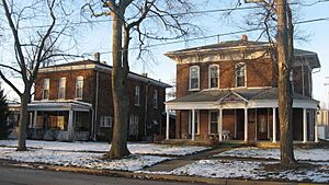
The East Fort Wayne Street Historic District is a neighborhood in Warsaw with many old and beautiful homes. This area became a historic district in 1993. Walking through this district is like taking a step back in time, seeing the different styles of houses from the past.
Hall Farm: A Historic Farm at Clunette
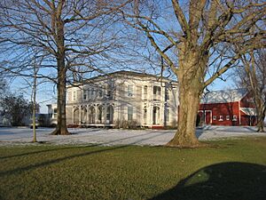
The Hall Farm is a historic farm located near Clunette, in Prairie Township. It was added to the National Register in 1992. This farm shows us what farming life was like many years ago and helps us understand the agricultural history of the area.
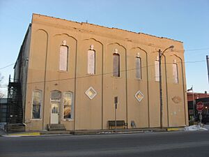
Kosciusko County Jail: A Look at the Past
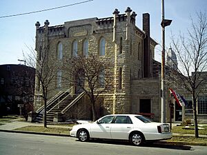
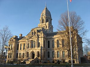
The Kosciusko County Jail is an old jail building located in Warsaw, at the corner of Main and Indiana Streets. It was listed on the National Register in 1978. This building tells a story about how law and order were managed in the county's earlier days.
Leesburg Historic District: A Small Town's History
The Leesburg Historic District is found in the town of Leesburg. This district, added in 1993, includes many of the town's original buildings. It helps preserve the unique character and history of this small Indiana community.
Mock School: A One-Room Schoolhouse
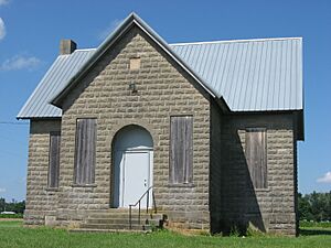
The Mock School is an old school building located south of Syracuse, in Turkey Creek Township. It was added to the National Register in 2010. This building is a great example of a one-room schoolhouse, where all ages learned together in the same classroom.
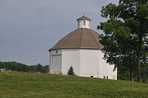
Robert Orr Polygonal Barn: A Unique Farm Building
The Robert Orr Polygonal Barn is a very special barn located south of North Webster, in Washington Township. It was listed in 1993. What makes it unique is its many sides, unlike typical rectangular barns. It's a cool example of different building styles used in farming.
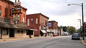
Pierceton Historic District: Downtown History
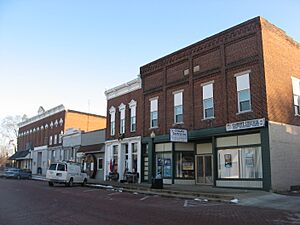
The Pierceton Historic District covers part of the downtown area in Pierceton. This district was added to the National Register in 1992. It includes many of the original buildings that made up the town's main street, showing how businesses and community life used to be.
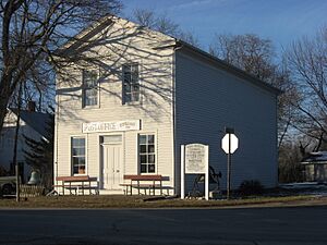
John Pound Store: An Old General Store
The John Pound Store is an old store building located at Oswego, in Plain Township. It was listed in 1992. This building was likely a general store, where people could buy all sorts of goods, and it gives us a peek into how people shopped in the past.
Silver Lake Historic District: A Village's Past
The Silver Lake Historic District includes parts of the main streets in the village of Silver Lake. It was added to the National Register in 1992. This district helps preserve the historic look and feel of the village center.
Warsaw Courthouse Square Historic District: The Heart of Warsaw
The Warsaw Courthouse Square Historic District is the central part of Warsaw, surrounding the county courthouse. This important area was first listed in 1982, and then expanded in 1993 to include even more historic buildings. It's the heart of the city's history, with many significant buildings.
Warsaw Cut Glass Company: Craftsmanship from the Past
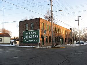
The Warsaw Cut Glass Company building is located in Warsaw. It was added to the National Register in 1984. This building was once home to a company famous for making beautiful cut glass items. It represents an important part of the area's industrial and artistic history.
Winona Lake Historic District: A Lakeside Community
The Winona Lake Historic District is a special area in the town of Winona Lake. It was listed in 1993. This district includes many historic buildings that were part of the community's development, especially as a popular lakeside resort and Chautauqua assembly in the past.
Justin Zimmer House: A Historic Home
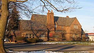
The Justin Zimmer House is a historic home located in Warsaw. It was added to the National Register in 1991. This house is an example of the architecture and lifestyle of important people in the community's history.


