National Register of Historic Places listings in Lafayette County, Missouri facts for kids
Have you ever wondered about old buildings or places that have a special story? In Lafayette County, Missouri, there are many such spots! These places are so important that they are listed on the National Register of Historic Places. This is like a special list kept by the United States government. It helps protect and celebrate buildings, sites, and objects that are important to American history, architecture, archaeology, engineering, or culture.
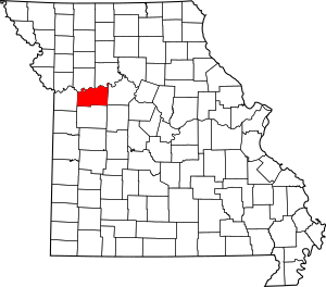
Lafayette County in Missouri has 29 different places on this special list. Each one tells a part of the county's unique past. Let's explore some of these amazing historic sites!
Historic Places in Lafayette County
Anderson House and Lexington Battlefield
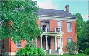
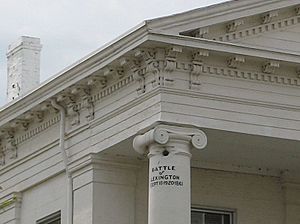
One of the most famous places is the Anderson House and Lexington Battlefield in Lexington, Missouri. This site is important because of a big event that happened here during the American Civil War. In 1861, the First Battle of Lexington took place around this house. The Anderson House itself was used as a hospital during the battle. Imagine soldiers caring for the wounded right inside this old home! It's a powerful reminder of a tough time in American history.
Lafayette County Courthouse
The Lafayette County Courthouse is another important building in Lexington. Courthouses are usually the center of a county's government and community life. This one was built a long time ago, in 1847. It's known for its unique architecture and has seen many important decisions made within its walls. It stands as a symbol of justice and local history for the people of Lafayette County.
Wentworth Military Academy
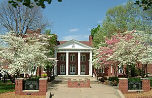
The Wentworth Military Academy in Lexington is a historic school. It was founded in 1880 and was a military boarding school for boys and young men. Many students lived and learned here, preparing for their futures. The academy's buildings and grounds have a long history of teaching and training. It's interesting to think about all the students who walked these halls over the years.
Confederate Memorial State Historic Site
Near Higginsville, Missouri, you can find the Confederate Memorial State Historic Site. This site includes a chapel, a cemetery, and a cottage. It was created to honor Confederate soldiers who died during the Civil War. It's a place for reflection and remembrance, showing how communities honored those who fought in the war.
Odessa Ice Cream Company Building
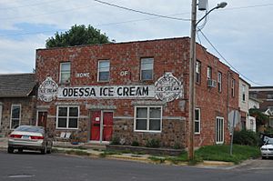
In Odessa, Missouri, there's a cool building called the Odessa Ice Cream Company Building. This building, constructed in 1922, was once where delicious ice cream was made! It's a great example of how businesses operated in the past. It reminds us of the local industries that helped towns grow and provided treats for everyone.
Historic Districts
Some places on the National Register are not just single buildings but entire areas called "historic districts." These districts have many buildings that together tell a story about a community's past.
- The Commercial Community Historic District in Lexington includes many old shops and businesses. It shows how the town's main street looked and functioned long ago.
- The Highland Avenue Historic District in Lexington is a neighborhood with many historic homes. It gives us a peek into how people lived and built their houses in the past.
- The Old Neighborhoods Historic District in Lexington also features a collection of historic homes and streets. These areas help us understand the growth and development of the town over time.
Other Notable Homes
Lafayette County is home to many historic houses, each with its own story. These homes belonged to important people or show interesting styles of architecture from different periods.
- The Hicklin Hearthstone and Hicklin School are two sites related to the Hicklin family, early settlers in the area.
- The Waddell House in Lexington is another beautiful historic home.
- The Spratt-Allen-Aull House and Thomas Talbot and Rebecca Walton Smithers Stramcke House are examples of the many unique homes that have been preserved.
These are just a few of the many fascinating places in Lafayette County that are listed on the National Register of Historic Places. Each one helps us learn more about the past and why these sites are important to remember and protect for future generations.
Images for kids


