National Register of Historic Places listings in Lafayette County, Wisconsin facts for kids
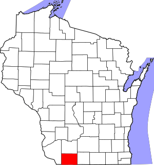
This is a list of the National Register of Historic Places listings in Lafayette County, Wisconsin. It is intended to provide a comprehensive listing of entries in the National Register of Historic Places that are located in Lafayette County, Wisconsin. The locations of National Register properties for which the latitude and longitude coordinates are included below may be seen in a map.
There are 11 properties and districts listed on the National Register in the county.
Current listings
| Name on the Register | Image | Date listed | Location | City or town | Description | |
|---|---|---|---|---|---|---|
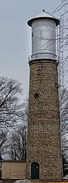
| 1 | Benton Stone Water Tower |
(#98001598) |
49 Water St. 42°34′15″N 90°22′58″W / 42.570833°N 90.382778°W |
Benton | ||
| 2 | First Capitol |
(#70000036) |
North of Belmont off U.S. 151 42°46′07″N 90°21′45″W / 42.768611°N 90.3625°W |
Belmont | ||
| 3 | Gratiot House |
(#80000153) |
South of Shullsburg on Rennick Rd. 42°33′09″N 90°13′52″W / 42.5525°N 90.231111°W |
Shullsburg | ||
| 4 | Lafayette County Courthouse |
(#78000114) |
626 Main St. 42°40′57″N 90°07′06″W / 42.6825°N 90.118333°W |
Darlington | ||
| 5 | Main Street Historic District |
(#94001210) |
Roughly bounded by Main, Ann, Louisa and Wells Sts. 42°40′46″N 90°07′04″W / 42.679444°N 90.117778°W |
Darlington | ||
| 6 | Mottley Family Farmstead |
(#01000564) |
21496 Ivey Rd. 42°48′14″N 90°08′45″W / 42.803889°N 90.145833°W |
Willow Springs | ||
| 7 | Pecatonica Battlefield |
(#11000488) |
2995 County Road Y 42°39′41″N 89°52′36″W / 42.661389°N 89.876667°W |
Wiota | ||
| 8 | Prairie Spring Hotel |
(#99001273) |
WI 23 South 42°48′02″N 90°07′56″W / 42.800524°N 90.132279°W |
Willow Springs | ||
| 9 | St. Augustine Church |
(#72000057) |
Off County Road W 42°31′59″N 90°20′01″W / 42.533056°N 90.333611°W |
New Diggings | ||
| 10 | Star Theatre |
(#80000154) |
200 S. North St. 42°41′59″N 89°52′02″W / 42.699722°N 89.867222°W |
Argyle | ||
| 11 | Water Street Commercial Historic District |
(#90000998) |
Roughly Water St. from Judgement to Kennedy Sts. and Gratiot St. from Water to Church Sts. 42°34′32″N 90°14′20″W / 42.575556°N 90.238889°W |
Shullsburg |

All content from Kiddle encyclopedia articles (including the article images and facts) can be freely used under Attribution-ShareAlike license, unless stated otherwise. Cite this article:
National Register of Historic Places listings in Lafayette County, Wisconsin Facts for Kids. Kiddle Encyclopedia.


