Lafayette County, Wisconsin facts for kids
Quick facts for kids
Lafayette County
|
|
|---|---|

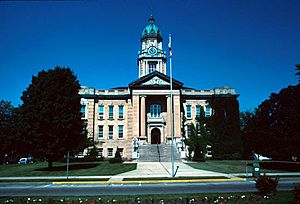
Lafayette County Courthouse in 1982
|
|

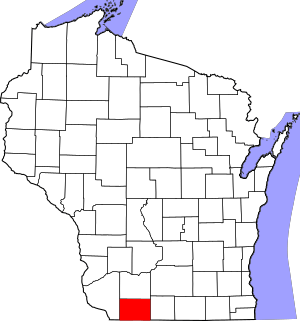
Location within the U.S. state of Wisconsin
|
|
 Wisconsin's location within the U.S. |
|
| Country | |
| State | |
| Founded | 1846 |
| Named for | Marquis de Lafayette |
| Seat | Darlington |
| Largest city | Darlington |
| Area | |
| • Total | 635 sq mi (1,640 km2) |
| • Land | 634 sq mi (1,640 km2) |
| • Water | 1.0 sq mi (3 km2) 0.2%% |
| Population
(2020)
|
|
| • Total | 16,611 |
| • Estimate
(2023)
|
16,945 |
| • Density | 26.2/sq mi (10.1/km2) |
| Time zone | UTC−6 (Central) |
| • Summer (DST) | UTC−5 (CDT) |
| Congressional district | 2nd |
Lafayette County, sometimes spelled La Fayette County, is a county in the state of Wisconsin. It was created in 1846 when Wisconsin was still a territory.
As of the 2020 census, about 16,611 people lived there. The main town and county seat is Darlington.
The county got its name from the Marquis de Lafayette. He was a French general who helped the American army during the American Revolutionary War. The Lafayette County Courthouse in Darlington was even used for filming scenes in the 2009 movie Public Enemies.
Contents
Exploring Lafayette County's Geography
Lafayette County covers a total area of 635 square miles. Most of this area, 634 square miles, is land. Only a small part, about 1.0 square mile (0.2%), is water.
Main Roads in Lafayette County
These are some of the important highways that run through Lafayette County:
 U.S. Highway 151
 Highway 11 (Wisconsin)
 Highway 23 (Wisconsin)
 Highway 78 (Wisconsin)
 Highway 81 (Wisconsin)
 Highway 126 (Wisconsin)
Neighboring Counties
Lafayette County shares borders with several other counties:
- Grant County to the west
- Iowa County to the north
- Green County to the east
- Stephenson County, Illinois to the southeast
- Jo Daviess County, Illinois to the south
Population and People of Lafayette County
Lafayette County's 2020 Census Details
In 2020, the county's population was 16,611 people. This means there were about 26.2 people living in each square mile.
There were 7,156 homes in the county. On average, there were 11.3 homes per square mile.
Most people in the county, about 91.7%, identified as White. Other groups included 0.3% Native American, 0.2% Asian, and 0.2% Black or African American. About 3.7% were from other races, and 3.9% were from two or more races. About 6.6% of the population identified as Hispanic or Latino.
Towns and Villages in Lafayette County
Lafayette County is home to several different types of communities.
Cities in Lafayette County
- Cuba City (most of it is in Grant County)
- Darlington (This is the county seat)
- Shullsburg
Villages in Lafayette County
- Argyle
- Belmont
- Benton
- Blanchardville (partly in Iowa County)
- Gratiot
- Hazel Green (most of it is in Grant County)
- South Wayne
Towns in Lafayette County
Census-Designated Places
These are areas that are like towns but are not officially incorporated as cities or villages:
Other Unincorporated Communities
These are smaller communities that are not officially part of a city, village, or town:
See also
 In Spanish: Condado de Lafayette (Wisconsin) para niños
 | Jessica Watkins |
 | Robert Henry Lawrence Jr. |
 | Mae Jemison |
 | Sian Proctor |
 | Guion Bluford |

