Iowa County, Wisconsin facts for kids
Quick facts for kids
Iowa County
|
|
|---|---|
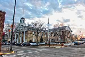
Iowa County Courthouse in March 2013
|
|
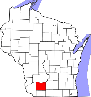
Location within the U.S. state of Wisconsin
|
|
 Wisconsin's location within the U.S. |
|
| Country | |
| State | |
| Founded | 1830 |
| Named for | Iowa people |
| Seat | Dodgeville |
| Largest city | Dodgeville |
| Area | |
| • Total | 768 sq mi (1,990 km2) |
| • Land | 763 sq mi (1,980 km2) |
| • Water | 5.4 sq mi (14 km2) 0.7%% |
| Population
(2020)
|
|
| • Total | 23,709 |
| • Estimate
(2023)
|
23,956 |
| • Density | 31.1/sq mi (12.0/km2) |
| Time zone | UTC−6 (Central) |
| • Summer (DST) | UTC−5 (CDT) |
| Congressional district | 2nd |
Iowa County is a special area in Wisconsin, a state in the United States. It's called a county. In 2020, about 23,709 people lived here. The main town and biggest city in Iowa County is Dodgeville.
When Iowa County was first created, it was part of the Michigan Territory. Today, it's part of the larger area around Madison, which is a big city in Wisconsin.
Contents
Discovering Iowa County's Past
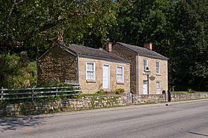
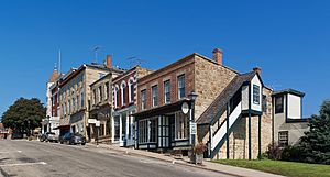
Iowa County was officially set up in 1830. This happened when the area was still part of the Michigan Territory. The county got its name from the Iowa tribe, a Native American group.
Exploring Iowa County's Geography
Iowa County covers about 768 square miles. Most of this area, about 763 square miles, is land. The rest, about 5.4 square miles, is water. This means water makes up a small part, around 0.7%, of the county's total area.
Many small rivers and streams flow through the county. These waters eventually join the Pecatonica River, which starts right here in Iowa County. The highest point in the county is West Blue Mound, which is 1,716 feet above sea level. The lowest point is where the Wisconsin River meets the Grant County line, at 667 feet above sea level.
Rivers and Streams Flowing Through the County
Major Roads and Transportation
Railroads Serving the Area
- Wisconsin and Southern Railroad
Bus Services for Travelers
You can travel by bus in Iowa County. Lamers Connect offers two buses each day. One bus goes east towards Madison and Milwaukee. The other bus goes west to Dubuque, stopping in Dodgeville along the way.
Local Airport Information
- The Iowa County Airport (KMRJ) helps people travel by air. It serves Iowa County and the towns nearby.
Neighboring Counties of Iowa County
Iowa County shares its borders with several other counties:
- Richland County to the northwest
- Sauk County to the northeast
- Dane County to the east
- Green County to the southeast
- Lafayette County to the south
- Grant County to the west
Understanding Iowa County's Population
In 2020, a census counted 23,709 people living in Iowa County. This means there were about 31 people living in every square mile. There were also about 10,905 homes in the county.
Most people living in Iowa County are White (94.2%). Other groups include Asian (0.8%), Black or African American (0.5%), Native American (0.2%), and Pacific Islander (0.1%). About 3.5% of people are from two or more races. When it comes to ethnic background, 1.9% of the population is Hispanic or Latino.
Parks and Fun Places to Visit
Iowa County has many great parks and natural areas where you can enjoy the outdoors. Some of these include:
- Arena Pines-Sand Barrens State Natural Area
- Pine Cliff State Natural Area
- Blue Mound State Park
- Tower Hill State Park
- Black Hawk Lake Recreation Area
- Governor Dodge State Park
Communities Within Iowa County
Iowa County is made up of several different types of communities, from cities to small villages and towns.
Cities in Iowa County
Villages in Iowa County
- Arena
- Avoca
- Barneveld
- Blanchardville (mostly in Lafayette County)
- Cobb
- Highland
- Hollandale
- Linden
- Livingston (mostly in Grant County)
- Montfort (mostly in Grant County)
- Muscoda (mostly in Grant County)
- Rewey
- Ridgeway
Towns in Iowa County
Census-Designated Place
Unincorporated Communities
Ghost Towns - Places No Longer Inhabited
- Adamsville
- Dirty Hollow
- Minersville
- Pendarvis
Notable People from Iowa County
- Gilbert L. Laws was an important person from Iowa County. He served as the Secretary of State for Nebraska and was also a US Congressman.
See also
 In Spanish: Condado de Iowa (Wisconsin) para niños
 | Isaac Myers |
 | D. Hamilton Jackson |
 | A. Philip Randolph |


