National Register of Historic Places listings in Moniteau County, Missouri facts for kids
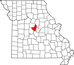
Moniteau County in Missouri is home to some really special places! These places are so important that they've been added to a list called the National Register of Historic Places. Think of it like a hall of fame for buildings, areas, and even old sites that tell us about the past.
This list helps protect these important spots so future generations can learn from them. In Moniteau County, there are 11 different places and areas that have made it onto this special list. Each one has a unique story to tell about the history of this part of Missouri.
Contents
- Cool Historic Spots to Discover
- Historic Districts and Buildings
- Assumption of the Blessed Virgin Mary Parish Historic District
- Louis Bruce Farmstead Historic District
- Finke Opera House
- Geiger Archeological Site
- Gray-Wood Buildings
- High Point Historic District
- Maclay Mansion
- Moniteau County Courthouse Square
- Old Barnhill Building
- Old California City Hall and Fire Station
- Historic Districts and Buildings
Cool Historic Spots to Discover
Let's take a look at some of the amazing historic places you can find in Moniteau County. These spots are recognized because they are important to the history of the United States.
Historic Districts and Buildings
Many of the places on the list are historic districts, which means a whole area or group of buildings is important. Others are single buildings that stand out.
Assumption of the Blessed Virgin Mary Parish Historic District
This historic district is located near Jamestown. It's a special area that includes buildings related to the Assumption of the Blessed Virgin Mary Parish. Historic districts often show how communities grew and how people lived a long time ago.
Louis Bruce Farmstead Historic District
Near Russellville, you'll find the Louis Bruce Farmstead Historic District. A farmstead is a group of buildings on a farm, like the farmhouse, barns, and other structures. This district helps us understand what farming life was like in the past.
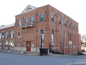
Finke Opera House
In California, there's the Finke Opera House. Imagine going to a show here many years ago! Opera houses were important places for entertainment and community gatherings. This building still stands as a reminder of those times.
Geiger Archeological Site
The Geiger Archeological Site is located near Sandy Hook. An archeological site is a place where scientists study human history by digging up old objects and structures. This site helps us learn about people who lived here long, long ago.
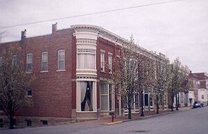
Gray-Wood Buildings
Also in California, the Gray-Wood Buildings are a group of historic buildings. They show us the kind of architecture and businesses that were common in the past.
High Point Historic District
The High Point Historic District is in High Point. Like other historic districts, it helps preserve the unique character and history of this community.
Maclay Mansion
In Tipton, you can find the Maclay Mansion. A mansion is a very large, impressive house. This one likely belonged to an important family and tells us about the grand homes of the past.
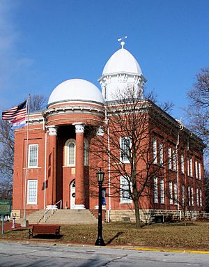
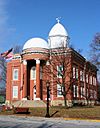
Moniteau County Courthouse Square
The Moniteau County Courthouse Square is in the heart of California. Courthouses are very important buildings where laws are made and justice is served. The square around it was often the center of town life.
Old Barnhill Building
Another historic spot in California is the Old Barnhill Building. Many old buildings like this were once shops, offices, or homes, and they show us how towns used to look and function.
Old California City Hall and Fire Station
Also in California, this building once served as both the city hall and the fire station. City halls are where local government happens, and fire stations protect the community. This building shows how important these services were, even long ago.
These places are more than just old buildings; they are pieces of history that help us understand how Moniteau County and Missouri have grown and changed over time.
| Name on the Register | Image | Date listed | Location | City or town | Description | |
|---|---|---|---|---|---|---|
| 1 | Assumption of the Blessed Virgin Mary Parish Historic District |
(#13001147) |
NW. corner of jct. of Cedron Rd. & Zey Ln. 38°46′25″N 92°34′05″W / 38.77368°N 92.568049°W |
Jamestown | ||
| 2 | Louis Bruce Farmstead Historic District |
(#91001916) |
Route V north of its junction with Route A, at Rock Enon Creek 38°27′53″N 92°31′07″W / 38.464722°N 92.518611°W |
Russellville | ||
| 3 | Finke Opera House |
(#04000214) |
312 N. High St. 38°38′07″N 92°33′55″W / 38.635278°N 92.565278°W |
California | ||
| 4 | Geiger Archeological Site |
(#69000114) |
Address Restricted |
Sandy Hook | ||
| 5 | Gray-Wood Buildings |
(#84002594) |
401-407 N. High St. 38°38′15″N 92°33′55″W / 38.6375°N 92.565278°W |
California | ||
| 6 | High Point Historic District |
(#04001561) |
61235-61243 Route C 38°29′04″N 92°35′24″W / 38.484444°N 92.59°W |
High Point | ||
| 7 | Maclay Mansion |
(#79001383) |
209 W. Howard St. 38°39′35″N 92°46′54″W / 38.659722°N 92.781667°W |
Tipton | ||
| 8 | Moniteau County Courthouse Square |
(#70000341) |
Public Sq. 38°38′11″N 92°33′53″W / 38.636389°N 92.564722°W |
California | ||
| 9 | Old Barnhill Building |
(#82003151) |
301 N. High St. 38°38′05″N 92°33′56″W / 38.634722°N 92.565556°W |
California | ||
| 10 | Old California City Hall and Fire Station |
(#82003152) |
101 N. High St. 38°37′58″N 92°33′55″W / 38.632778°N 92.565278°W |
California |


