Jamestown, Missouri facts for kids
Quick facts for kids
Jamestown, Missouri
|
|
|---|---|

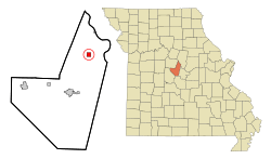
Location in Moniteau County and the state of Missouri
|
|
| Country | United States |
| State | Missouri |
| County | Moniteau |
| Founded | 1846 |
| Incorporated | 1850 |
| Named for | E.H. and S.L. James |
| Area | |
| • Total | 1.01 sq mi (2.61 km2) |
| • Land | 1.00 sq mi (2.59 km2) |
| • Water | 0.01 sq mi (0.02 km2) |
| Elevation | 869 ft (265 m) |
| Population
(2020)
|
|
| • Total | 330 |
| • Density | 330.33/sq mi (127.48/km2) |
| Time zone | UTC-6 (Central (CST)) |
| • Summer (DST) | UTC-5 (CDT) |
| ZIP code |
65046
|
| Area code(s) | 660 |
| FIPS code | 29-36368 |
| GNIS feature ID | 2397011 |
Jamestown is a small village located in the northeastern part of Moniteau County, Missouri, in the United States. In 2020, about 330 people lived there. This was a bit less than the 386 people who lived there in 2010. Jamestown is also part of the larger Jefferson City metropolitan area.
Contents
History of Jamestown
Jamestown started in 1846. Two people named E. H. and S. L. James opened a country store in this spot. A few years later, in 1850, a post office was opened, and it was called Jamestown.
Historic Places in Jamestown
Two important places in Jamestown are listed on the National Register of Historic Places. This means they are special and protected because of their history. These places are the Assumption of the Blessed Virgin Mary Parish Historic District and the Dick-Kobel Homestead.
Geography of Jamestown
Jamestown is located on Missouri Route 87. It is about 12 miles (19 km) northeast of California, which is the main town of Moniteau County. Another nearby place, Sandy Hook, is about 4 miles (6 km) east on Missouri Route 179, near the Missouri River.
Land and Water
According to the U.S. Census Bureau, Jamestown covers a total area of about 1.01 square miles (2.61 square kilometers). Most of this area is land. Only a tiny part, about 0.01 square miles (0.02 square kilometers), is water.
The village sits on a raised area, like a small hill. Water from this area flows in different directions. Some water drains north into Factory Creek. Other water flows southeast into Haldiman Branch and southwest into Hauck Branch. Factory Creek flows directly into the Missouri River. Haldiman Branch and Hauck Branch flow into Moniteau Creek, which also joins the Missouri River.
Population of Jamestown
| Historical population | |||
|---|---|---|---|
| Census | Pop. | %± | |
| 1880 | 185 | — | |
| 1890 | 313 | 69.2% | |
| 1900 | 344 | 9.9% | |
| 1910 | 305 | −11.3% | |
| 1920 | 264 | −13.4% | |
| 1930 | 273 | 3.4% | |
| 1940 | 269 | −1.5% | |
| 1950 | 245 | −8.9% | |
| 1960 | 216 | −11.8% | |
| 1970 | 243 | 12.5% | |
| 1980 | 317 | 30.5% | |
| 1990 | 298 | −6.0% | |
| 2000 | 382 | 28.2% | |
| 2010 | 386 | 1.0% | |
| 2020 | 330 | −14.5% | |
| U.S. Decennial Census | |||
Population in 2010
In 2010, there were 386 people living in Jamestown. These people lived in 161 different homes. About 100 of these homes were families.
Most of the people living in Jamestown were White (97.9%). A small number (2.1%) were from two or more different races. About 1% of the population was Hispanic or Latino.
Many homes (34.2%) had children under 18 living with them. Almost half of the homes (48.4%) were married couples living together. Some homes had a female head of the house without a husband (11.2%). A few homes had a male head of the house without a wife (2.5%). About 36.6% of all homes were made up of just one person. Also, 18.6% of homes had someone living alone who was 65 years old or older.
Education in Jamestown
Jamestown has one high school. It is called Jamestown C-1 High School.
See also
 In Spanish: Jamestown (Misuri) para niños
 | Percy Lavon Julian |
 | Katherine Johnson |
 | George Washington Carver |
 | Annie Easley |

