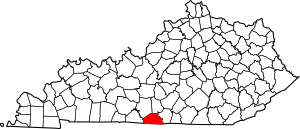
National Register of Historic Places listings in Monroe County, Kentucky facts for kids
Have you ever wondered about old buildings and places that are super important to history? In Monroe County, Kentucky, there are six special spots that are listed on the National Register of Historic Places. This means they are officially recognized by the United States government as places worth protecting because of their history.
These places tell us stories about the past, from old homes where important people lived to churches built by brave communities. By learning about them, we can understand more about how people lived long ago in Kentucky. This list will introduce you to these amazing historic sites in Monroe County!
Contents
What is the National Register of Historic Places?
The National Register of Historic Places is like a special list of buildings, sites, objects, and districts that are important in American history. It's managed by the National Park Service. When a place is added to this list, it means it has a unique story or shows us something special about the past.
Being on the Register helps protect these places. It encourages people to save them and learn from them. It's a way to make sure that future generations can also see and appreciate these parts of history.
Historic Homes in Monroe County
Monroe County is home to several historic houses that tell tales of the past. These homes were once lived in by families who helped shape the area.
Barlow Baxter House
The Barlow Baxter House is a historic home located on Celina Road, which is also Kentucky Route 163, in Hestand. It was officially added to the National Register of Historic Places on August 2, 2001. This house stands as a reminder of the early days and architecture in the region.
Thomas P. Evans House
The Thomas P. Evans House is found at 701 North Main Street in Tompkinsville. This house was recognized for its historical value on October 29, 1992. It is easy to find, located right where Kentucky Route 63 and Kentucky Route 163 meet, close to the center of town. It's a great example of historic homes in the area.
Clark C. Fowler House
Another important historic home is the Clark C. Fowler House. It is situated on Kentucky Route 214, also known as Turkey Neck Bend Road, near Tompkinsville. This house was added to the National Register of Historic Places on August 2, 2001, the same day as the Barlow Baxter House. It represents the history of families who lived in this part of Monroe County.
George W. Proffitt Jr. House
The George W. Proffitt Jr. House is located at 1945 County House Road, also in Tompkinsville. This house joined the list of historic places on August 2, 2001. It is another example of the important homes that have stood for many years in Monroe County, showing us how people lived in the past.
Important Community Buildings
Beyond homes, some community buildings also hold significant history. These places often served as gathering spots and played a big role in local life.
Mount Vernon AME Church
The Mount Vernon AME Church is a very special place located north of Gamaliel on Kentucky Route 100. This church was built by formerly enslaved people in the late 1840s. It was added to the National Register of Historic Places on November 17, 1977. This church is a powerful symbol of freedom and community for African Americans in the area. It shows the strength and determination of people building their own places of worship after gaining their freedom.
Old Mulkey Meetinghouse
The Old Mulkey Meetinghouse is a truly unique historic site. It is located south of Tompkinsville on Kentucky Route 1446. This meetinghouse was added to the National Register of Historic Places on May 7, 1973. Today, it is part of a state park, which means it's preserved for everyone to visit and learn from. It's one of the oldest log churches in Kentucky and has a very interesting twelve-sided shape. Many early Kentucky pioneers are buried in its graveyard.
Images for kids


