Gamaliel, Kentucky facts for kids
Quick facts for kids
Gamaliel, Kentucky
|
|
|---|---|

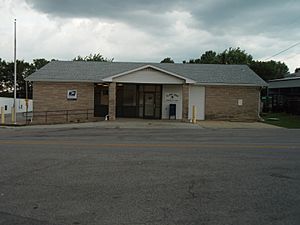
Gamaliel Post office
|
|

Location in Monroe County, Kentucky
|
|
| Country | United States |
| State | Kentucky |
| County | Monroe |
| Named for | 1st-century Jewish leader |
| Area | |
| • Total | 0.57 sq mi (1.48 km2) |
| • Land | 0.57 sq mi (1.47 km2) |
| • Water | 0.00 sq mi (0.01 km2) |
| Elevation | 843 ft (257 m) |
| Population
(2020)
|
|
| • Total | 391 |
| • Density | 690.81/sq mi (266.54/km2) |
| Time zone | UTC-6 (Central (CST)) |
| • Summer (DST) | UTC-5 (CDT) |
| ZIP code |
42140
|
| Area code(s) | 270 |
| FIPS code | 21-29872 |
| GNIS feature ID | 0492661 |
Gamaliel is a small city located in Monroe County, Kentucky, in the United States. In 2020, about 391 people lived there. The city is named after a wise leader from the Bible.
Contents
History of Gamaliel
How Gamaliel Started
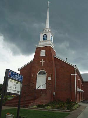
Around 1836, two men named James Crawford and John Hayes decided to help a new town grow. They gave 10 acres (about 4 hectares) of their land. This land was meant for schools and churches. Soon, a building was put up for both school and church use. In 1844, a cemetery was added nearby.
Setting Up the Town Rules
When they gave the land, Crawford and Hayes set some rules. They said that seven trustees should manage the property. These trustees would make sure the land was used as intended. The first trustees included William Crawford and John Hayes. The state of Kentucky officially recognized this plan on December 19, 1840. This made Gamaliel an official community.
Where the Name Came From
A local preacher and teacher named Samuel DeWitt suggested the name "Gamaliel." He thought it was a good name from the Bible for a good village. In the Bible's Book of Acts, Gamaliel was a wise leader. He spoke up for early Christians who had been arrested. The town liked the name and adopted it. A post office was opened in Gamaliel in 1870.
Geography of Gamaliel
Location and Nearby Areas
Gamaliel is in the southern part of Monroe County, Kentucky. It is only about 1 mile (1.6 km) north of the Tennessee border. Several roads connect Gamaliel to other towns. Kentucky Route 100 goes through the center of town. It leads northeast to Tompkinsville, which is the county seat. It also goes northwest to Fountain Run.
Connecting Roads
Kentucky Route 63 also passes through Gamaliel. To the south, it becomes Tennessee State Route 56 when it crosses into Tennessee. This road leads to Red Boiling Springs, Tennessee. Another road, Kentucky Route 87, goes southwest from Gamaliel. It leads to Bugtussle, Kentucky and then into Tennessee as Tennessee State Route 261, reaching Lafayette, Tennessee.
Land and Water
The United States Census Bureau says Gamaliel covers about 0.57 square miles (1.48 square kilometers). Most of this area is land, with a very small amount of water. The city is built on a hill. To the north is the East Fork of the Barren River. To the south is Line Creek, which flows into the Barren River. The Barren River is part of the larger Green River system. This system eventually flows into the Ohio River.
Population and People
How Many People Live Here?
The population of Gamaliel has changed over the years.
- 1960: 868 people
- 1970: 431 people
- 1980: 456 people
- 1990: 462 people
- 2000: 439 people
- 2010: 376 people
- 2020: 391 people
Who Lives in Gamaliel?
According to the 2000 census, there were 439 people living in Gamaliel. Most residents were White (about 98%). A small number of people were Native American or from other backgrounds. About 1.6% of the population identified as Hispanic or Latino.
There were 196 households in the city. About 26.5% of these households had children under 18. Many households (53.1%) were married couples living together. About 20.4% of households had someone living alone who was 65 or older. The average household had 2.24 people.
Age and Income
The population of Gamaliel is spread across different age groups. About 21.4% of the people were under 18 years old. About 20% of the people were 65 years or older. The average age in Gamaliel was 42 years old.
In 2000, the average income for a household in Gamaliel was $23,833 per year. For families, the average income was $29,000 per year. About 12.1% of all people in Gamaliel lived below the poverty line. This included 9.8% of those under 18 and 12.5% of those 65 or older.
Climate
Gamaliel has a type of weather called a humid subtropical climate. This means the area has hot and humid summers. The winters are usually mild to cool.
See also
 In Spanish: Gamaliel (Kentucky) para niños
 | Sharif Bey |
 | Hale Woodruff |
 | Richmond Barthé |
 | Purvis Young |


