
National Register of Historic Places listings in Montgomery County, Virginia facts for kids

Welcome to Montgomery County, Virginia! This article is all about the cool and historic places here that are listed on the National Register of Historic Places. Think of this register as a special list of buildings, areas, and sites that are super important to American history and culture.
When a place is on this list, it means it's worth protecting and remembering for future generations. In Montgomery County, there are 70 amazing places that have earned this special recognition. Let's explore some of them!
Historic Places You Can Visit
Many places in Montgomery County are on the National Register. These include old houses, churches, and even whole neighborhoods! Each one has a unique story to tell about the past.
Cool Buildings and Homes
Let's look at some interesting buildings and homes that are part of this special list.
|- class="vcard" ! style="background:#A8EDEF" | 1 | Alleghany Springs Springhouse
|

|
(#89001807)
| class="adr" | VA 637
37°07′40″N 80°15′51″W / 37.127778°N 80.264028°W
| class="note" | This old springhouse was part of a popular resort where people came to relax and enjoy the natural spring water.
|- class="vcard" ! style="background:#A8EDEF" | 2 | Amiss-Palmer House
|

|
(#89001804)
| class="adr" | Mountain View Dr. and Penn St. off Eakin St.
37°13′36″N 80°24′26″W / 37.226667°N 80.407222°W
| class="note" | A historic home in Blacksburg, showing how people lived long ago.
|- class="vcard" ! style="background:#A8EDEF" | 4 | William Barnett House
|

|
(#89001806)
| class="adr" | Off VA 637, 0.1 miles (0.16 km) north of VA 638
37°08′36″N 80°16′02″W / 37.143333°N 80.267222°W
| class="note" | Another historic house near Alleghany Springs, giving us a peek into the past.
|- class="vcard" ! style="background:#A8EDEF" | 5 | Barracks No. 1
|

|
(#14000947)
| class="adr" | 280 Alumni Mall
37°13′51″N 80°25′11″W / 37.23083°N 80.419722°W
| class="note" | This building, also known as Lane Hall, is on the campus of Virginia Tech. It was one of the first buildings used by students.
|- class="vcard" ! style="background:#A8EDEF" | 9 | Blacksburg Motor Company, Inc.
|

|
(#08000074)
| class="adr" | 400 S. Main St.
37°13′37″N 80°24′42″W / 37.226944°N 80.411667°W
| class="note" | This building was once a motor company, showing how businesses looked in the past.
|- class="vcard" ! style="background:#A8EDEF" | 11 | Bowstring Truss Bridge
|

|
(#12001136)
| class="adr" | I-81, Ironto Rest Area
37°14′21″N 80°13′28″W / 37.23921°N 80.22444°W
| class="note" | A special type of bridge design, preserved for its engineering history.
|- class="vcard" ! style="background:#A8EDEF" | 13 | Pompey Callaway House
|

|
(#89001811)
| class="adr" | VA 754, 0.2 miles (0.32 km) east of US 460
37°13′00″N 80°13′48″W / 37.216667°N 80.230000°W
| class="note" | This house is named after Pompey Callaway, an important figure in local history.
|- class="vcard" ! style="background:#A8EDEF" | 14 | Cambria Freight Station
|
|
(#85003351)
| class="adr" | 630 Depot St.
37°08′29″N 80°24′17″W / 37.141389°N 80.404722°W
| class="note" | This old train station was a busy place where goods were loaded and unloaded, helping the local economy grow.
|- class="vcard" ! style="background:#A8EDEF" | 18 | Christiansburg Presbyterian Church
|

|
(#78003031)
| class="adr" | 107 W. Main St.
37°07′43″N 80°24′39″W / 37.128611°N 80.410833°W
| class="note" | A beautiful historic church in Christiansburg.
|- class="vcard" ! style="background:#A8EDEF" | 25 | Edgemont Church
|
|
(#89001902)
| class="adr" | VA 666, 1 mile (1.6 km) east of VA 645
37°06′28″N 80°28′44″W / 37.107778°N 80.478889°W
| class="note" | This church is another important religious landmark in the county.
|- class="vcard" ! style="background:#A8EDEF" | 27 | Fotheringay
|
.jpg)
|
(#69000262)
| class="adr" | South of the junction of Rtes. 11 and 631
37°11′45″N 80°13′51″W / 37.195833°N 80.230833°W
| class="note" | A grand historic estate with a long history.
|- class="vcard" ! style="background:#A8EDEF" | 31 | Graysontown Methodist Church
|

|
(#89001889)
| class="adr" | VA 613
37°02′14″N 80°33′38″W / 37.037222°N 80.560556°W
| class="note" | This church has been a central part of the Graysontown community for many years.
|- class="vcard" ! style="background:#A8EDEF" | 34 | Hornbarger Store
|

|
(#89001888)
| class="adr" | VA 659, 0.1 miles (0.16 km) east of VA 719
37°09′50″N 80°29′09″W / 37.163889°N 80.485833°W
| class="note" | An old general store, which would have been a hub for the community in its time.
|- class="vcard" ! style="background: #E6E6FA" | 36 | Ingles Bottom Archeological Sites
|

|
(#78003032)
| class="adr" | Address Restricted
| class="note" | This area holds important clues about early human life and settlements in the region.
|- class="vcard" ! style="background: #E6E6FA" | 38 | Kentland Farm Historic and Archeological District
|

|
(#91000833)
| class="adr" | At the end of VA 623 along the New River; also the western terminus of Whitethorne Rd.
37°11′42″N 80°34′46″W / 37.195000°N 80.579444°W
| class="note" | A large farm with a rich history, including important archaeological findings.
|- class="vcard" ! style="background:#A8EDEF" | 43 | Edgar A. Long Building
|

|
(#01000149)
| class="adr" | 140 Scattergood Dr.
37°08′33″N 80°25′03″W / 37.142500°N 80.417500°W
| class="note" | This building is named after Edgar A. Long, a notable person in the area's history.
|- class="vcard" ! style="background:#A8EDEF" | 47 | Montgomery Primitive Baptist Church
|

|
(#89001803)
| class="adr" | VA 624, southwest of the junction with US 460/11
37°11′02″N 80°24′39″W / 37.183750°N 80.410833°W
| class="note" | An old church that shows the religious history of the Merrimac community.
|- class="vcard" ! style="background:#A8EDEF" | 49 | The Oaks
|

|
(#94000709)
| class="adr" | 311 E. Main St.
37°08′00″N 80°24′16″W / 37.133472°N 80.404444°W
| class="note" | A beautiful historic home known as "The Oaks."
|- class="vcard" ! style="background:#A8EDEF" | 50 | Odd Fellows Hall
|

|
(#05000770)
| class="adr" | 203 Gilbert St.
37°14′04″N 80°25′15″W / 37.234306°N 80.420833°W
| class="note" | This building was once a meeting place for the Independent Order of Odd Fellows, a fraternal organization.
|- class="vcard" ! style="background:#A8EDEF" | 51 | Old Christiansburg Industrial Institute
|

|
(#79003056)
| class="adr" | 570 High St.
37°08′21″N 80°24′20″W / 37.139167°N 80.405556°W
| class="note" | This institute was an important school that provided education and vocational training.
|- class="vcard" ! style="background:#A8EDEF" | 53 | Phlegar Building
|

|
(#89001892)
| class="adr" | 2 S. Franklin St.
37°07′46″N 80°24′29″W / 37.129583°N 80.408056°W
| class="note" | A historic building in Christiansburg's downtown area.
|- class="vcard" ! style="background:#A8EDEF" | 56 | Rife House
|

|
(#89001900)
| class="adr" | VA 633 at US 460/11
37°10′38″N 80°14′12″W / 37.177361°N 80.236667°W
| class="note" | An old house in Shawsville that tells a part of the town's story.
|- class="vcard" ! style="background:#A8EDEF" | 59 | Smithfield
|

|
(#69000261)
| class="adr" | West of Blacksburg
37°13′05″N 80°25′55″W / 37.218056°N 80.432083°W
| class="note" | This historic plantation was home to important early Virginia families.
|- class="vcard" ! style="background:#A8EDEF" | 60 | Solitude
|

|
(#89000363)
| class="adr" | Greenhouse Rd. on Virginia Polytechnic Institute campus
37°13′34″N 80°25′37″W / 37.226111°N 80.426944°W
| class="note" | Another historic building on the Virginia Tech campus, adding to its rich heritage.
|- class="vcard" ! style="background:#A8EDEF" | 62 | Surface House
|

|
(#89001883)
| class="adr" | High St., east of Depot St.
37°08′21″N 80°24′29″W / 37.139028°N 80.408056°W
| class="note" | A historic house in Christiansburg.
|- class="vcard" ! style="background:#A8EDEF" | 63 | Trinity United Methodist Church
|

|
(#89001894)
| class="adr" | VA 723, 0.1 miles (0.16 km) south of VA 603
37°11′19″N 80°22′06″W / 37.188611°N 80.368333°W
| class="note" | This church has served the Ellett community for many years.
|- class="vcard" ! style="background:#A8EDEF" | 64 | US Post Office-Christiansburg
|

|
(#90002168)
| class="adr" | Northwest corner of public square
37°07′49″N 80°24′33″W / 37.130278°N 80.409167°W
| class="note" | The historic post office building in Christiansburg.
|- class="vcard" ! style="background:#A8EDEF" | 65 | Virginian Railway Underpass
|

|
(#89001903)
| class="adr" | Junction of Norfolk Southern Railway tracks and VA 723, south of New Ellett
37°11′58″N 80°21′50″W / 37.199583°N 80.363889°W
| class="note" | An underpass built for the Virginian Railway, showing old transportation routes.
|- class="vcard" ! style="background:#A8EDEF" | 69 | Whitethorn
|

|
(#89001879)
| class="adr" | VA 685, 1 mile (1.6 km) west of the junction with US 460
37°12′30″N 80°27′04″W / 37.208472°N 80.451111°W
| class="note" | A historic property in Blacksburg.
|- class="vcard" ! style="background:#A8EDEF" | 70 | Yellow Sulphur Springs
|

|
(#79003057)
| class="adr" | North of Christiansburg on VA 643
37°10′44″N 80°23′52″W / 37.178889°N 80.397778°W
| class="note" | This site was once a popular health resort, known for its natural sulphur springs. |}
Historic Districts: Whole Neighborhoods with History!
Some places on the National Register are not just single buildings, but entire areas called "historic districts." These districts have many old buildings that together tell a story about how a town or community grew.
|- class="vcard" ! style="background: #E6E6FA" | 8 | Blacksburg Historic District
|

|
(#90002165)
| class="adr" | Roughly, area north of the junction of Main and Jackson Sts. including sections out along Lee and Progress Sts.
37°13′51″N 80°24′48″W / 37.230833°N 80.413333°W
| class="note" | This district includes many of Blacksburg's oldest and most important buildings.
|- class="vcard" ! style="background: #E6E6FA" | 15 | Cambria Historic District
|

|
(#90002002)
| class="adr" | 500-600 blocks Depot St., 500-600 block Montgomery St., 900-1000 blocks Cambria St., and railroad depots
37°08′35″N 80°24′19″W / 37.143056°N 80.405278°W
| class="note" | Cambria was once a separate town, and this district preserves its historic center.
|- class="vcard" ! style="background: #E6E6FA" | 17 | Christiansburg Downtown Historic District
|

|
(#13000340)
| class="adr" | East Main St. West Main St., North Franklin St., and South Franklin St.
37°07′47″N 80°24′31″W / 37.129722°N 80.408611°W
| class="note" | The heart of Christiansburg, with many old buildings that show its long history.
|- class="vcard" ! style="background: #E6E6FA" | 24 | East Main Street Historic District
|

|
(#90002008)
| class="adr" | E. Main St. from Roanoke and Pepper Sts. to the old high school and Park St. from E. Main to Lester St.
37°07′58″N 80°24′19″W / 37.132778°N 80.405278°W
| class="note" | This district on East Main Street shows how Christiansburg grew over time.
|- class="vcard" ! style="background: #E6E6FA" | 40 | Lafayette Historic District
|

|
(#90002005)
| class="adr" | Roughly, High St. from Main to Washington Sts., Main from High to Water Sts. and Church St. from Main to Washington
37°14′07″N 80°12′39″W / 37.235278°N 80.210833°W
| class="note" | The historic center of Lafayette, with buildings that tell its story.
|- class="vcard" ! style="background: #E6E6FA" | 46 | Miller-Southside Residential Historic District
|

|
(#90002110)
| class="adr" | Roughly bounded by Miller St., S. Main St., Airport Rd. and Preston Ave.
37°13′18″N 80°24′26″W / 37.221667°N 80.407222°W
| class="note" | A neighborhood in Blacksburg with many historic homes.
|- class="vcard" ! style="background: #E6E6FA" | 48 | North Fork Valley Rural Historic District
|

|
(#90002169)
| class="adr" | Along the North Fork of the Roanoke R. from the Roanoke Co. line S to Lusters Gate
37°15′51″N 80°19′49″W / 37.264167°N 80.330278°W
| class="note" | This rural area along the North Fork of the Roanoke River has a long history of farming and community life.
|- class="vcard" ! style="background: #E6E6FA" | 55 | Prices Fork Historic District
|

|
(#90002004)
| class="adr" | Prices Fork Rd. from VA 737 roughly to VA 654; also Prices Fork Rd.
37°12′35″N 80°29′27″W / 37.209722°N 80.490833°W
| class="note" | The historic center of Prices Fork, showing its development over the years.
|- class="vcard" ! style="background: #E6E6FA" | 57 | Riner Historic District
|

|
(#90002006)
| class="adr" | Roughly, east and south of the junction of Main St. and Franklin Sts.
37°04′00″N 80°26′24″W / 37.066667°N 80.440000°W
| class="note" | This district in Riner includes many buildings that show the town's history.
|- class="vcard" ! style="background: #E6E6FA" | 58 | Shawsville Historic District
|

|
(#90002009)
| class="adr" | Main St. east and west of the junction with VA 637
37°10′08″N 80°15′16″W / 37.168889°N 80.254444°W
| class="note" | The historic center of Shawsville, with buildings that tell its story.
|- class="vcard" ! style="background: #E6E6FA" | 61 | South Franklin Street Historic District
|

|
(#90002007)
| class="adr" | 100-308 S. Franklin St.
37°07′40″N 80°24′22″W / 37.127778°N 80.406111°W
| class="note" | A historic street in Christiansburg with many old homes and buildings. |}
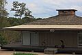
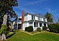
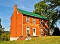
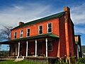
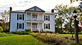
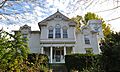
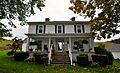
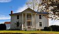
Images for kids
-
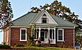
The Bishop House in Graysontown.
-
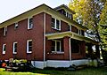
The Blankenship Farm house.
-
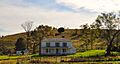
The Bowyer-Trollinger Farm.
-
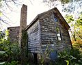
The Cromer House.
-
The Currie House.
-
The Earhart House.
-
The George Earhart House.
-
Evans House No. 2.
-
The John Grayson House.
-
The Grayson-Gravely House.
-
The Guerrant House in Pilot.
-
The Thomas Hall House.
-
The Howard-Bell-Feather House.
-
The Keister House.
-
The Michael Kinzer House.
-
The Frank Lawrence House.
-
The Joseph McDonald Farm.
-
The Phillips-Ronald House.


