
National Register of Historic Places listings in Orange County, California facts for kids

This page lists all the amazing historic places in Orange County, California, that are part of the National Register of Historic Places. Think of the National Register as a special list of buildings, sites, and objects that are important to American history.
These cool places show off the rich history of the area, from its Native American roots to its Spanish and Mexican heritage. You'll find grand old houses from when people got rich from growing citrus fruits or discovering oil. Some places even tell stories about important leaders or big scientific discoveries!
There are 131 historic spots listed in Orange County. Two of these are extra special and are called National Historic Landmarks. One place used to be on the list but isn't anymore.
What are the National Register of Historic Places?
The National Register of Historic Places is the official list of places in the United States that are important to history. It's like a hall of fame for buildings, structures, objects, sites, and districts that have special meaning. When a place is added to this list, it means it's recognized for its historical, architectural, archaeological, engineering, or cultural importance.
Being on the National Register helps protect these places. It encourages people to preserve them so future generations can learn from and enjoy them. It also means these places might get special grants or tax benefits to help with their upkeep.
Historic Places You Can Explore
Orange County is home to many fascinating places on the National Register. Let's look at some of them!
Anaheim's Historic Gems
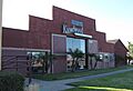
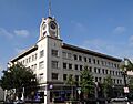
- Anaheim Packing House: This building, once used for packing oranges and lemons, is now a cool food hall where you can grab a bite to eat. It's a great example of how old buildings can get a new life!
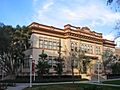
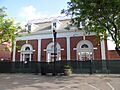
- Carnegie Library: Built in 1909, this beautiful old library was funded by Andrew Carnegie, a famous businessman who helped build many libraries across the country.
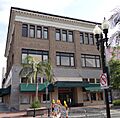
- Samuel Kraemer Building: This building, also known as the American Savings Bank or First National Bank, is a historic landmark in Anaheim.
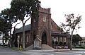
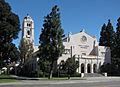
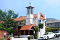
- St. Michael's Episcopal Church: This church, built in 1904, is a lovely example of early 20th-century architecture in Anaheim.
Fullerton's Famous Spots
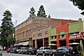
- Chapman Building: Located in downtown Fullerton, this building is a key part of the city's historic center.
- Dr. George C. Clark House: You can find this historic house on the California State University campus. It's a reminder of the early days of Fullerton.
- Elephant Packing House: Don't let the name fool you, there were no elephants here! This building was once a busy place for packing citrus fruits, which was a huge industry in California.
- Fender's Radio Service: This was the radio repair shop of Leo Fender, who invented the famous Fender guitars and amplifiers! A must-see for music fans.
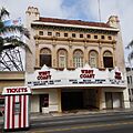
- Fox Fullerton Theatre Complex: This grand old theater, built in 1925, was once a popular spot for movies and shows. It's a beautiful example of historic theater architecture.
- Fullerton City Hall: The city's government building is also a historic landmark, showing off important architecture from its time.
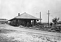
- Fullerton Union Pacific Depot: This old train station is now the Fullerton Transportation Center, a busy hub for trains and buses. It's a great example of how historic buildings can still be useful today.
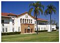
- Muckenthaler House: This large, beautiful house was built in 1924 and is now an arts and cultural center. It's a fantastic place to see art and enjoy events.
Newport Beach's Coastal Landmarks
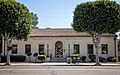
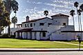
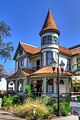
- Balboa Inn: This historic hotel has been welcoming guests since 1929, offering a classic coastal experience.
- Balboa Pavilion: Built in 1906, this iconic building is one of California's last remaining examples of the grand waterfront recreation structures from that era. It's a symbol of Newport Beach's history.
- Lovell Beach House: This unique house, built right on the beach, is famous for its modern design and was completed in 1926. It's a great example of early modern architecture.
- WILD GOOSE (yacht): This yacht, originally a US Navy patrol boat, was later owned by famous actor John Wayne. It's a cool piece of maritime history!
Orange's Old Town Charm
- Old Towne Orange Historic District: This whole area is a historic district, meaning many buildings within it are protected. It's known for its charming old buildings, antique shops, and the central "Orange Circle."
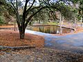
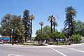
- Irvine Park: One of the oldest regional parks in California, Irvine Park has been a popular spot for outdoor fun since 1897.
- The Plaza: The central roundabout in Old Towne Orange, also known as the Orange Circle, is a historic landmark itself. It's the heart of the historic district.
San Juan Capistrano's Rich Heritage
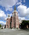
- Mission San Juan Capistrano: Founded in 1776, this is one of the most famous and beautiful of the California missions. It's a very important historical and cultural site.
- Los Rios Street Historic District: This street is home to some of the oldest residential buildings in California, including several historic adobes. It's like stepping back in time!
- Montanez Adobe: One of the oldest homes on Los Rios Street, this adobe house gives a glimpse into early California life.
- Domingo Yorba Adobe and Casa Manuel Garcia: These historic adobe homes are also part of the rich history of San Juan Capistrano.
Santa Ana's Downtown History
- Downtown Santa Ana Historic Districts: This area includes many historic buildings that show how the city grew over time, from government buildings to retail shops.
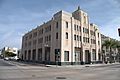
- Old Orange County Courthouse: This beautiful old courthouse, built in 1901, is a stunning example of Romanesque Revival architecture. It's now a museum where you can learn about local history.
- Santa Ana City Hall: The city's government building is also recognized for its historical importance.
- Santora Building: This building, constructed in 1928, is a landmark in downtown Santa Ana, known for its unique architecture.
Other Notable Historic Places
- Crystal Cove Historic District: Located near Laguna Beach, this district features historic beach cottages from the 1930s and 40s. It's a beautiful and unique place to visit.
- Lighter-than-Air Ship Hangars (Tustin): These massive blimp hangars, built during World War II, are huge and impressive structures. They are a reminder of the area's military history.
- Modjeska House: This was the home of Helena Modjeska, a famous Polish actress who lived in Orange County in the late 1800s. It's a National Historic Landmark.
- Richard Nixon Birthplace: The small house in Yorba Linda where Richard Nixon, the 37th President of the United States, was born in 1913. It's now part of the Richard Nixon Presidential Library and Museum.
- Huntington Beach Municipal Pier: This iconic pier, stretching out into the Pacific Ocean, has been a central part of Huntington Beach life for over a century. It's a great place for a stroll and to enjoy the ocean views.
- Jose Serrano Adobe: Located in Lake Forest, this adobe house dates back to the 1840s and is one of the oldest homes in Orange County.
Former Listing
Sometimes, a place might be removed from the National Register. This can happen if the building is changed too much, or if it's destroyed.
- Kraemer Garage: This building in Anaheim was once on the list but was removed in 1979.
Images for kids
-
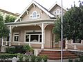
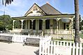
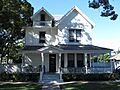
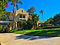
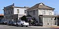
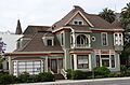
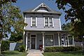
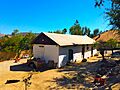
The Lewis Ainsworth House in Orange.
-
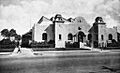
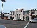
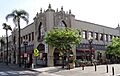
The Anaheim Packing House in its early days.
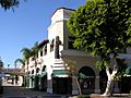
-
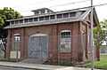
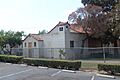
The Artz Building in Tustin.
-
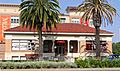
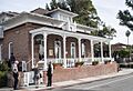
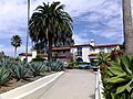
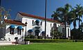
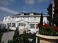
The historic Balboa Inn in Newport Beach.
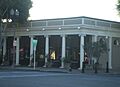
-
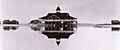
The Balboa Pavilion around 1906.
-
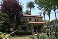
The Bixby-Bryant Ranch House in Yorba Linda.
-
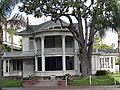
The A. S. Bradford House in Placentia.
-
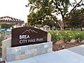
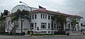
Brea City Hall and Park.
-
The Builders Exchange Building in Santa Ana.
-
The Carnegie Library in Anaheim.
-
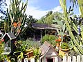
Casa de Esperanza in San Juan Capistrano.
-
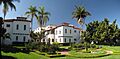
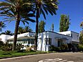
Casa Romantica in San Clemente.
-
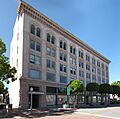
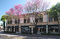
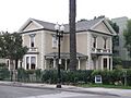
The Chapman Building in Fullerton.
-
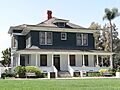
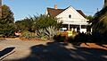
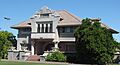
The Dr. George C. Clark House.
-
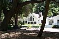
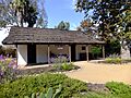
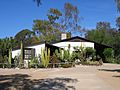
The Joel R. Congdon House, now The Ecology Center.
-
Historic cottages at Crystal Cove.
-
The C. Z. Culver House in Orange.
-
The Cypress Street Schoolhouse in Orange.
-
The Dewella Apartments in Fullerton.
-
The Old Orange County Courthouse, part of the Downtown Santa Ana Historic Districts.
-
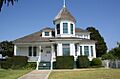
The Oscar Easley Block in San Clemente.
-
The Ebell Society of Santa Ana Valley building.
-
The Richard Egan House in San Juan Capistrano.
-
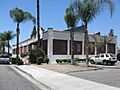
The Elephant Packing House in Fullerton.
-
The Esslinger Building in San Juan Capistrano.
-
The Farmers and Merchants Bank of Fullerton.
-
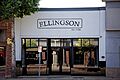
Fender's Radio Service in Fullerton.
-
The First Baptist Church of Orange.
-
The Frank A. Forster House in San Juan Capistrano.
-
The Fox Fullerton Theatre Complex.
-
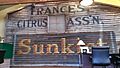
The Frances Packing House (now demolished).
-
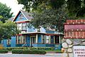
A view of the French Park Historic District.
-
Fullerton City Hall.
-
The Fullerton First Methodist Episcopal Church.
-
The Fullerton Odd Fellows Temple.
-
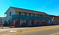
The Fullerton Post Office.
-
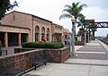
The Fullerton Union Pacific Depot.
-
The Goldschmidt House in San Clemente.
-
Greystone Villa-Cabin 18 in Cleveland National Forest.
-
The Harrison House in San Juan Capistrano.
-
The Helme-Worthy Store and Residence in Huntington Beach.
-
The Hetebrink House in Fullerton.
-
Hillcrest Park in Fullerton.
-
The Hotel San Clemente.
-
The Howe-Waffle House and Carriage House in Santa Ana.
-
The Huntington Beach Elementary School Gymnasium and Plunge.
-
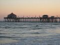
The Huntington Beach Municipal Pier.
-
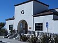
The Huntington Beach Public Library on Triangle Park.
-

The Irvine Bean and Growers Association Building.
-
The Irvine Blacksmith Shop.
-
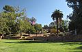
Irvine Park in Orange.
-
The George Key Ranch in Placentia.
-
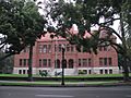
The Lydia D. Killefer School in Orange.
-
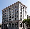
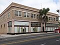
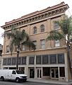
The Samuel Kraemer Building in Anaheim.
-
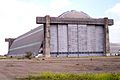
One of the Lighter-than-Air Ship Hangars in Tustin.
-
A building in the Los Rios Street Historic District.
-
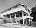
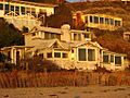
The Lovell Beach House in Newport Beach.
-
The Masonic Temple in Fullerton.
-
The George W. Minter House in Santa Ana.
-
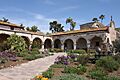
Mission San Juan Capistrano.
-
The Modjeska House.
-
The Montanez Adobe in San Juan Capistrano.
-
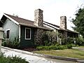
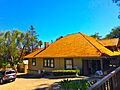
The Muckenthaler House in Fullerton.
-
The Newland House in Huntington Beach.
-
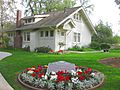
The Richard Nixon Birthplace in Yorba Linda.
-
The Odd Fellows Hall in Santa Ana.
-
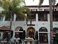
The Old Towne Orange Historic District.
-
The Old Orange County Courthouse.
-
The Orange Intermediate School-Central Grammar School.
-
Orange Union High School.
-
The Pacific Electric Railway Company Depot in Yorba Linda.
-
Pacific Electric Sub-Station No. 14 in Santa Ana.
-
The Parker House in Orange.
-
The Miguel Parra Adobe in San Juan Capistrano.
-
The Plaza in Orange.
-
The Louis Plummer Auditorium in Fullerton.
-
The Porter-French House in Orange.
-
The Rankin Building in Santa Ana.
-
The San Clemente Beach Club.
-
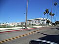
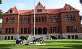
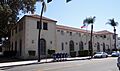
Santa Ana City Hall.
-
Santa Ana Fire Station Headquarters No. 1.
-
The Santora Building in Santa Ana.
-

Seal Beach City Hall.
-
The Jose Serrano Adobe in Lake Forest.
-
The Smith and Clark Brothers Ranch and Grounds in Villa Park.
-
The Smith-Tuthill Funeral Parlors in Santa Ana.
-
The Southern Counties Gas Co. building in Santa Ana.
-
The Spurgeon Block in Santa Ana.
-
St. Francis by-the-Sea American Catholic Church in Laguna Beach.
-
St. John's Lutheran Church in Orange.
-
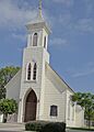
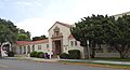
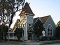
St. Michael's Episcopal Church in Anaheim.
-
The Phillip Ackley Stanton House in Anaheim.
-
The Sherman Stevens House in Tustin.
-
The Carl Stroschein House in San Juan Capistrano.
-
The Truxaw-Gervais House in Anaheim.
-
The US Post Office Station-Spurgeon Station in Santa Ana.
-
The Villa Park School.
-
Walkers Orange County Theater in Santa Ana.
-
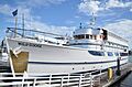
The WILD GOOSE yacht.
-
The Roger Y. Williams House in San Juan Capistrano.
-
The John Woelke House in Anaheim.
-
The George L. Wright House in Santa Ana.
-
The Domingo Yorba Adobe and Casa Manuel Garcia in San Juan Capistrano.
-
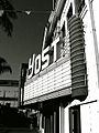
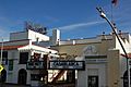
The Yost Theater-Ritz Hotel in Santa Ana.
-
The Young Men's Christian Association-Santa Ana-Tustin Chapter.


.JPG)
.JPG)


.jpg)
.jpg)


.JPG)


.jpg)


.jpg)


.jpg)


.jpg)


.jpg)


