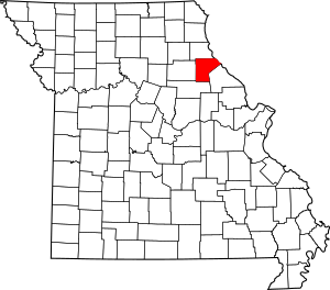
National Register of Historic Places listings in Ralls County, Missouri facts for kids
Welcome to Ralls County, Missouri! Did you know that some buildings and places here are so special that they are listed on something called the National Register of Historic Places? This is like a special list kept by the United States government. It helps protect important places that tell us about history.
When a place is on this list, it means it's really important for understanding the past of our country, state, or local area. It could be an old house, a church, a school, or even a whole neighborhood! In Ralls County, there are 9 different places that have earned a spot on this special list. Let's explore some of them!
Contents
Historic Homes and Buildings in Ralls County
Some of the most interesting places on the National Register are old homes and public buildings. They often have unique stories to tell.
The John Garth House: A Grand Mansion
One of the most famous historic homes in Ralls County is the John Garth House. It's located just south of Hannibal. This beautiful mansion was built way back in 1871. Imagine living in a house that's over 150 years old! Today, it's known as the Garth Woodside Mansion Bed and Breakfast Inn. It's a great example of the fancy homes built long ago.
Ralls County Courthouse and Jail
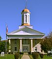
In New London, you'll find the Ralls County Courthouse and Jail-Sheriff's House. This building is super important because it's where many of the county's official decisions have been made for a long time. Courthouses are often the heart of a county's government. This one was added to the National Register in 1972, showing its long history and importance to the community.
The James B. Brown House
Also in Hannibal, there's the James B. Brown House. This house was added to the National Register in 1984. While we don't have many details about it, just being on the list means it has a special history or unique architecture that makes it stand out.
Historic Community Places
Beyond homes, many community buildings like churches and schools also hold important historical value.
Greenlawn Methodist Church and Cemetery
Near Perry, you can find the Greenlawn Methodist Church and Cemetery. Churches are often central to a community's history, serving as gathering places for generations. This church and its cemetery were recognized in 2007 for their historical importance. Cemeteries often tell stories of the people who lived in the area long ago.
St. Paul Catholic Church in Center
In Center, there's the St. Paul Catholic Church. This church was added to the National Register in 1979. It has been a significant spiritual and community center for many years in the Center area.
St. Peter's Catholic Church in Rensselaer
Another important church is St. Peter's Catholic Church, located southwest of Rensselaer. This church is especially notable because the original building was built in 1862. It's also the site where Augustus Tolton, who later became the first African American Catholic priest, was baptized. This makes it a very special place in American history. It was listed in 1980.
Saverton School: A Place of Learning
Schools are also vital parts of history, showing how communities valued education. The Saverton School in Saverton is one such place. It was added to the National Register in 1998. Imagine all the students who learned and grew up within its walls over the years!
Historic Districts: More Than One Building
Sometimes, it's not just one building that's historic, but a whole area! These are called "historic districts."
Ilasco Historic District
The Ilasco Historic District in Ilasco became a historic district in 2016. A historic district means that a group of buildings or an area together tells an important story about the past. This might be about how people lived, worked, or how a town developed.
Lock and Dam No. 22 Historic District
The Lock and Dam No. 22 Historic District is near New London. This district is unique because it's about engineering and transportation history. Locks and dams help boats travel safely along rivers. This district, listed in 2004, even extends into Pike County, Illinois. It shows how important the Mississippi River has been for trade and travel in this region.
Why is This Important?
Having these places on the National Register of Historic Places helps us remember and learn from the past. It encourages people to take care of these special sites so that future generations, like you, can also visit them and understand the rich history of Ralls County and Missouri.
Images for kids


